Circular walk starting from Cuers

A varied walk in Cuers leading to Les Apies de Cuers, the hamlet of Valcros and the Notre-Dame de Santé Chapel.

Details

17290318
Creation:
Last update:
Last review:
  • Walking
    Activity: Walking
  • ↔
    Distance: 8.70 mi
  • ◔
    Average duration: 5h 20 
  • ▲
    Difficulty: Moderate

  • ⚐
    Back to start: Yes
  • ↗
    Ascent: + 1,535 ft
  • ↘
    Descent: - 1,532 ft

  • ▲
    Highest point: 1,404 ft
  • ▼
    Lowest point: 489 ft
  • ⚐ Country: France
  • ⚐ City: Cuers (83390)
  • ⚑
    Start/End: N 43.240619° / E 6.066763°
  • ❏
    IGN map(s): Ref. 3345OT, 3346OT, 3445OT
  • Hour-by-hour weather

Description of the walk

Park in the car park at Cuers cemetery, on Route du Souvenir Français, or along the road on the left-hand side.

(S/E) Follow the Route de Valcros and walk alongside the cemetery until you reach a crossroads.

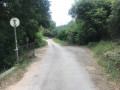
(1) Carry on for forty metres and turn right onto the tarmac road to Saint-Eutrope. Follow this road, ignoring the turnings to the houses. You’ll come to a three-way junction.

(2) Leave the tarmac road and take the dirt track that climbs uphill; this is the Chemin des Régagnades. Continue along this track until you reach the junction with the track leading to Les Basses Sambalettes.

(3) Stay on the track on the right and begin a fairly steep climb to reach a multi-way junction at a hairpin bend.

(4) Take the path opposite, which is not marked on the IGN map and serves as a shortcut to the track; join the track and turn left to reach another junction.

(5) Continue straight ahead to reach the Col du Pérussier, a multi-way junction. Take the wide track running alongside a wire fence. Pass the hamlet of Les Cabrides and continue on to the water tank.

(6) Leave the track and, behind the cistern, take a path that descends to the right into the Vallon du Réal. Follow it until you reach another path junction.

(7) Turn right here. Please note that thefirst section of this path is not shown on the IGN map but is marked on OSM. Follow the wire fence until you emerge onto a cleared plateau near a farm in a state of disrepair.

(8) Turn left onto a visible track and follow it, guided by a few cairns. Stay at the same level, but a GPS track is essential to find the Apies site, which lies after a very short descent behind a low wall.

(9) Return via the same route to the previous junction.

(8) Continue straight ahead downhill to reach the junction you passed earlier.

(5) Turn left and follow the path back in the opposite direction to reach the junction you also passed on the way there, at the hairpin bend.

(4) Turn right onto the path and cross the Ubac de Capus stream. At the next junction, take the path on the left. Continue downhill to reach the Valcros road.

(10) Cross the road and head uphill opposite. When you reach a gate, leave the track and take a path that rejoins it. Follow this path until you reach a crossroads with a water tank.

(11) Take the small track on the left. Stay on this track, ignoring the paths branching off to the right and left, until you reach the crossroads in the hamlet of Les Couestes.

(12) Turn left onto a stony path and, after a gentle descent, you’ll reach the Notre-Dame de Santé Chapel.

(13) Walk down the street to the first junction, turn left into Rue des Manants, then turn right and then left onto Lou Camin de Valcros; do not take Avenue Guy Teisseire. Follow the path until you return to the original junction.

(1) Turn right onto Route de Valcros to return to the cemetery car park (S/E).

Waypoints

  1. S/E : mi 0 - alt. 495 ft - Cuers cemetery car park
  2. 1 : mi 0.1 - alt. 499 ft - Junction marking the end of the circular loop
  3. 2 : mi 0.49 - alt. 581 ft - Three-way junction
  4. 3 : mi 1.19 - alt. 899 ft - Crossroads of trails
  5. 4 : mi 1.93 - alt. 1,096 ft - Shortcut junction
  6. 5 : mi 2.27 - alt. 1,302 ft - Crossroads before the Col du Pérussier
  7. 6 : mi 2.93 - alt. 1,322 ft - Citerne
  8. 7 : mi 3.41 - alt. 1,083 ft - Vallon du Réal crossroads
  9. 8 : mi 4 - alt. 1,243 ft - Farmhouse in ruins
  10. 9 : mi 4.35 - alt. 1,158 ft - Apie
  11. 10 : mi 6.13 - alt. 889 ft - Valcros Road
  12. 11 : mi 6.67 - alt. 1,079 ft - Carrefour Citerne
  13. 12 : mi 7.72 - alt. 787 ft - Les Couestes
  14. 13 : mi 8.15 - alt. 666 ft - Chapel of Sainte Christine
  15. S/E : mi 8.7 - alt. 495 ft - Cuers cemetery car park

Worth a visit

(9) The ‘Apies’ consist of a row of stone hive compartments where beehives were once placed. They are very well situated, facing due south, and are in a good state of preservation. An ideal spot for a picnic: sunshine and views are guaranteed.
(10) You might want to make a short detour to the hamlet of Valcros.
(13) The Notre-Dame de la Santé chapel is not open to visitors, but the view from the forecourt is well worth a visit. There are some interesting inscriptions on the ground.

Reviews and comments

4.1 / 5
Based on 4 reviews

Reliability of the description
4 / 5
Ease of following the route
4.3 / 5
Route interest
4 / 5
gegemft
gegemft

Overall rating : 4.7 / 5

Date of your route : Oct 23, 2022
Reliability of the description : ★★★★★ Very good
Ease of following the route : ★★★★★ Very good
Route interest : ★★★★☆ Good
Very busy route : No

The first part of the route (D to point 4) is of little interest apart from the Cuers aqueduct, but it’s a gentle way to warm up. Please note that this is the hunting season, so you need to be vigilant. From point 4 to point 6, the route continues along a track, offering views of the Cuers ridges as well as beautiful scenery towards the sea. From point 6 to point 9, the walk becomes more interesting as the track turns into a lovely little hiking trail that leads to Les Apies. This is a must-see spot for its natural beauty. The descent back to point 4 is well-known, but the path leading back to Cuers is magnificent. Please note that a short section, just after point 4 heading towards point 10, is quite steep. You should also stop at the Notre-Dame-de-Santé chapel (beautiful views). A lovely walk.

Machine-translated

259VIRE
259VIRE

Overall rating : 4.3 / 5

Date of your route : Feb 14, 2022
Reliability of the description : ★★★★☆ Good
Ease of following the route : ★★★★☆ Good
Route interest : ★★★★★ Very good
Very busy route : No

That’s fine with us – go ahead and suggest it!

Machine-translated

collaud
collaud

Overall rating : 3.7 / 5

Date of your route : Feb 07, 2022
Reliability of the description : ★★★★☆ Good
Ease of following the route : ★★★★☆ Good
Route interest : ★★★☆☆ Average
Very busy route : No

There are no technical difficulties. There are just some fairly steep slopes on the way back between points 4 and 13, which might be best avoided after heavy rain.
The ‘bees’ are the main attraction of this walk. Don’t miss a short detour to the village of Valcros.

Machine-translated

madi83
madi83

Overall rating : 3.7 / 5

Date of your route : Jan 31, 2022
Reliability of the description : ★★★☆☆ Average
Ease of following the route : ★★★★☆ Good
Route interest : ★★★★☆ Good
Very busy route : No

A lovely walk to enjoy the forest along easy paths and trails, all of which are gently sloping. The valley floors, which were covered in frost when we passed through, must be pleasantly cool in summer.

Machine-translated

Other walks in the area

For more walks, use our search engine .

The GPS track and description are the property of this route's author. Please do not copy them without permission.