Circular walk starting from Cantaron

This walk, just a short distance from Nice, offers lovely views of the village of Tourette-Levens and the ruins of Châteauneuf.
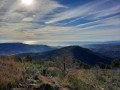
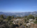
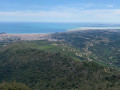
At the highest point of the walk, before beginning the descent, the panoramic view stretching from the western end of the Baie des Anges to the Lérins Islands is truly a feast for the eyes.

Details

42333039
Creation:
Last update:
Last review:
  • Walking
    Activity: Walking
  • ↔
    Distance: 4.82 mi
  • ◔
    Average duration: 3h 50 
  • ▲
    Difficulty: Moderate

  • ⚐
    Back to start: Yes
  • ↗
    Ascent: + 1,844 ft
  • ↘
    Descent: - 1,844 ft

  • ▲
    Highest point: 2,195 ft
  • ▼
    Lowest point: 351 ft

Description of the walk

Park in the car park near the bar, town hall and cemetery in Cantaron.

(S/E) Follow the Route du Cognas for about twenty metres, then cross Rue de l’Iscle and, at signpost 786, join theGR®51and 653A, the Chemin de Compostelle, known here as the Chemin de l’Europe. Continue uphill to reach the hamlet of Bordinas.

(1) Pass through the hamlet and continue uphill until you reach the Baisse de Bordinas.

(2) Leave theGR® trails here and take the DFCI track opposite, heading north. At the next junction, keep right and continue along the path that follows it. You’ll reach a ridge and a fork in the path.

(3) Turn right, heading north-east, and continue along the foot of this ridge to reach the highest point at the Baisse du Macaron, marked by marker 744.

(4) Turn 90° to the right onto the descending path. After a few tight hairpin bends at the start, followed by a straighter section, you’ll reach the junction at Baisse de Bordinas.

(2) Follow the route taken on the way out in the opposite direction to return to the Cantaron car park (S/E).

Waypoints

  1. S/E : mi 0 - alt. 351 ft - Cantaron car park
  2. 1 : mi 1.15 - alt. 1,335 ft - Bordinas
  3. 2 : mi 1.48 - alt. 1,565 ft - Crossroads at the end of the circular loop - Baisse de Bordinas (476m)
  4. 3 : mi 2.09 - alt. 1,762 ft - Ridge junction
  5. 4 : mi 2.52 - alt. 2,195 ft - Descent from Le Macaron
  6. S/E : mi 4.82 - alt. 351 ft - Cantaron car park

Notes

(S/E) Easy, free parking at Cantaron, near the bar, the town hall and the cemetery (Rue du Calvaire).
No water along the route.
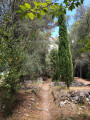
The path is largely shaded.

Worth a visit

(1) The hamlet of Bordinas is splendid.
Between (3) and (4), on the climb, you can admire the view of Cap d’Antibes, the Lérins Islands, and then the village of Tourette-Levens.

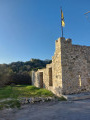
(4) The Macaron signpost – make the most of it to admire the view of the ruins of Châteauneuf Villevieille.

(4) If you’re up for it, you can carry on to the ruins of Châteauneuf Villevieille.

Always be cautious and plan ahead when you're outdoors. Visorando and the author of this route cannot be held responsible for any accidents occurring on this route.

The GR® and PR® markings are the intellectual property of the Fédération Française de Randonnée Pédestre.

Reviews and comments

4.8 / 5
Based on 2 reviews

Reliability of the description
5 / 5
Ease of following the route
4.5 / 5
Route interest
5 / 5
Alexiavrt
Alexiavrt

Overall rating : 4.7 / 5

Date of your route : Jun 08, 2025
Reliability of the description : ★★★★★ Very good
Ease of following the route : ★★★★☆ Good
Route interest : ★★★★★ Very good
Very busy route : No

A very pleasant hike, but if you stop at point 4 as described in the itinerary, you won't get the panorama promised in the description.
For that, you have to keep climbing, following the yellow markers. At one point you'll come across an orientation table, but the best thing to do is keep climbing for a magnificent 360° panorama.
With this addition, the hike took us 9km with 680m of positive ascent in 3h25 and the result is well worth the diversions.

Machine-translated

Oliv_MRN
Oliv_MRN

Overall rating : 5 / 5

Date of your route : Nov 27, 2023
Reliability of the description : ★★★★★ Very good
Ease of following the route : ★★★★★ Very good
Route interest : ★★★★★ Very good
Very busy route : No

A lovely little walk just a stone’s throw from Nice to stretch your legs
Pure enjoyment!

Machine-translated

Other walks in the area

For more walks, use our search engine .

The GPS track and description are the property of this route's author. Please do not copy them without permission.