From Les Grands Vignes to the Coline de Marmion in Brussieu (southern circular loop)

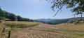
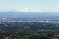
A family walk to explore the southern slopes of the village of Brussieu. From the Marmion plateau, there’s a lovely view of the Monts du Lyonnais.

Details

n°17687668
Creation:
Last update:
Last review:
  • Walking
    Activity: Walking
  • ↔
    Distance: 3.32 mi
  • ◔
    Average duration: 2h 05 
  • ▲
    Difficulty: Easy

  • ⚐
    Back to start: Yes
  • ↗
    Ascent: + 630 ft
  • ↘
    Descent: - 640 ft

  • ▲
    Highest point: 1,713 ft
  • ▼
    Lowest point: 1,099 ft

Description of the walk

At the entrance to the village of Brussieu, coming from La Giraudière, park in the car park by the village hall.

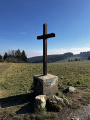
(S/E) Walk uphill towards the village until you reach the junction with a metal cross overlooking the street on the right. Turn right onto Chemin de Marmion. At the next junction, turn right, then walk uphill to the Marmion plateau. On the flat stretch, enjoy the view to the left over the Monts du Lyonnais.

(1) Continue to the junction with the road leading to the farm, known as ‘Chez Nicolas’, and turn left as you head downhill.

(2) A little further on, before the farm, leave the road and take the dirt track on the left. Walk down into the valley in the shade of the trees. Further down, when you reach a small tarmac road, turn left until you reach the first houses, at the junction with Chemin de Drillard.

(3) Head down to the right past the houses and continue until you reach the D101 county road.

(4) Cross with care and head down the dirt track opposite. The descent ends at the junction with a track above the D389. Turn left and continue until you reach the hamlet of Gonichon.

(5) After the houses, you’ll come to a small road with a hairpin bend; head down to the right. Further on, at the next junction, carry straight on. Before reaching the D389 roundabout, you’ll see a sewage treatment plant situated above the road on your left.

(6) Take the path opposite, which climbs gently, and leave the path leading up to the village on your left. Carry on until you reach a house.

(7) Go round the house to the left, then head up a narrow path on the left at the edge of the woods. Further up, the path turns right; carry on. Further on, the path takes a sharp left-hand bend; carry on between cultivated land above and a meadow below. After 250 metres, pass the Roux hut, a former farm hut renovated by a local association in Brussieu. Climb up to the next junction, where you’ll join the GR®7.

(8) Turn left; once you reach level ground, walk past the cemetery.

(9) At the next metal cross, a public bench invites you to take a break whilst enjoying the panoramic view of the Monts du Lyonnais. Continue to the right of the school. Further on, ignore a road leading up to the village on the left and a path leading down to the right; carry on straight ahead. The Brussieu village hall comes into view. Go round it on the right or left to reach the car park (S/E).

Waypoints

  1. S/E : mi 0 - alt. 1,447 ft - Car park at the village hall
  2. 1 : mi 0.83 - alt. 1,696 ft - Near the Nicolas Cross
  3. 2 : mi 0.89 - alt. 1,657 ft - A place called ‘Chez Nicolas’. Fork in the road
  4. 3 : mi 1.34 - alt. 1,450 ft - Le Drillard. Fork in the path
  5. 4 : mi 1.51 - alt. 1,345 ft - Route du Moulin D101
  6. 5 : mi 2.01 - alt. 1,260 ft - Le Gonichon
  7. 6 : mi 2.37 - alt. 1,099 ft - Roundabout. D389 - Brévenne(rivière) - Affluent de l'Azergues
  8. 7 : mi 2.48 - alt. 1,155 ft - House. Fork in the path
  9. 8 : mi 2.86 - alt. 1,407 ft - GR7
  10. 9 : mi 3.14 - alt. 1,467 ft - Metal cross
  11. S/E : mi 3.33 - alt. 1,447 ft - Car park at the village hall

Notes

What to bring: walking shoes or trainers.

Worth a visit

You’ll be able to see an active quarry, formerly known as the ‘town quarry’.
You’ll pass through Les Grands Vignes, an area that was once agricultural land covered in vines. A renovated farm hut bears witness to this past.
Find out more about the history of the village of Brussieu.

Always be cautious and plan ahead when you're outdoors. Visorando and the author of this route cannot be held responsible for any accidents occurring on this route.

The GR® and PR® markings are the intellectual property of the Fédération Française de Randonnée Pédestre.

Reviews and comments

4.7 / 5
Based on 1 review

Reliability of the description
5 / 5
Ease of following the route
5 / 5
Route interest
4 / 5
TEYSSIER YVES
TEYSSIER YVES

Overall rating : 4.7 / 5

Date of your route : Dec 16, 2024
Reliability of the description : ★★★★★ Very good
Ease of following the route : ★★★★★ Very good
Route interest : ★★★★☆ Good
Very busy route : No

A lovely route – moderate difficulty
Lovely view

Machine-translated

Other walks in the area

For more walks, use our search engine .

The GPS track and description are the property of this route's author. Please do not copy them without permission.