The Pampailly to Brussieu circular walk (northern loop)

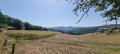
Starting from the village, you’ll walk around the small hill of Pampailly, following the course of the Le Cosne stream for part of the way before returning via the path to the washhouse. Half-path, half-road, half-shade, half-sun – this is a walk suitable for all seasons.

Details

n°16935361
Creation:
Last update:
Last review:
  • Walking
    Activity: Walking
  • ↔
    Distance: 4.16 mi
  • ◔
    Average duration: 2h 30 
  • ▲
    Difficulty: Easy

  • ⚐
    Back to start: Yes
  • ↗
    Ascent: + 689 ft
  • ↘
    Descent: - 673 ft

  • ▲
    Highest point: 1,683 ft
  • ▼
    Lowest point: 1,178 ft

Description of the walk

Park in the car park of the Brussieu village hall.

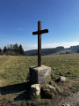
(S/E) Head towards the Chambost stables along the old Roman road and former trade route between Lyon and Bordeaux. This is now theGR®7and theGR®89, also known as the Chemin de Montaigne. Follow the red and white markings and, after a steep climb, you’ll reach a crossroads in the Alouettes neighbourhood.

(1) Turn right onto theGR® and begin a descent to the River Cosne. Cross the river and you’ll immediately come to a junction with a tarmac road.

(2) Leave theGR® here and turn right onto this road, passing the disused Chapel of Saint-Nicolas before reaching the hamlet of La Rivière.

(3) Continue along the same road until you reach a crossroads on the edge of the Bois de Pampailly.

(4) Turn right and cross the river via the Charfetain Bridge. Begin another climb. You will then emerge from the woods and come to a crossroads with a track at the edge of a large field.

(5) Turn right onto this track, follow the edge of the field and reach the junction with a road at the entrance to the hamlet of Charachon.

(6) Cross the road, taking care of traffic. Walk down the path opposite. Pass the old wash house and continue uphill. At the next junction, carry on and take the next road on the left, then the next one on the right. Before reaching the top, go through a small gate on the right to enter the Cour des Aîtres. Come out onto the village’s main street and walk down towards the village hall car park (S/E).

Waypoints

  1. S/E : mi 0 - alt. 1,447 ft - Car park at the Brussieu village hall
  2. 1 : mi 0.42 - alt. 1,371 ft - Le Charachon
  3. 2 : mi 0.6 - alt. 1,473 ft - Open-country track
  4. 3 : mi 2.17 - alt. 1,299 ft - Carfetain Bridge over the - Cosne (rivière) - Affluent de la Brévenne
  5. 4 : mi 2.53 - alt. 1,375 ft - The River
  6. 5 : mi 3.06 - alt. 1,417 ft - GR junction
  7. 6 : mi 3.66 - alt. 1,683 ft - Les Alouettes
  8. S/E : mi 4.16 - alt. 1,447 ft - Car park at the Brussieu village hall

Always be cautious and plan ahead when you're outdoors. Visorando and the author of this route cannot be held responsible for any accidents occurring on this route.

The GR® and PR® markings are the intellectual property of the Fédération Française de Randonnée Pédestre.

Reviews and comments

5 / 5
Based on 1 review

Reliability of the description
5 / 5
Ease of following the route
5 / 5
Route interest
5 / 5
Michel Mayoud
Michel Mayoud

Thank you very much for bringing this to our attention; the route has been reversed, as has the description. I will edit the description again and check with support to find out why it wasn’t saved.
Kind regards

Machine-translated

Topodarles13
Topodarles13
• Edited:

The description of the walk is the reverse of the route shown on the map
In fact, the details of the walk are the reverse of the route shown on the map

Machine-translated

jemache
jemache

Overall rating : 5 / 5

Date of your route : Oct 09, 2022
Reliability of the description : ★★★★★ Very good
Ease of following the route : ★★★★★ Very good
Route interest : ★★★★★ Very good
Very busy route : No

.

Machine-translated

Other walks in the area

For more walks, use our search engine .

The GPS track and description are the property of this route's author. Please do not copy them without permission.