


Ptit- Randonneur

 Visorando Member
 Premium user
 - Location: Aiffres (79230)
- Gender: man
Sign up:
Published route(s)
 Circular Pommier starting from Lachereau
 5.28 mi
 +207 ft
 -210 ft
 2h 35
2h 35
 Easy
Easy
 Departure from Exireuil (Deux-Sèvres)
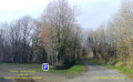
In the commune of Exireuil, this short route follows the eastern bank of the La Touche Poupard reservoir.Starting from the Lachereau sailing club car park, it partly follows the GR®364 trail, passes through the Bois de la Vergne and Bois de Chantoiseau woods, and joins the Clavé au Pommier road.
Shore of the Noron lake
 4.59 mi
+16 ft
-16 ft
2h 05
Easy
Departure from Niort (Deux-Sèvres)
4.59 mi
+16 ft
-16 ft
2h 05
Easy
Departure from Niort (Deux-Sèvres)
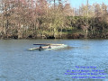
A short 7.5 km route along the banks of the Sèvre Niortaise: a walk around the lake, starting from the Noron water sports centre.
Circular route of the Rabané and Renardière valleys
 5.60 mi
+472 ft
-443 ft
3h 00
Easy
Departure from Exireuil (Deux-Sèvres)
5.60 mi
+472 ft
-443 ft
3h 00
Easy
Departure from Exireuil (Deux-Sèvres)
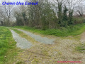
A peaceful hike in the countryside around Exiroise and Nanteuillaise. This circular hike, marked by the presence of several streams, takes you through villages, across a ford and past a 19th-century private cemetery.
Mont Alaric, Pallu and Ruisseau de Magnerolles starting from Nanteuil
 4.80 mi
+318 ft
-292 ft
2h 30
Easy
Departure from Nanteuil (Deux-Sèvres)
4.80 mi
+318 ft
-292 ft
2h 30
Easy
Departure from Nanteuil (Deux-Sèvres)
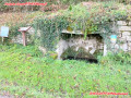
Short hike south-east of Nanteuil to explore the countryside. Go around Mont Alaric, pass through the hamlet of Pallu, then cross the Ruisseau de Magnerolles valley after the Bois de Fayes. Return via the Grandes Maisons and the Dolmen la Pierre Levée.
The banks of the Sèvre Niortaise at the start of Ricou
 5.04 mi
+417 ft
-420 ft
2h 40
Easy
Departure from Azay-le-Brûlé (Deux-Sèvres)
5.04 mi
+417 ft
-420 ft
2h 40
Easy
Departure from Azay-le-Brûlé (Deux-Sèvres)
Hike starting from Ricou. The trail first joins the approximately five-hectare Ricou quarry geosite, located on the right bank of the Sèvre Niortaise river in the commune of Azay-le-Brûlé. It consists of an open-air quarry formerly exploited for its limestone of varying types used as building material (rubble stone). Leaving the site, the route descends into the Sèvre Niortaise valley and leads to Veillon, before turning right onto the other bank of the river to reach the first houses of Sainte-Néomaye. You will then have to cross the Sèvre again to return to Ricou after passing through La Corbelière.
Circular Touche Poupard in Saint-Georges-de-Noisné
 4.80 mi
+174 ft
-207 ft
2h 20
Easy
Departure from Saint-Georges-de-Noisné (Deux-Sèvres)
4.80 mi
+174 ft
-207 ft
2h 20
Easy
Departure from Saint-Georges-de-Noisné (Deux-Sèvres)
This is an easy route that runs along the right bank of the Touche Poupard reservoir, crosses a few small streams that partially feed the dam, and passes through a few hamlets in Saint-Georges-de-Noisné. Part of the GRP® des Marches de Gâtine and GR®364 trails are used. Waterproof walking shoes with good gripping soles are recommended in case of recent rainfall.
Around Sainte-Néomaye via Mons, Fenioux and Kadoré
 5.06 mi
+266 ft
-246 ft
2h 35
Easy
Departure from Sainte-Néomaye (Deux-Sèvres)
5.06 mi
+266 ft
-246 ft
2h 35
Easy
Departure from Sainte-Néomaye (Deux-Sèvres)
This hike starting from the Pont de Sainte-Néomaye car park (on the banks of the Sèvre Niortaise) is an excellent suggestion. It is a route that allows you to discover the rural charm of the Deux-Sèvres, between valleys and small typical hamlets, while remaining accessible to all levels. Dirt tracks, forest paths and small tarmac roads (local roads). The Chemin de la Crépinière is a green introduction that runs partly along wooded areas. The gradient is very gentle, ideal for warming up your legs at a leisurely pace. The circular hamlet route: Mons, Fenioux and Kadoré. The route then revolves around three authentic villages: Mons: A peaceful passage where you can appreciate the local stone architecture. Fenioux: A central crossing point that often offers beautiful views of the surrounding countryside. Kadoré: The last hamlet before heading back down to the valley. Gently descend towards the banks of the Sèvre Niortaise.
"Terres Romanaises" initiative
 4.55 mi
+102 ft
-98 ft
2h 10
Easy
Departure from Romans (Deux-Sèvres) (Deux-Sèvres)
4.55 mi
+102 ft
-98 ft
2h 10
Easy
Departure from Romans (Deux-Sèvres) (Deux-Sèvres)
Heading for Romans (79). They say walking is the fountain of youth in Deux-Sèvres... Is this legend true? For this local outing, the ice axes and oxygen masks have been put away: we’ve focused on enjoyment, the great outdoors and a route accessible to all. Starting from the school car park, Romans Town Hall, Rue du Prieuré, let’s start with the vast and peaceful Maupré plain. We’ll skirt respectfully around the Logis de Vieux Romans. A quiet passage, almost on tiptoe, so as not to disturb the (benevolent!) ghosts of the past. Head towards La Garde and La Guittonnerie via the grassy service paths, perfect for unwinding without tiring yourself out. A bucolic detour along the Chemin de la Mare, a crossing of the Plaine de La Règle, before returning to the heart of Romans via Rue de la Garenne. A circular route that's ideal for those who love history as much as they love the great outdoors, without ending the day completely knackered.