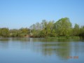
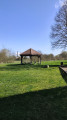
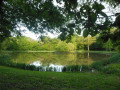
Along the banks of the Saône, starting from Seurre

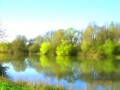
A pleasant walk that takes you along the Saône from Seurre to Pagny-la-Ville and back, partly through woodland. There are plenty of picnic spots, particularly near Le Châtelet and Pagny-la-Ville.

Details

241158
Creation:
Last update:
Last review:
  • Walking
    Activity: Walking
  • ↔
    Distance: 15.85 mi
  • ◔
    Average duration: 7h 20 
  • ▲
    Difficulty: Moderate

  • ⚐
    Back to start: Yes
  • ↗
    Ascent: + 36 ft
  • ↘
    Descent: - 36 ft

  • ▲
    Highest point: 623 ft
  • ▼
    Lowest point: 577 ft

Photos

Description of the walk

The walk starts from the car park located before the sports complexes, near the VNF offices.

(S/E) From the car park, cross the bridge over the Saône diversion canal, then turn left onto the yellow-markedPR® trail.

(1) After passing the high-voltage power lines, leave thePR® and turn left onto the white towpath. Follow this path, which runs alongside the Saône, until you reach the underpass beneath the A36 motorway.

(2) Continue along a grassy path that follows on from this. This path follows the meandering course of the Saône, offering beautiful scenery for around two kilometres.

(3) At the last bend before Lechâtelet, turn onto the path on the right which follows the fence and leads to the Chemin des Bungalows. Turn right: benches await you for a well-deserved break. Follow this path to a Fork in the road near a campsite.

(4) Turn left to go round the campsite and walk alongside the Saône to the old locks.

(5) Carry on straight ahead along the towpath lined with poplars until you reach the Saône. Pass under the bridge leading to Charrey-sur-Saône and continue on to Pagny-la-Ville. Follow the Saône quays, which will take you behind the church, where you’ll find a lovely picnic area

(6) Then continue along the Voie Bleue (tarmac path) to the diversion canal.

(7) Turn right and follow the canal until you reach the bridge linking Pagny-la-Ville to Pagny-le-Château.

(8) Turn right, then left to cross this bridge.

(9) Before you reach the first houses in Pagny-le-Château, turn right onto the path (Allée de Chassaigne). Follow this path, which ends in a lane lined with a few fir trees.

(10) Go round the ditch blocking the path via the woods on the right.

(11) 200 metres before the end of this avenue, take a small, gently sloping path on the right which leads to the Technoport de Pagny-Bourgogne.

(12) Turn left and follow the road to the D976 roundabout.

(13) At this roundabout, head right towards Seurre and continue along the D976, crossing the bridge over the motorway. About 300 metres further on, leave the D97 and take a track on the right which leads to a point a few dozen metres from the toll booth.

(14) Cross the access road and take the tarmac track opposite leading to Chamblanc. Pass a wayside cross on your left, then a castle on your right.

(15) In Chamblanc, take the road on the left, then turn immediately right onto the street leading to the church. Go round the church, then cut across Rue des Prés and continue along Rue du Château until you reach the junction with Rue Verte.

(16) Take Rue Verte on your right. This street soon becomes a dirt track, which you follow all the way to Seurre. Pass the sports hall, the tennis courts and the football pitch. Finally, take the first street on the right, which leads back to the starting car park (S/E).

Waypoints

  1. S/E : mi 0 - alt. 587 ft - Car park in front of the sports complexes
  2. 1 : mi 1.69 - alt. 584 ft - Leave the PR, turn left
  3. 2 : mi 2.79 - alt. 584 ft - Carry on straight ahead along the grassy path
  4. 3 : mi 5.06 - alt. 584 ft - Take the path on the right
  5. 4 : mi 5.96 - alt. 587 ft - At the fork in the road, turn left
  6. 5 : mi 6.71 - alt. 594 ft - Straight ahead along an avenue lined with poplars
  7. 6 : mi 8.91 - alt. 584 ft - Saône Quays
  8. 7 : mi 9.79 - alt. 597 ft - Diversion canal, turn right
  9. 8 : mi 10.48 - alt. 597 ft - Cross the bridge
  10. 9 : mi 10.96 - alt. 597 ft - Turn right onto Impasse de Chassaigne
  11. 10 : mi 11.54 - alt. 591 ft - Go round the ditch
  12. 11 : mi 12.02 - alt. 597 ft - Turn right towards Technoport
  13. 12 : mi 12.15 - alt. 597 ft - Turn left
  14. 13 : mi 12.4 - alt. 607 ft - At the roundabout, turn right onto the D976
  15. 14 : mi 13.08 - alt. 604 ft - At the toll booth, take the tarmac path opposite
  16. 15 : mi 14.12 - alt. 587 ft - Chamblanc: take the street on the left
  17. 16 : mi 14.68 - alt. 594 ft - Rue Verte, turn right
  18. S/E : mi 15.85 - alt. 587 ft - Car park in front of the sports complexes

Notes

This walk offers little shade: make sure you bring sun protection, plenty of water, good walking shoes and a few energy bars. We completed this walk in just over 5 hours without a picnic break. Allow an extra one to two hours for less experienced walkers due to the distance.

Always be cautious and plan ahead when you're outdoors. Visorando and the author of this route cannot be held responsible for any accidents occurring on this route.

The GR® and PR® markings are the intellectual property of the Fédération Française de Randonnée Pédestre.

Reviews and comments

3.7 / 5
Based on 5 reviews

Reliability of the description
3.6 / 5
Ease of following the route
4 / 5
Route interest
3.4 / 5
jcpocheron@aol.com
jcpocheron@aol.com

I can understand your disappointment that there is indeed asphalt, but 80% is perhaps an exaggeration; 50/50 would be more accurate, and of that 50%, only half is open to traffic. Now you say that at the end it is no longer passable. I don't understand at all, as the last few kilometres are on the road. The only problem on this hike is the Chassaigne forest between 9 and 11, where the trail has indeed changed over the last nine years
I'm sorry you didn't enjoy this hike, others have appreciated it
Best wishes

Machine-translated

fox210
fox210
• Edited:

Overall rating : 1.7 / 5

Date of your route : Jul 20, 2025
Reliability of the description : ★☆☆☆☆ Very disappointing
Ease of following the route : ★★☆☆☆ Disappointing
Route interest : ★★☆☆☆ Disappointing
Very busy route : No

Hike with 80% tarmac and an impassable path at the end!
The first 17 km are fine despite the tarmac, but the rest is uninteresting and increasingly impassable.
Hike to be avoided.

Machine-translated

Yovisheygo
Yovisheygo

Overall rating : 3 / 5

Date of your route : Aug 12, 2024
Reliability of the description : ★★★☆☆ Average
Ease of following the route : ★★★☆☆ Average
Route interest : ★★★☆☆ Average
Very busy route : No

A lovely but long walk… At one point in the forest, the signposting went wrong and we ended up wandering through the middle of nowhere! Luckily, we found our way back on to the path after a while.
Very little shade.

Machine-translated

mimijulien
mimijulien

Overall rating : 4.7 / 5

Date of your route : May 02, 2019
Reliability of the description : ★★★★★ Very good
Ease of following the route : ★★★★★ Very good
Route interest : ★★★★☆ Good

A good way to get back into the swing of things after the winter break...

Machine-translated

ponsot
ponsot

Overall rating : 4.3 / 5

Date of your route : Apr 07, 2018
Reliability of the description : ★★★★☆ Good
Ease of following the route : ★★★★★ Very good
Route interest : ★★★★☆ Good

A bit monotonous, especially between 7 and 9. The terrain is completely flat throughout, so it requires no physical effort and is suitable for everyone. Best avoided in hot weather as there is little shade. A lovely walk all the same.

Machine-translated

frederic.fautrelle
frederic.fautrelle

Overall rating : 4.7 / 5

Date of your route : May 15, 2016
Reliability of the description : ★★★★★ Very good
Ease of following the route : ★★★★★ Very good
Route interest : ★★★★☆ Good

A very pleasant walk with no difficulties in terms of navigation or elevation gain, ideal for exploring the banks of the Saône and the Saône Valley. 5 hours 45 minutes of actual walking, 6 hours 45 minutes in total. A brilliant day out. Highly recommended.

Machine-translated

Other walks in the area

For more walks, use our search engine .

The GPS track and description are the property of this route's author. Please do not copy them without permission.