


 Country:
 City:
City:



Park near Montmain Town Hall.
(S/E) Set off south-west, then quickly take the path that follows the road to reach the Bois de la Cure. You’ll come to a crossroads at the edge of the woods.
(1) Follow the edge of the woodland, turning left, then enter the woodland on the right. Continue along this straight path, crossing the Route de la Tuilerie. You’ll reach a crossroads of paths marked by a historic boundary stone.
(2) Take the path on the left. Pass the Chemin des Chasseurs, then cross the Rue de Gravelle. Carry on until you reach the junction at the Bois de la Tuilerie.
(3) Take the path on the left and enter the Bois de la Tuilerie; you’ll come to another junction by the small stream just before you leave the woods.
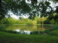
(4) Then turn right twice, then a little further on, turn left. You’ll soon reach the Étang de la Gravelle. Walk round the pond, then take the wide track of white pebbles until you reach a bridge.
(5) Cross this bridge to the right and continue to the D115.
When you reach it, turn left onto the D115 and continue due west, skirting the village to the north until you reach the D35e.
Then turn right onto this road for a few hundred metres before turning left just before the motorway bridge.
(6) Carry on along the path between the forest on your left and the Comtoise on your right.
(7) Then turn left and head back into the forest, heading south. Carry on, passing close to the Étang Neuf, and once you’ve left the edge of the forest, join the D115 on your left.
(8) Then walk straight through the village and head for the car park at Montmain Town Hall (S/E).

 Visorando Member
 Moderate
 Tourist office
