


Bonito New Route
Details
Creation:
Last update:
–
–
-
 Activity: Walking
 -
 Distance: 9.57 mi
 -
 Average duration: 6h 35
 -
 Difficulty: Not specified
 -
-
 Back to start: Yes
 -
 Ascent: + 2,533 ft
 -
 Descent: - 2,516 ft
 -
-
 Highest point: 2,428 ft
 -
 Lowest point: 135 ft
-
 Country:
Canary Islands
Country:
Canary Islands
-
 City:
Agaete
City:
Agaete -
 Start/End: N 28.106133° / W 15.707824°
 -


 Hour-by-hour weather


Waypoints
- S/E : mi 0 - alt. 144 ft - Start on
- 1 : mi 0.19 - alt. 190 ft - At roundabout, take exit 2 onto Paseo Obispo Pildain
- 2 : mi 0.27 - alt. 157 ft - Keep left
- 3 : mi 0.29 - alt. 151 ft - Turn right
- 4 : mi 0.33 - alt. 151 ft - Turn left
- 5 : mi 0.35 - alt. 157 ft - Turn sharp left onto Paseo Obispo Pildain
- 6 : mi 0.51 - alt. 141 ft - Keep right onto Paseo Obispo Pildain
- 7 : mi 0.52 - alt. 138 ft - At roundabout, take exit 3 onto GC-2
- 8 : mi 0.6 - alt. 161 ft - Keep left onto Paseo Obispo Pildain
- 9 : mi 0.61 - alt. 164 ft - Turn left onto GC-293
- 10 : mi 0.62 - alt. 167 ft - Turn sharp right onto Calle San Sebastián
- 11 : mi 0.63 - alt. 167 ft - Keep right
- 12 : mi 0.64 - alt. 167 ft - Turn sharp right onto Calle San Sebastián
- 13 : mi 0.66 - alt. 171 ft - Turn left onto Calle Garachico
- 14 : mi 0.69 - alt. 194 ft - Turn right onto Calle Buenavista
- 15 : mi 0.73 - alt. 217 ft - Turn left onto Calle Molinillos
- 16 : mi 0.75 - alt. 230 ft - Keep right onto Calle Señorita María Manrique Lara
- 17 : mi 0.83 - alt. 302 ft - Turn left
- 18 : mi 0.83 - alt. 302 ft - Turn right
- 19 : mi 0.89 - alt. 354 ft - Turn right
- 20 : mi 0.89 - alt. 354 ft - Turn sharp left
- 21 : mi 0.93 - alt. 397 ft - Keep right
- 22 : mi 1.01 - alt. 489 ft - Turn left
- 23 : mi 1.05 - alt. 515 ft - Keep right
- 24 : mi 1.25 - alt. 604 ft - Keep right
- 25 : mi 1.27 - alt. 617 ft - Keep left
- 26 : mi 1.57 - alt. 696 ft - Turn slight left
- 27 : mi 1.57 - alt. 692 ft - Turn slight left
- 28 : mi 1.83 - alt. 627 ft - Turn right
- 29 : mi 1.89 - alt. 633 ft - Keep left
- 30 : mi 2.1 - alt. 531 ft - Turn right onto GC-293
- 31 : mi 2.16 - alt. 531 ft - Turn right onto Calle Canaria
- 32 : mi 2.47 - alt. 643 ft - Keep right onto Calle Subida Las Rosas
- 33 : mi 3.43 - alt. 1,060 ft - Keep left onto Calle Subida Las Rosas
- 34 : mi 3.6 - alt. 1,204 ft - Keep left
- 35 : mi 4.26 - alt. 1,526 ft - Turn sharp right
- 36 : mi 4.48 - alt. 1,736 ft - Keep left
- 37 : mi 4.62 - alt. 1,850 ft - Turn right
- 38 : mi 5.22 - alt. 2,425 ft - Turn sharp right
- 39 : mi 5.23 - alt. 2,425 ft - Keep right
- 40 : mi 5.63 - alt. 2,293 ft - Turn sharp right
- 41 : mi 5.74 - alt. 2,218 ft - Turn right
- 42 : mi 7.34 - alt. 889 ft - Turn sharp left
- 43 : mi 7.36 - alt. 879 ft - Turn sharp right
- 44 : mi 7.76 - alt. 489 ft - Turn sharp left
- 45 : mi 8.07 - alt. 344 ft - Turn slight right onto GC-231
- 46 : mi 8.26 - alt. 302 ft - Keep right onto Calle Hermanos Castillo Olivares
- 47 : mi 8.32 - alt. 276 ft - At roundabout, take exit 1 onto GC-231
- 48 : mi 8.35 - alt. 279 ft - Turn right onto Calle Aguadulce
- 49 : mi 8.61 - alt. 318 ft - Keep right
- 50 : mi 8.76 - alt. 302 ft - Turn left
- 51 : mi 8.77 - alt. 302 ft - Turn left
- 52 : mi 8.78 - alt. 299 ft - Turn slight left onto Calle Tagayete
- 53 : mi 8.79 - alt. 285 ft - Turn right onto Calle Escultor Martín Andujar
- 54 : mi 8.89 - alt. 230 ft - Turn left onto Calle Molinillos
- 55 : mi 8.91 - alt. 217 ft - Turn right onto Calle Buenavista
- 56 : mi 8.95 - alt. 194 ft - Turn left onto Calle Garachico
- 57 : mi 8.99 - alt. 171 ft - Turn right onto Calle San Sebastián
- 58 : mi 9.01 - alt. 167 ft - Turn sharp left onto GC-293
- 59 : mi 9.02 - alt. 164 ft - Turn right onto Paseo Obispo Pildain
- 60 : mi 9.09 - alt. 141 ft - At roundabout, take exit 3 onto Paseo Obispo Pildain
- 61 : mi 9.34 - alt. 184 ft - At roundabout, take exit 2 onto Avenida Alfredo Kraus
- 62 : mi 9.38 - alt. 190 ft - Turn left
- 63 : mi 9.38 - alt. 187 ft - Turn right
- 64 : mi 9.39 - alt. 187 ft - Turn left
- 65 : mi 9.39 - alt. 190 ft - Turn left onto Avenida Alfredo Kraus
- S/E : mi 9.57 - alt. 141 ft
Other walks in the area
Sotavento beach from Agaete
 Visorando Member4.43 mi
+1,030 ft
-1,014 ft
2h 55
Visorando Member4.43 mi
+1,030 ft
-1,014 ft
2h 55
 Moderate
 Departure from Agaete (Province de Las Palmas)
Short hike before swimming in the Salinas pools and eating a delicious seafood dish. We follow part of the S-90, with a slight variation on the way back. The only drawback is that part of the road is dangerous, but there's a beautiful beach at the end.
Agaete, Lomo del Manco and Playa Guayedra
 5.25 mi
+2,313 ft
-2,329 ft
4h 25
Moderate
Departure from Agaete (Province de Las Palmas)
5.25 mi
+2,313 ft
-2,329 ft
4h 25
Moderate
Departure from Agaete (Province de Las Palmas)
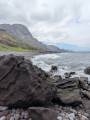
Set off from the charming town of Agaete for a hike that quickly gains altitude. The lush ascent offers superb views of the surrounding mountains and the white village of Agaete, nestled between the sea and the hills. The path then winds along the coast with spectacular panoramic views of the ocean. The descent leads to Guayedra beach, a wild and unspoilt spot surrounded by cliffs. This secluded beach offers an impressive natural setting and a timeless atmosphere. A beautiful circular route between mountains, ocean and landscapes typical of north-west Gran Canaria.
Heart of Artenara
 Association / Club / Walk leader2.80 mi
+1,322 ft
-1,325 ft
2h 25
Moderate
Departure from Artenara (Province de Las Palmas)
Association / Club / Walk leader2.80 mi
+1,322 ft
-1,325 ft
2h 25
Moderate
Departure from Artenara (Province de Las Palmas)
As the highest village on Gran Canaria, Artenara offers unrivalled views. Numerous well-signposted belvederes allow you to appreciate them to the full. Artenara is also renowned for its caves, some of which have been converted into guest rooms. Worth a visit.
To Artenara from Cruz de Tejeda
4.98 mi
+1,604 ft
-1,591 ft
3h 40
Moderate
Departure from Tejeda (Province de Las Palmas)
Starting out from Cruz de Tejeda, this is a great hike for the whole family. The views over Tejeda and its valley are magnificent, with the remarkable peaks of Roque Nubio and Roque Bentayga on the horizon.
Roque Nublo from Cruz de Timagada
 7.72 mi
+2,346 ft
-2,362 ft
5h 35
Moderate
Departure from Tejeda (Province de Las Palmas)
7.72 mi
+2,346 ft
-2,362 ft
5h 35
Moderate
Departure from Tejeda (Province de Las Palmas)
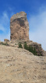
Nice hike near Tejeda, a little "off the beaten" tourist track.
Accessible by car via GC-60 and the small parking area at Mirador Cruz de Timagada.
This itinerary takes you up to Roque de Nublode, where you'll enjoy beautiful views of Tenerife on one side and Fuerteventura on the other.
Teror loop
 3.13 mi
+935 ft
-945 ft
2h 15
3.13 mi
+935 ft
-945 ft
2h 15
 Easy
Departure from Teror (Province de Las Palmas)
Easy
Departure from Teror (Province de Las Palmas)
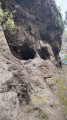
Circular walk easily accessible from Teror town centre, which is a sight to behold.
Several views of mountain villages (including Teror), the ocean and troglodyte caves.
A word of advice: beware of thorns if you decide to try the prickly pear!
Roque Nublo from La Culata
 4.67 mi
+1,729 ft
-1,722 ft
3h 40
Moderate
Departure from Tejeda (Province de Las Palmas)
4.67 mi
+1,729 ft
-1,722 ft
3h 40
Moderate
Departure from Tejeda (Province de Las Palmas)
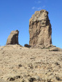
Superb hike to one of Gran Canaria's most beautiful sites. The road to La Culata is beautiful but narrow and winding, so honk your horn on the bends.
Discover Pico de Las Nieves
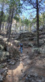 4.77 mi
+1,030 ft
-1,030 ft
3h 05
Moderate
Departure from Tejeda (Province de Las Palmas)
4.77 mi
+1,030 ft
-1,030 ft
3h 05
Moderate
Departure from Tejeda (Province de Las Palmas)
This route offers almost 360° views of Gran Canaria's breathtaking scenery. The fresh air at this altitude makes for a serene hike, with alternating undergrowth and volcanic areas offering sumptuous views.
For more walks, use our search engine .
The GPS track and description are the property of this route's author. Please do not copy them without permission.

