


Refine your search for walks in Bondoufle
Bondoufle walks


 Circular walk starting from Bondoufle
 Visorando Member
 9.14 mi
 +112 ft
 -112 ft
 4h 20
4h 20
 Moderate
 Departure from Bondoufle (Essonne)
A circular route of around 14 km between Bondoufle and the Domaine de Montauger – which is an absolute must-visit, including the park and the exhibitions at the château – returning via Écharcon, the Braseux farm and the Vert le Grand recycling centre. Allow just under 4 hours, not including the visit to Montauger.
The Russian Cemetery, the Bois des Trous, the Donjon de Ste-Geneviève-des-Bois
 3.90 mi
+23 ft
-23 ft
1h 50
3.90 mi
+23 ft
-23 ft
1h 50
 Easy
Departure from Sainte-Geneviève-des-Bois (Essonne) (Essonne)
Easy
Departure from Sainte-Geneviève-des-Bois (Essonne) (Essonne)
This route, which is half urban and half forest, focuses on footpaths. Along the way, you can visit the Russian cemetery (no dogs allowed), see an elephant, cross the Bois des Trous, admire the majestic keep and its flower beds, and be sure to visit the miraculous cave of Sainte Geneviève... An easy walk and a good time guaranteed.
Villagexpo circular in Saint-Michel-sur-Orge
 1.88 mi
+7 ft
-7 ft
0h 50
Easy
Departure from Saint-Michel-sur-Orge (Essonne)
1.88 mi
+7 ft
-7 ft
0h 50
Easy
Departure from Saint-Michel-sur-Orge (Essonne)
A route, ideal for lockdown, along the footpaths of Villagexpo and the Allée de la Bouloie in Saint-Michel-sur-Orge, within a one-kilometre radius of the Villagexpo, Genêts and Fontaine de l’Orme neighbourhoods.
Remarkable trees of the royal hunts of Sénart
 12.37 mi
+157 ft
-157 ft
5h 50
Moderate
Departure from Évry (Essonne) (Essonne)
12.37 mi
+157 ft
-157 ft
5h 50
Moderate
Departure from Évry (Essonne) (Essonne)
Some of these trees have probably seen the royal hunting parties pass by! This hike is partly like a treasure hunt. The remarkable trees are usually located a few dozen metres from the forest paths and require a little effort to discover. But the beauty of these specimens quickly makes you forget the difficulties. The route is further enhanced by passing close to two 18th-century castles.
The Tower of Montlhéry and the Basilica of Longpont
 6.53 mi
+358 ft
-387 ft
3h 20
Moderate
Departure from Saint-Michel-sur-Orge (Essonne)
6.53 mi
+358 ft
-387 ft
3h 20
Moderate
Departure from Saint-Michel-sur-Orge (Essonne)
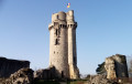
A hike that alternates between pleasant paths along the water's edge and urban passages. The Tower of Montlhéry, which offers a beautiful panorama, and the Basilica of Longpont, the destinations of this hike, are beautiful reminders of the Middle Ages in Île-de-France.
Banks of the Seine and Sénart Forest
 7.81 mi
+135 ft
-151 ft
3h 40
Moderate
Departure from Draveil (Essonne)
7.81 mi
+135 ft
-151 ft
3h 40
Moderate
Departure from Draveil (Essonne)
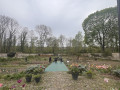
An easy hike that alternates between the Forest of Sénart, the banks of the Seine and some beautiful estates such as the Ermitage de Sénart, where Nadar lived, and the Parc du Grand Veneur in Soisy-sur-Seine.Please note the opening hours of the public garden. In addition, the park is closed during storms.
From Etiolles to Port aux Cerises along the banks of the Seine
 12.76 mi
+177 ft
-164 ft
6h 00
Moderate
Departure from Étiolles (Essonne)
12.76 mi
+177 ft
-164 ft
6h 00
Moderate
Departure from Étiolles (Essonne)
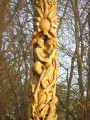
Circular starting from the Coudray roundabout in Etiolles. Descend the Seine to the Port aux Cerises leisure centre in Draveil, passing by the Lac des Docks and the Ris-Orangis eco-neighbourhood, the Port aux Malades, the Port aux Dames and the Fosse aux Carpes. The return journey takes you through the Paris-Jardins neighbourhood of Draveil, the Sénart Forest and the Grand Veneur park in Soisy-sur-Seine.
From Mennecy to Corbeil-Essonnes via Robinson Park
 8.16 mi
+102 ft
-135 ft
3h 50
Moderate
Departure from Mennecy (Essonne)
8.16 mi
+102 ft
-135 ft
3h 50
Moderate
Departure from Mennecy (Essonne)
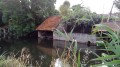
This last stage of the journey along the Essonne offers many opportunities to play leapfrog with the river. It is obviously the stage with the most urban sections. The town of Corbeil-Essonnes reveals its rich religious, civil and industrial heritage.
The Mennecy ponds
 8.87 mi
+161 ft
-131 ft
4h 15
Moderate
Departure from Mennecy (Essonne)
8.87 mi
+161 ft
-131 ft
4h 15
Moderate
Departure from Mennecy (Essonne)
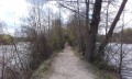
A lovely walk among ponds, marshes and, above all, birds, ducks, etc., lasting 4½ to 5 hours, or longer if you stop to watch the birds on the ponds.
Following the Orge from Sainte-Geneviève-des-Bois to Athis-Mons
 8.52 mi
+184 ft
-269 ft
4h 05
Moderate
Departure from Sainte-Geneviève-des-Bois (Essonne) (Essonne)
8.52 mi
+184 ft
-269 ft
4h 05
Moderate
Departure from Sainte-Geneviève-des-Bois (Essonne) (Essonne)
A hike from station to station that constitutes the last stage of this route along the Orge River, ending at its confluence with the Seine. Although the area is highly urbanised, the walkway along the river, which takes us back and forth across it, often offers a bucolic setting.
Longpont-sur-Orge and its basilica
 4.90 mi
+135 ft
-135 ft
2h 20
Easy
Departure from Saint-Michel-sur-Orge (Essonne)
4.90 mi
+135 ft
-135 ft
2h 20
Easy
Departure from Saint-Michel-sur-Orge (Essonne)
A short, varied and easy hike. Streams, meadows, forests, housing estates and fields, and of course the basilica of Longpont, are the ingredients of this walk just a few kilometres from Paris.
In the footsteps of Charles the Bold at the Battle of Montlhéry
 6.77 mi
+400 ft
-407 ft
3h 30
Moderate
Departure from Saint-Michel-sur-Orge (Essonne)
6.77 mi
+400 ft
-407 ft
3h 30
Moderate
Departure from Saint-Michel-sur-Orge (Essonne)
In 1465, Louis XI and Charles the Bold clashed at Montlhéry. This hike takes you to some of the historic sites in Essonne that witnessed this confrontation (Leuville, Montlhéry Castle, the battlefield, etc.). The return route takes you via Longpont Basilica.
Along the Seine from Corbeil to Juvisy
 8.46 mi
+13 ft
-23 ft
3h 55
Moderate
Departure from Corbeil-Essonnes (Essonne)
8.46 mi
+13 ft
-23 ft
3h 55
Moderate
Departure from Corbeil-Essonnes (Essonne)
A walk from station to station with a relatively straightforward route, as it mainly follows the right bank of the Seine. Apart from the approach from the starting station and the approach to the finishing station, the route stays as close as possible to the river.
From Corbeil to Ballancourt via Villeroy Park and the Fontenay Marshes
 12.46 mi
+354 ft
-302 ft
6h 00
12.46 mi
+354 ft
-302 ft
6h 00
 Difficult
Departure from Corbeil-Essonnes (Essonne)
Difficult
Departure from Corbeil-Essonnes (Essonne)
A walk from station to station starting in Vieux Corbeil (large mills, cathedral). After following the Seine, the route climbs before descending to Moulin Galant, then follows the Essonne. The walk concludes with a stroll through Villeroy Park, set in a wooded landscape, followed by an exploration of the Fonteanay Marshes and their birdwatching hides.
Following the Essonne
 97.78 mi
+3,153 ft
-3,136 ft
10 days
Moderate
Departure from Corbeil-Essonnes (Essonne)
97.78 mi
+3,153 ft
-3,136 ft
10 days
Moderate
Departure from Corbeil-Essonnes (Essonne)
Named after Acionna, the Gallo-Roman goddess of rivers, the Essonne flows through the north of the Loiret department and the south of the Île-de-France region. The first five stages follow its course downstream, while the last four follow it upstream. These nine stages are accessible by train. One stage, which is not accessible by train, forms a circular route upstream. The route alternates between paths along the river, passages through woods and those across cultivated plateaus.
From the Orge to the Yvette
 6.28 mi
+151 ft
-177 ft
3h 00
Moderate
Departure from Épinay-sur-Orge (Essonne)
6.28 mi
+151 ft
-177 ft
3h 00
Moderate
Departure from Épinay-sur-Orge (Essonne)
Hike around Epinay sur Orge (a small town south of Paris) from the train station of the RER C.It follows paths and quiet streets, heads through Bois des Templiers and follows the courses of three rivers: the Orge, the Rouillon and the Yvette. A trail through the Bois des Templiers with views of an old stone bridge with three arches of the ancient Templar Commandery of the eleventh century.
The Basilica of Longpont and the Templar Bridge of Balizy
 8.78 mi
+233 ft
-203 ft
4h 15
Moderate
Departure from Épinay-sur-Orge (Essonne)
8.78 mi
+233 ft
-203 ft
4h 15
Moderate
Departure from Épinay-sur-Orge (Essonne)
Starting from the town hall in Epinay-sur-Orge, this varied hike takes you along the banks of the Orge between Epinay and Longpont, to the 11th-century Basilica of Longpont and the Pont des Templiers de Balizy, the oldest bridge in the Île-de-France region and a remnant of a former 13th-century commandery.
 A walk in the Gatinais
 19.20 mi
+282 ft
-302 ft
2.5 hrs
Moderate
Departure from Fontenay-le-Vicomte (Essonne)
19.20 mi
+282 ft
-302 ft
2.5 hrs
Moderate
Departure from Fontenay-le-Vicomte (Essonne)
A very varied route: minor roads /GR® &PR® trails / narrow paths (single track) / passing through villages, forests and the plains of the Gatinais.
From the Essonne valley to the Mondeville plateau.
Through the towns of Fontenay-le-Vicomte, Chevannes, Champcueil, Nainville-les-Roches, Mondeville and Ballancourt-sur-Essonnes
The Grange du Breuil plain
1.75 mi
+105 ft
-105 ft
0h 55
Easy
Departure from Épinay-sur-Orge (Essonne)
Short hike across the Grange du Breuil plain and the Bois des Templiers woods.
From Juvisy to Choisy-le-Roi via Lac Montalbot
 8.58 mi
+16 ft
-20 ft
4h 00
Moderate
Departure from Juvisy-sur-Orge (Essonne)
8.58 mi
+16 ft
-20 ft
4h 00
Moderate
Departure from Juvisy-sur-Orge (Essonne)
A walk that starts in the Port aux Cerises park, with its ponds and Neolithic menhir. You then walk alongside a large lake and cross an urbanised area. The final third of the walk takes place mainly on the towpath along the Seine.
Between Leuville-sur-Orge and Brétigny-sur-Orge
 6.14 mi
+200 ft
-200 ft
3h 00
Easy
Departure from Leuville-sur-Orge (Essonne)
6.14 mi
+200 ft
-200 ft
3h 00
Easy
Departure from Leuville-sur-Orge (Essonne)
A few kilometres from Paris, this refreshing hike takes you through the village of Leuville-sur-Orge, along a path that runs alongside the Orge river, and to the Carouge basin in Brétigny-sur-Orge.
The banks of the Seine from Le Plessis-Chênet to Évry
 7.95 mi
+66 ft
-112 ft
3h 45
Moderate
Departure from Le Coudray-Montceaux (Essonne)
7.95 mi
+66 ft
-112 ft
3h 45
Moderate
Departure from Le Coudray-Montceaux (Essonne)
The banks of the Seine and the town of Corbeil have a rich historical and industrial past, which is highlighted on this walk. Among other things: Kings and Queens of France, famous figures, historical events, and prestigious industrial establishments. It is also a walk where, despite increasing urbanisation, nature and beautiful landscapes are still very much present.
The Port aux Cerises and the Château de Draveil
 6.04 mi
+105 ft
-105 ft
2h 50
Easy
Departure from Draveil (Essonne)
6.04 mi
+105 ft
-105 ft
2h 50
Easy
Departure from Draveil (Essonne)
Draveil, the Port aux Cerises, the Château de Draveil (Paris Jardins) and the Château de Villiers (Town Hall) and the footbridges along the Seine with views of the marinas.Reminder: Paris Jardins is private property. Passage is tolerated, but please be discreet and respectful so that the estate remains open to visitors.
The Bois des Templiers
 Association / Club / Walk leader
 1.26 mi
+66 ft
-66 ft
0h 40
Easy
Departure from Longjumeau (Essonne)
1.26 mi
+66 ft
-66 ft
0h 40
Easy
Departure from Longjumeau (Essonne)
A short walk through the Bois des Templiers in Balisy.
Urban walk on the Coteaux d’Athis-Mons
 7.63 mi
+240 ft
-256 ft
3h 45
Moderate
Departure from Savigny-sur-Orge (Essonne)
7.63 mi
+240 ft
-256 ft
3h 45
Moderate
Departure from Savigny-sur-Orge (Essonne)
An urban route between Savigny-sur-Orge, Athis-Mons and Juvisy-sur-Orge. After a very urban first half, the second half follows paths between detached houses and buildings, roughly following the course of the River Orge.
From Ballancourt-sur-Essonne to La Ferté-Alais via Mondeville
 12.27 mi
+663 ft
-630 ft
6h 15
Difficult
Departure from Ballancourt-sur-Essonne (Essonne)
12.27 mi
+663 ft
-630 ft
6h 15
Difficult
Departure from Ballancourt-sur-Essonne (Essonne)
Twenty-ninth stage of the Grand Tour of Île-de-France via the GR®11, linking Ballancourt-sur-Essonne to La Ferté-Alais. Although both towns are located in the Essonne valley, the proposed route passes through the plateau overlooking the valley on the east side, in the Gâtinais Français Regional Nature Park, to the charming village of Mondeville. The GR® then winds its way between valleys, forests dotted with sandstone boulders and agricultural plateaus. This stage is shorter than the previous ones but is not without its difficulties as it still covers steep sections of terrain similar to the Fontainebleau forest, particularly around Mondeville. The route also allows you to discover some unusual sights, such as the Roches du Père La Musique in Ballancourt.
From Ballancourt to La Ferté-Alais, the Itteville marshes and the Sanglier rock
 8.20 mi
+381 ft
-354 ft
4h 05
Moderate
Departure from Ballancourt-sur-Essonne (Essonne)
8.20 mi
+381 ft
-354 ft
4h 05
Moderate
Departure from Ballancourt-sur-Essonne (Essonne)
A walk from station to station that starts gently along the Essonne. Further on, the crossing of the Itteville marshes allows you to discover ponds and reed beds and admire the birds from the observation points provided. After passing an imposing menhir, you climb the Butte d’Itteville. You then reach the rocky outcrops of Le Sanglier. The walk ends with a stroll through the narrow streets of La Ferté-Alais.
In the west of the Rougeau Forest
 6.75 mi
+197 ft
-197 ft
3h 15
Moderate
Departure from Morsang-sur-Seine (Essonne)
6.75 mi
+197 ft
-197 ft
3h 15
Moderate
Departure from Morsang-sur-Seine (Essonne)
A pleasant hike mainly through the forest. A route punctuated by several ponds.
In the Forest of Sénart
 8.64 mi
+20 ft
-20 ft
4h 00
Moderate
Departure from Montgeron (Essonne)
8.64 mi
+20 ft
-20 ft
4h 00
Moderate
Departure from Montgeron (Essonne)
A forest route that alternates between wide paths under tall trees and winding trails in the undergrowth that require a good sense of direction. At the end of the route, a beautiful isolated pond is a great place to stop.
Circular between Le Coudray and Saint-Fargeau along the banks of the Seine
 7.68 mi
+144 ft
-144 ft
3h 40
Moderate
Departure from Le Coudray-Montceaux (Essonne)
7.68 mi
+144 ft
-144 ft
3h 40
Moderate
Departure from Le Coudray-Montceaux (Essonne)
This walk allows you to discover one of the meanders of the Seine, with lovely views of the right bank with Morsang, the Rougeau forest and Seine-Port. On the way, you can stop to discover the circular wash house in Tilly.
Short circular of Rocher de Saulx
 3.19 mi
+233 ft
-253 ft
1h 40
Easy
Departure from Saulx-les-Chartreux (Essonne)
3.19 mi
+233 ft
-253 ft
1h 40
Easy
Departure from Saulx-les-Chartreux (Essonne)
Tour du Rocher de Saulx, a forest home to interesting flora and fauna to discover along the way.
Ballancourt-sur-Essonne circular
 6.97 mi
+367 ft
-371 ft
3h 30
Moderate
Departure from Ballancourt-sur-Essonne (Essonne)
6.97 mi
+367 ft
-371 ft
3h 30
Moderate
Departure from Ballancourt-sur-Essonne (Essonne)
A route between town, fields and forest, during which you will have the opportunity to discover some of the points of interest in the commune of Ballancourt-sur-Essonne.
Around the Yvette via Villebon and Saulx-les-Chartreux
5.85 mi
+157 ft
-157 ft
2h 50
Easy
Departure from Saulx-les-Chartreux (Essonne)
This route follows thePR®10and 13 trails and the Promenade de l'Yvette. It has been chosen to avoid as much as possible the busy roads crossing the Basses Roches district in Villebon. Only the crossing over the A10 motorway via the viaduct is unavoidable, but it is short (200 m) and the pavement is wide. The rest of the route is pleasant along the Promenade de l'Yvette, the paths in the plain and around the Étang de Saulx-les-Chartreux.
The Bassin, the Plaine and the Forest of Saulx
 6.97 mi
+358 ft
-354 ft
3h 30
Moderate
Departure from Saulx-les-Chartreux (Essonne)
6.97 mi
+358 ft
-354 ft
3h 30
Moderate
Departure from Saulx-les-Chartreux (Essonne)
A varied route in a peri-urban setting, along rivers and streams and the Bassin de Saulx, and in the heart of the Rocher de Saulx departmental forest.
Please note! Work around the Bassin de Saulx means that the route has been changed at the end: follow the suggested alternative route.
Between Villebon-sur-Yvette and Saulx-les-Chartreux, following the Yvette
8.37 mi
+285 ft
-285 ft
4h 05
Moderate
Departure from Saulx-les-Chartreux (Essonne)
A very beautiful and fairly easy walk, stunning all along the Yvette, then a short steep climb on Rue des Bouleaux for 300 m and you’ll find yourself in the Gelles Departmental Forest. Overall, there’s very little walking on the road; it’s all on lovely paths, finishing around Lac de Saulx. You’ll see wild ducks and moorhens along the Yvette and also around the lake, along with swans and a few waders. If you like horses, you’ll also see several stud farms and occasionally riders. This is my Sunday jogging route.
New Year's Eve at the abbey
 6.91 mi
+197 ft
-194 ft
3h 20
Moderate
Departure from Brunoy (Essonne)
6.91 mi
+197 ft
-194 ft
3h 20
Moderate
Departure from Brunoy (Essonne)
Circular route around the former Yerres Abbey (12th century) located at the confluence of the Yerres and Réveillon rivers. The start of the route follows the course of the Yerres to the abbey, then climbs through a highly urbanised area to the former Camaldolese monastery, before descending towards the Réveillon, which you follow to the confluence. The return journey takes you through Brunoy, past the Robert Dubois-Corneau Museum, Saint-Médard Church and finally the Perronet Bridge.
The Rocher Mignot and the Marais d'Itteville
 8.09 mi
+269 ft
-285 ft
3h 55
Moderate
Departure from Bouray-sur-Juine (Essonne)
8.09 mi
+269 ft
-285 ft
3h 55
Moderate
Departure from Bouray-sur-Juine (Essonne)
Discover some geological and natural sites in the south of the Essonne department: a landscape of flat land, a sandpit and a vast marshland area that is home to many birds. This hike alternates between sections in the undergrowth, which are the most numerous, and sections between fields.
Along the banks of the Réveillon and the Yerres to the Servon ponds
12.91 mi
+331 ft
-331 ft
6h 15
Difficult
Departure from Yerres (Essonne)
A walk along the riverbank that follows the Réveillon upstream from its confluence with the Yerres. Alternating between woodland, urban parks, an old village and the countryside, almost the entire route offers views of the Réveillon.