Country:

 City:
City:


The route starts from the car park at the foot of the Gravelle bandstand, near the Vincennes Racecourse. ‘Plateau de Gravelle’ bus stop.
(S/E) On leaving the car park, turn right onto the Route du Pesage and follow it for about fifty metres.
(1) Turn off onto the path on the left which crosses over the Ruisseau de Gravelle and continue to a roundabout. Go round it on the right, leaving two roads on your right-hand side.
(2) Take the first path on your right, veer left at the next junction of paths, then go straight on and cross two roads.
(3) Continue along the path, cross a bridle path and, at the next junction, take the path on the left, then the one on the right. Further on, turn left, pass the Butte aux Canons and join Route Saint-Hubert, following it to the left until you reach the roundabout.
(4) Turn right onto Allée Royale, heading due north, and carry on straight ahead until the next junction. Turn left, then continue to Avenue du Polygone and cross Route de la Tourelle. Carry on to the stream without crossing it.
(5) Now turn left and follow the path running alongside the stream. Cross Route Brûlée, changing banks, then follow the same stream.
(6) Cross Route Saint-Louis, then rejoin the path to reach the road leading to the roundabout, which you passed on the way there. Take the right-hand exit until you reach the second road, heading south.
(7) Take this path and continue straight on until you reach Route de la Tourelle. Stay on the path running along the left-hand side of the new stream, turn right, then cross the Ruisseau de la Gravelle and turn left immediately after crossing it. Continue until you cross a road coming from the roundabout, which you also passed on the way out.
(8) Carry on straight ahead, then follow the path on the right at the footbridge (do not cross it). Follow this same path, cross the Route de la Tourelle and walk alongside the Ruisseau de Gravelle to reach the Route du Pesage and the original junction.
(1) Following the reverse route of the outward journey, turn right and head back to the car park (S/E).

 Visorando Member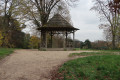


 Local authority
 Moderate