Country:

 City:


Access is via Modane. Turn right towards Valfréjus, drive through the resort, then at a hairpin bend, leave the Lavoir track on your right towards Le Seuil, which you’ll reach after two hairpin bends. Two hairpin bends further up, and after passing Le Mélezet, the car park is on the left, with a view of the Fréjus Tunnel’s ventilation shaft.
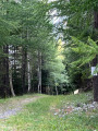
(S/E) Take the track that climbs to the left at the back of the car park until you reach a cairn on the right.
(1) Follow the winding path to the right, which crosses the ruins of Le Pontet and climbs steeply to a junction marked by two cairns.
(2) Turn right and head south-east to reach the Chalet de la Combaz.
(3) Continue south-east, following the tracks left by sheep in the tall grass. Climb up the gullies – one of which is full of water and features a beautiful waterfall – and arrive at a barely marked fork.
(4) Turn north, then go round the ridge above the waterfall.
(5) Head east-southeast without crossing the main torrent straight away, then due east, and climb the grassy slopes dominated by the Belle Plinier to reach a small pass just to the right of the summit.
(6) Turn left and, via a short, easy ridge, reach the summit.
(7) Magnificent views over the Ecrins, the Thabor, the Grandes Rousses, Belledonne, the Aiguilles d’Arves, the Vanoise with Péclet, Dent Parrachée, Grande Casse, Grande Motte and the Grand Roc Noir taking centre stage; the Aiguille de Scolette is very close by.
Return to the small pass.
(6) Continue straight ahead, without difficulty, along the ridge towards Punta Bagna, heading south then south-west. Reach the Passage du Vallon.
(8) Continue along the ridge, which soon turns due south, to reach the Col des Sables; take care on the descent.
(9) Continue south to the foot of the Punta Bagna summit at a fork in the path.
(10) Finish with a steep section of around 200 m in elevation gain, cut across by a snowfield, leaving the ridge and skirting the rocks to the right. Reach the summit of Punta Bagna.
(11) A sweeping view over Bardonecchia and, in the distance, Mount Viso.
Begin the descent and cross the snowfield to reach the previous fork.
(10) After the snowfield, veer left to move away from the ridge. Traversing across several gullies, reach the point directly above the Col des Sables, which you crossed earlier.
(12) Following the contour line more or less closely, head for a large red boulder. Turn left, heading north-west, and reach a small crescent-shaped lake spotted earlier.
(13) Two cairns indicate the direction to follow. Follow a track north-east until you are overlooking the ascent route. Join this route via an off-trail descent.
(4) Retracing your steps along the ascent route, head back to the Chalet de la Combaz, the crossroads of paths and then the car park at the start (S/E).

 Visorando Member
 Difficult


 Moderate
 Easy