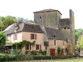
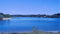
Forest walk near Mazeyrolles

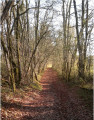
A walk through the forest between Monpazier and Villefranche-du-Périgord; very easy on limestone and dirt tracks; very little walking on tarmac roads. Shaded for much of the route, though there may be a few muddy patches in wet weather. Ideal for exploring the forest of southern Périgord.

Details

106091192
Creation:
Last update:
Last review:
  • Walking
    Activity: Walking
  • ↔
    Distance: 4.99 mi
  • ◔
    Average duration: 2h 30 
  • ▲
    Difficulty: Easy

  • ⚐
    Back to start: Yes
  • ↗
    Ascent: + 243 ft
  • ↘
    Descent: - 236 ft

  • ▲
    Highest point: 866 ft
  • ▼
    Lowest point: 735 ft

Description of the walk

The easiest way to access this walk is to park at the side of the D660 (on the right-hand side when coming from Monpazier), in a small forest car park opposite the access road to the Bastides football pitch.

(S/E) Take the ‘chemin de castine’ which leads into the woodland, rising slightly. Continue until you reach a T-junction facing a large, open meadow.

(1) Turn left onto the dirt track, which soon leads into the tree cover. Continue through the woods, following the track closely (the path used by farm machinery) until you reach a junction with a limestone track.

(2) Turn right and walk for about 250 m until you reach a crossroads.

(3) Turn left onto the very straight limestone track heading towards the Route du Roc de Claricou.

(4) Before reaching the road, follow the yellow signposts and turn left onto a track towards Lac Blanc (firebreak).

(5) Go round the lake on the left and join the D660. Cross it carefully and follow the Route de Mazeyrolles for 50 m.

(6) Turn left onto the limestone track and head through the woods to the Route de l’Usine.

(7) Cross it and continue straight ahead along the dirt track for about 200 m, then turn left onto a limestone track and follow it to the junction with the road leading to Le Got, passing through the hamlet of Les Mazades.

(8) Turn left, then left again to follow the D660 and reach the car park (S/E).

Waypoints

  1. S/E : mi 0 - alt. 745 ft - Car park by the D660
  2. 1 : mi 1.21 - alt. 755 ft - Junction opposite a large meadow
  3. 2 : mi 1.87 - alt. 840 ft - Junction at La Croix de Souilé
  4. 3 : mi 2 - alt. 850 ft - Crossroads
  5. 4 : mi 2.64 - alt. 837 ft - Turn-off towards Lac Blanc
  6. 5 : mi 2.9 - alt. 860 ft - Le Lac Blanc (Capdrot)
  7. 6 : mi 3.23 - alt. 840 ft - Route de Mazeyrolles
  8. 7 : mi 3.71 - alt. 837 ft - Route de l’Usine
  9. 8 : mi 4.6 - alt. 751 ft - Route du Got. D58
  10. S/E : mi 4.99 - alt. 745 ft - Car park by the D660

Notes

Please note: this is an easy walk, but there are no drinking water points. It is usually quite shaded, except when the sun is at its highest.

No special footwear required, but there are a few muddy patches in wet weather.

Two crossings of the D660; please take care.

The walk is entirely through woodland; please do not smoke or light fires.

Deer and wild boar drives are quite common in this area during autumn.

Worth a visit

The fortified villages of Monpazier and Villefranche-du-Périgord.

Other walks in the area

For more walks, use our search engine .

The GPS track and description are the property of this route's author. Please do not copy them without permission.