
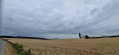
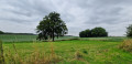
A figure-of-eight walk linking Lillois-Witterzée and Ophain-Bois-Seigneur-Isaac

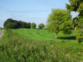
This walk, which takes place almost entirely in the countryside, links two of the three localities in the Brainoise area: Lillois-Witterzée and Ophain-B-S-I. See the practical information section for alternative routes.

Details

n°57883330
Creation:
Last update:
Last review:
  • Walking
    Activity: Walking
  • ↔
    Distance: 5.70 mi
  • ◔
    Average duration: 2h 50 
  • ▲
    Difficulty: Easy

  • ⚐
    Back to start: Yes
  • ↗
    Ascent: + 203 ft
  • ↘
    Descent: - 207 ft

  • ▲
    Highest point: 459 ft
  • ▼
    Lowest point: 328 ft

Photos

Description of the walk

Start in Lillois-Witterzée. Parking is available either on Rue Motte des Bergers or at the entrance to Rue des Hayettes.

(S/E) At the junction of Rue Motte des Bergers, Rue des Hayettes and the Route de Lillois (Rue du Berger), cross the latter and take the farm track opposite for about 50 metres. Take the first track on the right, Chemin Chesseroux.

(1) At the end of this, turn left onto Rue des Belles Pierres until you reach the Notre-Dame des Belles-Pierres Chapel, situated on the left at the second junction. Turn right and follow the cobbled road, Chemin de la Chapelle, until you reach the start of the bend.

(2) Turn left and keep left to take Chemin Robin, which winds its way under the trees. At the junction, turn right towards the Hain and a meadow. A small bridge and a footbridge allow you to cross them. Keep well to the left, along the edge of the stream. The path leads out onto wooden planks due to the high humidity in the area.

(3) On Chemin Bertinchamps, turn right onto the tarmac road, ignore the two entrances to the Bois du Drape on the left and take the first street on the left, Rue des Culots. Cross Rue de Bois-Seigneur-Isaac and continue straight ahead.

(4) At the fork in the road, keep to the right. Rue Baty du Cerisier climbs up to the plateau and a riding school. The road then becomes a farm track

(5) Take the first farm track on the right, the Chemin de Haut-Ittre, and cross over the ring road.

(6) At the first junction (a wayside shrine between two trees), turn right onto the Chemin du Pont Haye and follow it until you reach Rue de Dinant.

(7) Caution: this is a very busy road. Cross with care and turn slightly right onto Rue Jacques Hubeau, a very short street ending in a footpath (caution: the ground is often very muddy – see practical information *). Join Rue du Gazon and turn right.

(8) At the junction at the top of the hill, turn left onto Rue du Pirois. Ignore a street on the left, then cross Rue de Lillois. Take Rue Giroune opposite, then the right-hand branch at the Y-junction. Ignore the first street on the right.

(9) Take the second street on the right, the cobbled extension of Rue Giroune. It climbs steeply through the woodland. You’ll reach Rue des Hayettes.

(10) Turn right, go over the ring road and carry on straight ahead to reach the car park on Rue Motte des Bergers (S/E).

Waypoints

  1. S/E : mi 0 - alt. 449 ft - Rue Motte des Bergers
  2. 1 : mi 0.85 - alt. 390 ft - Junction
  3. 2 : mi 1.3 - alt. 361 ft - Chemin Robin - Hain (rivière) - Belgique - Affluent du Canal Bruxelles-Charleroi
  4. 3 : mi 1.59 - alt. 358 ft - Chemin Bertinchamps
  5. 4 : mi 1.99 - alt. 397 ft - Junction
  6. 5 : mi 2.64 - alt. 446 ft - Chemin de Haut-Ittre
  7. 6 : mi 3.27 - alt. 433 ft - Junction, wayside shrine
  8. 7 : mi 4.15 - alt. 354 ft - Crossing the road
  9. 8 : mi 4.49 - alt. 351 ft - Rue du Pirois
  10. 9 : mi 4.87 - alt. 377 ft - Junction
  11. 10 : mi 5.34 - alt. 436 ft - Junction
  12. S/E : mi 5.7 - alt. 453 ft - Rue Motte des Bergers

Notes

It also links up with various other walks described under my name, allowing for shortcuts either to shorten the routes originally planned or, conversely, to lengthen them by combining them. The route itself can be split into two if necessary.

This walk is also suitable for mountain bikes
You can also start from Place d’Ophain. In this case, turn your back on the church and take Rue de Dinant until you reach the junction with the route. Follow it to the left.

  • This path continues on from Rue Jacques Hubeau. If it is or has been raining, do not take this street, but head back up Rue de Dinant to the left until you reach Rue du Gazon, which branches off to the right.

(8) The centre of the ‘8’: a possible shortcut back to the start. Turn right, cross over the motorway and, immediately afterwards, turn left onto Chemin de Chesseroux, which you took on the way out.

Worth a visit

Reviews and comments

4.7 / 5
Based on 1 review

Reliability of the description
5 / 5
Ease of following the route
5 / 5
Route interest
4 / 5
Patrick Vanbellinghen

Thanks, Luc, and enjoy your walks. I’ve got some more in the area on my website www.nature-et-coeur.be.

Machine-translated

Luc1
Luc1

Overall rating : 4.7 / 5

Date of your route : Aug 10, 2024
Reliability of the description : ★★★★★ Very good
Ease of following the route : ★★★★★ Very good
Route interest : ★★★★☆ Good
Very busy route : No

nestled between woodland and meadows, lovely in warm weather

Machine-translated

Other walks in the area

For more walks, use our search engine .

The GPS track and description are the property of this route's author. Please do not copy them without permission.