Country:
 City:


Car park at Lillois-Witterzée station.
There are numerous buses from Braine-L’Alleud or Nivelles.
(S/E) With your back to the railway line, head towards the Grand’Route via Rue de la Libération. Turn right and cross the Grand’Route at the traffic lights. Opposite, take Rue Raymond Lebleux for about 100 metres.
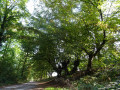
(1) Turn left onto the Sentier de la Grosse Borne and carry on straight ahead until you reach a lovely large farmhouse on your right. By now, the path – which started as a tarmac road and then became a dirt track – has turned into a footpath leading you to a tarmac road, Rue Comte J. de Meeus. Walk past the Ferme de la Neuve-Cour and carry on until you reach the first country lane branching off to the right, the Chemin de Vieux-Genappe.
(2) Take this path and, at the first junction, carry on straight ahead. You’ll pass the Hulencourt Golf Club.
(3) At the second junction, turn right. You are now on the Chemin du Crucifix, the old road linking Brussels to Lillois. It is paved with old cobblestones. You will pass the golf course again and keep it on your right until you reach the Route de Lillois. Turn right. Caution: this is a very busy road with no pavement! Stay well to the right-hand verge until you reach the first houses (about 200 m).
(4) Cross Route de Lillois carefully and head diagonally right onto Chemin n°4. Carry on straight ahead until you reach the small wood, which you cross. On the other side, turn right onto Rue du Cours d’Eau and follow it to the Grand’Route, ignoring all the streets on both the right and left.
(5) At the road, turn right onto the footpath. Cross over, walk 10 metres to the left and turn right into Rue du Jacquet; then, at the end of this street, turn left.
(6) Just before a slight bend, turn right onto the Sentier du Moulin à Vent, which climbs between two houses. It leads to Rue Mottet. First turn left then right to continue along it until you reach Rue du Moulin. Turn left and cross the railway line.
(7) Immediately afterwards, turn right onto Rue Verte, which continues as a path lined with meadows, with the school on your right.
(8) At the end of this, turn right, then right again onto the Sentier du Pré Coquette. At Rue René Francq, turn right until you reach the railway line. Cross it and turn left to reach the car park (S/E). (An underpass allows you to cross when the railway barriers are closed.)


 Visorando Member
 Moderate