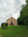
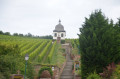
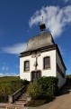
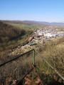
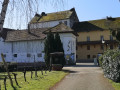
Walk through the Kochersberg countryside

A pleasant little walk in the Kochersberg, exploring the villages of Kuttolsheim and Fessenheim-le-Bas.

Details

n°65669438
Creation:
Last update:
Last review:
  • Walking
    Activity: Walking
  • ↔
    Distance: 4.70 mi
  • ◔
    Average duration: 2h 15 
  • ▲
    Difficulty: Easy

  • ⚐
    Back to start: Yes
  • ↗
    Ascent: + 108 ft
  • ↘
    Descent: - 108 ft

  • ▲
    Highest point: 663 ft
  • ▼
    Lowest point: 522 ft
  • ⚐ Country: France
  • ⚐ City: Kuttolsheim (67520)
  • ⚑
    Start/End: N 48.643268° / E 7.529726°
  • ❏
    IGN map(s): Ref. 3715ET, 3816OT
  • Hour-by-hour weather

Photos

Description of the walk

Parking is available in front of the Kuttolsheim multi-purpose hall.

Blue Ring signposting

(S/E) With your back to the car park, follow Rue des Prés to the left. Ignore the next street on the left and, at the bend, turn left, passing in front of the church.

(1) After the church, follow Rue de l’Église to the left until you reach Route des Romains further on.

(2) Turn left and carry on until you reach the junction with Route du Calvaire (the second street on the right), which you follow to the right. Ignore the next two streets on your left and right and carry on until you reach the bend.

(3) Follow the dirt track that branches off to the left and leads to a small stream.

(4) Turn left and head towards the village of Fessenheim-le-Bas. Take thefirst street on the right and continue until you reach Rue de Nordheim.

(5) Follow it to the left until the next junction, then turn right and continue along Rue de Marlenheim until the junction with Rue des Champs, which you follow to the left. Keep going straight on, leave the village and join the old Roman road.

(6) Carry on to the right for a few metres, then cross the road (the Roman road) with care and continue along the path opposite. Walk past the Sainte-Marguerite Chapel and carry on to the next junction.

(7) Turn left and continue along this path to reach the village of Kuttolsheim and the car park at the Kuttolsheim multi-purpose hall (S/E).

Waypoints

  1. S/E : mi 0 - alt. 584 ft - Kuttolsheim Community Centre
  2. 1 : mi 0.12 - alt. 591 ft - Kuttolsheim Church
  3. 2 : mi 0.19 - alt. 610 ft - Roman Road
  4. 3 : mi 0.45 - alt. 659 ft - Turn left
  5. 4 : mi 0.9 - alt. 633 ft - Stream – on the left
  6. 5 : mi 1.46 - alt. 627 ft - Rue de Nordheim
  7. 6 : mi 2.13 - alt. 587 ft - Ancient Roman road
  8. 7 : mi 2.81 - alt. 525 ft - Crossroads – turn left towards the - Soullel (cours d'eau) - Affluent de l'Ill
  9. S/E : mi 4.7 - alt. 584 ft - Kuttolsheim Community Centre

Notes

Avoid this walk in wet weather as it is very muddy in places.

Worth a visit

Reviews and comments

5 / 5
Based on 1 review

Reliability of the description
5 / 5
Ease of following the route
5 / 5
Route interest
5 / 5
Alain Guy
Alain Guy

Overall rating : 5 / 5

Date of your route : Jul 02, 2025
Reliability of the description : ★★★★★ Very good
Ease of following the route : ★★★★★ Very good
Route interest : ★★★★★ Very good
Very busy route : No

Good idea for a walk

Machine-translated

Other walks in the area

For more walks, use our search engine .

The GPS track and description are the property of this route's author. Please do not copy them without permission.