A stroll along the water’s edge in Munster

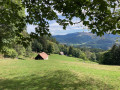
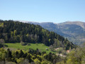
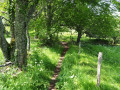
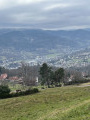
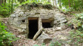
A walk through the town of Munster and its surroundings, centred on the theme of water. It is suitable for families. Come and discover Munster’s heritage through some twenty fun and educational panels, placed along the route. Do take a moment to explore the old wash houses in particular. The walk also offers a glimpse of the hydroelectric power stations still in operation.

Details

n°75681992
Creation:
Last update:
Last review:
  • Walking
    Activity: Walking
  • ↔
    Distance: 3.90 mi
  • ◔
    Average duration: 1h 55 
  • ▲
    Difficulty: Easy

  • ⚐
    Back to start: Yes
  • ↗
    Ascent: + 138 ft
  • ↘
    Descent: - 141 ft

  • ▲
    Highest point: 1,325 ft
  • ▼
    Lowest point: 1,194 ft

Description of the walk

The route starts at the car park by Munster swimming pool.
Signs marked ‘Balade au fil de l’eau’ have been put up to guide you along the route.

(S/E) From the car park, head south towards Parc de la Fecht and its pond. Walk along the right-hand side of the pond until you reach the bridge over the Fecht, at a pedestrian crossing. See the ‘Nearby’ section below.

(1) Leave the return route on your left andcross the bridge to continue through the Parc du Docteur Albert Schweitzer along the bank of the Petite Fecht, then turn left to emerge at the car park on the Place des Tuileries.

(2) Head towards the Espace Saint-Grégoire and go round it on the left via Rue de l’Église. When you reach the junction with Rue Saint-Léger, turn left towards the church. In front of the entrance, cross at the pedestrian crossing to continue along Rue des Clefs, opposite. At the end of the street, carry on straight ahead along Rue des Potiers, then turn right twice onto Cité de l’Île to reach the bridge over the Petite Fecht.

(3) Cross the bridge and turn left onto Chemin de Dubach. At the end, as you come out of the right-hand bend, take the path that veers to the left to enter the lovely Promenade du Dubach park. Head left, towards the bank of the Petite Fecht stream, and follow it. Cross the stream, then turn left onto Rue Jean Bresch, then right towards Rue Loewel.

(4) Turn left twice to take a path alongside the Stadtbach stream, which, at the end, continues after a right-left turn and leads to Place du 11 Novembre. Walk along it on the left, then straight on to reach Rue de la Fecht. At the bridge, look out for the church tower on your right – your next destination. See section ‘Nearby’.

(5) In front of the Protestant church, turn left towards the village square and the Lion Fountain. Turn right, keeping the fountain on your right, then left, along the Place du Marché. Then head diagonally right towards the village hall, then the tourist office. Go round the building on the right to find, at the back, opposite the media library, the ruins of the former Munster Abbey (Saint-Grégoire Abbey). See section “Nearby”.

(6) Head back towards the D10 (Rue Marcel Haedrich) and follow it towards the secondary school. After the car park on your left, turn left into Rue Koechlin. At the end, continue to the right along Rue Frédéric Hartmann until you reach the junction with Rue du Dr Heid, having walked past Hartmann Park. See section “Nearby”.

(7) Turn left, following Rue du Dr Heid, cross the railway line, pass the secondary school, then cross the bridge over the Fecht, until you reach a crossroads.

(8) Pass the footpath and cycle path (Chemin de Feseneck, the return route) at a 90° angle on your left, then turn right into the cul-de-sac, Rue du Leymel. Shortly afterwards, you’ll come to the hydroelectric power station – which is still in operation – on your left, followed by the artificial Leymel pond on your right.

(9) From the pond, continue along Chemin du Nagelstall, a small dirt track with a wash house on your left. Then turn left and cross the small bridge. Continue left along Chemin du Leymel, following the mill canal. You will come back to the previous junction.

(8) Turn 90°, to the right, onto the Chemin du Feseneck. Further on, you’ll come to a junction with numerous signposts and a footpath on the left.

(10) Take this path to the left to reach Rue du Pont. Go under the railway line, then turn right onto Rue Saint-Jean. Cross the D10 (at the pedestrian crossing) onto Rue de la République. Enter the park and take the paths on the right. You’ll pass the children’s playground and reach the Parc de la Fecht, crossing the bridge you passed on the way there.

(1) Walk round the Étang de la Fecht on your right. Walk past the swimming pool, then across the old wrought-iron bridge. Turn left and head for the car park (S/E).

Waypoints

  1. S/E : mi 0 - alt. 1,201 ft - Car park at the Munster swimming pool
  2. 1 : mi 0.08 - alt. 1,214 ft - Bridge over the Fecht - Source de la Fecht
  3. 2 : mi 0.26 - alt. 1,224 ft - Place de la Tuilerie
  4. 3 : mi 0.56 - alt. 1,230 ft - Bridge - Petite Fecht (cours d'eau) - Affluent de la Fecht
  5. 4 : mi 1.04 - alt. 1,276 ft - Junction with Rue Loewel
  6. 5 : mi 1.37 - alt. 1,250 ft - Temple – Lion Fountain
  7. 6 : mi 1.57 - alt. 1,237 ft - Ruins of the former Munster Abbey
  8. 7 : mi 1.93 - alt. 1,260 ft - André Hartmann Park – Rue du Dr Heid
  9. 8 : mi 2.12 - alt. 1,260 ft - Crossroads – Bridge over the Fecht
  10. 9 : mi 2.32 - alt. 1,276 ft - Leymel artificial lake
  11. 10 : mi 3.17 - alt. 1,230 ft - Head towards Rue des Remparts
  12. S/E : mi 3.9 - alt. 1,204 ft - Swimming pool car park

Notes

Picnic areas along the route.

Worth a visit

(1) The pond in the beautiful Fecht Park is an ideal haven of peace for a picnic.
Between (1) and (2) lies Dr Albert Schweitzer Park. Named in honour of the great doctor, known for his work in Lambaréné, Gabon. It features some remarkable century-old trees. Picnic area and children’s play area.

(5) The Lion Fountain is situated in the village square in front ofthe Protestant church. The church is built of pink Vosges sandstone in the Neo-Romanesque style. Tradition has it that whenever the town was at odds with the abbot, it would turn the lion so that it was showing its backside to the abbey, which would send the abbot into a rage!

(6) Ruins of the former Munster Abbey, also known as Saint-Grégoire Abbey, situated in the centre of the town of Munster.

(7) Hartmann Park: A lovely park, with a bandstand and a war memorial. Children’s play area.

Do make sure to visit the two magnificent churches.

Reviews and comments

3.8 / 5
Based on 7 reviews

Reliability of the description
4 / 5
Ease of following the route
3.6 / 5
Route interest
3.9 / 5
jacqueschatillon
jacqueschatillon

Overall rating : 2.3 / 5

Date of your route : Sep 21, 2026
Reliability of the description : ★★★☆☆ Average
Ease of following the route : ★★☆☆☆ Disappointing
Route interest : ★★☆☆☆ Disappointing
Very busy route : No

The urban route isn’t always pleasant; the Visorando guidance was created by someone with dyslexia (instructions to turn left instead of right, for example, on several occasions); the council’s signposting is patchy; it’s easy to get lost in the streets just outside the northern end of Fecht Park. The circular route along the road between the station and the Leymel neighbourhood is particularly uninteresting and dangerous. Only the A. Schweitzer Park (beautiful trees) and the monuments in the city centre are of interest. Ultimately quite disappointing, although Munster Town Hall promotes this route (signs, markings).

Machine-translated

User 20137521

Overall rating : 4 / 5

Date of your route : Jul 27, 2026
Reliability of the description : ★★★★☆ Good
Ease of following the route : ★★★★☆ Good
Route interest : ★★★★☆ Good
Very busy route : No

A lovely walk that lets you explore Munster. It’s almost impossible to do the walk without the description – relying solely on the signs put up by the town hall. However, it’s straightforward if you follow the directions in the app. You can take this walk at a leisurely pace, enjoying the park and its beautiful trees, the information boards, and the sight of a grey heron taking flight from the pond...

Machine-translated

Myrabelle-Dorée E.
Myrabelle-Dorée E.

Overall rating : 5 / 5

Date of your route : May 10, 2026
Reliability of the description : ★★★★★ Very good
Ease of following the route : ★★★★★ Very good
Route interest : ★★★★★ Very good
Very busy route : No

There are information boards explaining the history and ecology of the city of Münster all along the route. It’s very interesting, but you’ll need to allow twice as long… Reading the boards really does slow you down considerably.

Machine-translated

User 8153791

Overall rating : 3.3 / 5

Date of your route : May 05, 2026
Reliability of the description : ★★★☆☆ Average
Ease of following the route : ★★★☆☆ Average
Route interest : ★★★★☆ Good
Very busy route : No

Machine-translated

Schneider
Schneider

Hello
Thank you for your comment

Machine-translated

Mamie Bernadette
Mamie Bernadette

Overall rating : 4 / 5

Date of your route : Oct 15, 2025
Reliability of the description : ★★★★☆ Good
Ease of following the route : ★★★☆☆ Average
Route interest : ★★★★★ Very good
Very busy route : No

Hello,
I just did the water route in Munster this morning with friends, and it was very enjoyable. You mention 10 points of interest, but the signs on site indicate 20, and you don't mention the beautiful wash house that we can enter. The parks we passed through are very beautiful, and some of the sequoias (I think) are remarkable.
Bernadette Jehel

Machine-translated

User 8282968

Overall rating : 3.3 / 5

Date of your route : Jun 30, 2025
Reliability of the description : ★★★★☆ Good
Ease of following the route : ★★★☆☆ Average
Route interest : ★★★☆☆ Average
Very busy route : No

Signage is not very visible as signs are small and sometimes difficult to spot.

Machine-translated

Nine 68
Nine 68

Overall rating : 4.7 / 5

Date of your route : Jun 03, 2025
Reliability of the description : ★★★★★ Very good
Ease of following the route : ★★★★★ Very good
Route interest : ★★★★☆ Good
Very busy route : No

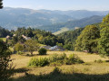
The signposts are easy to follow and there are some fine viewpoints in the second part. Beautiful park with fine specimens.....

Machine-translated

Other walks in the area

For more walks, use our search engine .

The GPS track and description are the property of this route's author. Please do not copy them without permission.