The ‘Porte aux Chiens’ in Val d’Hazey

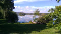
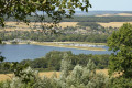
The route is punctuated by a succession of landscapes, blending nature and heritage. This is a hilly walking route offering a challenging and varied walk: undulating terrain and views over the Seine valley!

Details

51053161
Creation:
Last update:
Last review:
  • Walking
    Activity: Walking
  • ↔
    Distance: 8.34 mi
  • ◔
    Average duration: 4h 40 
  • ▲
    Difficulty: Moderate

  • ⚐
    Back to start: Yes
  • ↗
    Ascent: + 912 ft
  • ↘
    Descent: - 902 ft

  • ▲
    Highest point: 423 ft
  • ▼
    Lowest point: 46 ft
  • ⚐ Country: France
  • ⚐ City: Aubevoye (27940)
  • ⚑
    Start/End: N 49.17044° / E 1.32782°
  • ❏
    IGN map(s): Ref. 2012OT
  • Hour-by-hour weather

Photos

Description of the walk

Starting point: Impasse des Fontenelles, Aubevoye-Le Val d’Hazey.
Parking: church car park.

Signposting: Yellow

(S/E) From the car park, head left up Impasse des Fontenelles until you reach a Fork in the road.

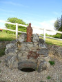
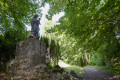
(1) Follow the path on the left through the woodland. Take the path on the left. Walk past the Black Madonna and continue along the Allée des Tilleuls. Before it ends, head up to the right towards the viewpoint. Exit via the Sainte Barbe gate.

(2) Continue to the road.

(3) Walk up the road. At the bend, continue along the path that goes round the church to the right to reach the wall of the Renault technical centre.

(4) Follow it to the left until you reach the junction.

(5) Carry on alongside the test centre until you reach a crossroads.

(6) Turn left onto a track. Turn right onto the road, which becomes a track leading towards Vieux-Villez. You’ll reach the crossroads at the entrance to the town.

(7) Continue to the right along the road, then along the track which descends and then climbs back up to Fontaine la Verte at Rue Caboche.

(8) Follow it to the left, then take the track on the right until you reach the Venables information sign.

(9) At the fork in the road, veer slightly to the left, then at the next fork, take the path on the right until you reach the crossroads.

(10) Head down the path on the right, then climb back up to the edge of the fields.

(11) Turn right and follow the path, then the road through the hamlet of Le Montier. Keep left twice to reach the church.

(12) Continue along the road, past the wayside cross, until you reach a Fork in the road.

(13) Take the path on the right until you reach the first junction.

(14) Turn left, then immediately right onto Rue Postel, and follow it to the end.

(15) Turn left onto Rue de l’Ouverdière, then right onto Rue de la Blanche Voie. At the end of the street, turn left onto Sente de Tournebut to find a path on the right.

(16) Follow it to the end.

(17) Take the road on the right. At the junction, cross the D65 with care, head down the path slightly to the left and continue to the railway line.

(18) Go under the railway line. At the next junction, take Rue de Tournebut straight ahead until you reach the junction at its end.

(19) Take the path straight ahead. Then, veering slightly to the right, follow another path to its end.

(20) Turn right and continue along this uphill road, which becomes a footpath. You’ll come to a Fork in the road.

(21) Turn right and walk past the entrance to the Chapel of Bethlehem. Then veer left to return to the starting point. (S/E)


Waypoints

  1. S/E : mi 0 - alt. 144 ft - Église Saint-Georges (Aubevoy)
  2. 1 : mi 0.05 - alt. 190 ft - Fork in the road - Vierge Noire (Sainte-Barbe-sur-Gaillon)
  3. 2 : mi 0.39 - alt. 262 ft - Sainte-Barbe Gate
  4. 3 : mi 0.51 - alt. 295 ft - Road
  5. 4 : mi 0.75 - alt. 377 ft - Renault site
  6. 5 : mi 1.74 - alt. 417 ft - Crossroads
  7. 6 : mi 2.07 - alt. 417 ft - Crossroads
  8. 7 : mi 2.38 - alt. 400 ft - Junction
  9. 8 : mi 3.14 - alt. 364 ft - Rue Caboche
  10. 9 : mi 4.04 - alt. 354 ft - Venables
  11. 10 : mi 4.54 - alt. 272 ft - Crossroads in the fields
  12. 11 : mi 4.95 - alt. 217 ft - Edge of the fields
  13. 12 : mi 5.32 - alt. 308 ft - Église Saint-Ursin (Le Montier)
  14. 13 : mi 5.48 - alt. 289 ft - Junction
  15. 14 : mi 5.78 - alt. 279 ft - Crossroads
  16. 15 : mi 5.97 - alt. 279 ft - Rue Postel terminus
  17. 16 : mi 6.15 - alt. 262 ft - Path
  18. 17 : mi 6.29 - alt. 240 ft - Crossroads
  19. 18 : mi 6.67 - alt. 46 ft - Railway line - Seine [la]
  20. 19 : mi 7.34 - alt. 52 ft - End of Rue de Tournebut
  21. 20 : mi 7.65 - alt. 52 ft - Crossroads
  22. 21 : mi 7.82 - alt. 98 ft - Fork in the road
  23. S/E : mi 8.34 - alt. 135 ft - Église Saint-Georges (Aubevoy)

Worth a visit

Did you know?
It is behind the walls of the Aubevoye technical centre, dedicated to vehicle testing, that the Renault Group’s automotive future is being shaped. It is here that Renault tests its prototypes and fine-tunes its vehicles before bringing them to market.

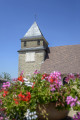
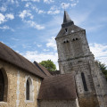
The Church of Saint-Ursin in Villers-sur-le-Roule. The original church was ceded in the 11th century by Roger Tosny to Conches Abbey. The present building is thought to date from the 16th century.

The Notre-Dame-de-la-Mer Fountain, above the Church of Saint-Ursin, is situated fifty metres north of the church. Its water is said to have the power to protect cattle from foot-and-mouth disease.

Tournebut Castle. The fiefdom of Tournebut has existed since the 11th century. The present-day Tournebut Castle was built on the ruins of the old Maurillac Castle, which was destroyed in 1856. The latter was made famous in the 19th century by the eventful life of the Marquise de Cambray, an unyielding royalist. In opposition to Napoleon, she organised numerous attacks on stagecoaches to finance acts of rebellion. She was buried in the cemetery in 1823. From 1891 onwards, the building housed a Christian school for girls.

The Créquinière Park.

The Renault site, a vehicle testing centre.

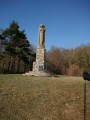
The Statue of the Black Madonna, erected by Mr François-Frédéric Alaboissette in 1883 (Notre-Dame d’Aubevoye), known as the ‘Black Madonna’.

Reviews and comments

4.3 / 5
Based on 2 reviews

Reliability of the description
5 / 5
Ease of following the route
4.5 / 5
Route interest
3.5 / 5
Office de Tourisme Seine-Eure

Hello,

Thank you for your review of the Porte aux Chiens trail.
Please feel free to try our other courses.
Kind regards,

The Seine-Eure Tourist Office team

Machine-translated

dmoutier
dmoutier

Overall rating : 4.7 / 5

Date of your route : Sep 01, 2025
Reliability of the description : ★★★★★ Very good
Ease of following the route : ★★★★★ Very good
Route interest : ★★★★☆ Good
Very busy route : No

A large part of the route is through forest.
Although it is not as difficult as a mountain route, the circuit is still hilly with some steep climbs.
There are a few points of interest, such as the Black Madonna, but views are very rare.
A pleasant route in good weather

Machine-translated

Office de Tourisme Seine-Eure

Hello,

Thank you for your comment.

Kind regards,

The Tourist Office team

Machine-translated

elices
elices

Overall rating : 4 / 5

Date of your route : Aug 23, 2024
Reliability of the description : ★★★★★ Very good
Ease of following the route : ★★★★☆ Good
Route interest : ★★★☆☆ Average
Very busy route : No

A manageable route, at a leisurely pace, in under 4 hours… even though the climbs are a bit challenging, there aren’t many of them.
We were a bit disappointed by the lack of beautiful scenery and panoramic views… though this was fortunately made up for by some lovely woodland.

Machine-translated

Other walks in the area

For more walks, use our search engine .

The GPS track and description are the property of this route's author. Please do not copy them without permission.