Country:

 City:
City:


Start from the Val Joly Park visitor centre.
(S/E) Head towards the park’s water sports centre. You’ll pass the mountain bike hire point and the mini-golf course. Keep the lake on your left, cross the footbridge and you’ll come to a Fork in the road.
(1) Head up to the right, then quickly follow the path to the left towards the departmental road. Walk past the Val Joly holiday resort. Keep to the right at the roundabout. Follow the D133 to the left and cross the bridge to the campsite.
(2) After the bridge, turn right onto the access road to the Val Joly campsite. Before the campsite entrance, take a dirt track on the left. Go round the campsite and you’ll reach a road.
(3) First turn left onto Rue Camberlin, then turn right and follow the dirt track to the T-junction at La Fausse Terre.
(4) Follow the road to the right until you reach a junction with another road.
(5) Cross the road at right angles and go straight on along Chemin de Beumont, a downhill track that curves to the left. After crossing the stream, keep the pond on your left.
(6) Continue along the path on the right. Quite soon, turn left.Please note that you are on the private property of Liessies Hospital. Please respect the site. Continue to the stream.
(7) Walk along the tarmac road until you reach Chemin Baptiste.
(8) Head down to the right until you reach the D 963. After the bend, head up to the left along Chemin Baptiste until you reach Rue Roger Salengro. Follow Chemin du Fosset on your right, pass a few houses and you’ll arrive at Les Beaux Monts.
(9) Turn right towards the D133, which you must cross with care. Continue straight on along Rue des Beaux Monts until you reach a footpath on the left.
(10) Turn left onto the footpath towards “Culot”, then follow Impasse du Culot. At the end, turn left onto Rue de l’Helpe and continue to the junction with Rue Roger Salengro.
(11) Turn left towards the town bridge and pass Helpe Majeure. Walk alongside the Abbaye de Liessies Regional Park and head towards the village centre. Follow the D963, Rue du Maréchal Foch, until you reach Rue Sainte-Hiltrude.
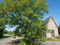
(12) Turn left onto the street leading to the chapel of the same name. At the Y-junction, follow the Chemin de Sainte-Hiltrude to the left. At the end of the small road, head down to the left and you will enter the Abbé ValJoly State Forest.
(13) The path winds up and down as you continue straight on to the Rieu Trouble.
(14) Cross the stream and head up to the right along the Chemin de La Fagne towards the Sainte-Hiltrude Chapel. Please note: you are on private property. Continue uphill to the Route Forestière de Champiau, which you follow to the left until you reach a Fork in the road.
(15) Leave the road and take the path on the right, which descends towards the ‘Fonds des Coqs’. You’ll arrive near the arm of Lac du ValJoly, which will be on your left.
(16) Walk along the right-hand side of the lake’s inlet, then join the path on the right which winds along the edge of the forest. It offers numerous views of the lake and the Val Joly Departmental Park. You’ll reach the Voyon inlet.
(17) Cross the Voyon inlet, follow the path opposite to the right of the road, then carry on straight ahead. At the next Y-junction, take the path on the left and you’ll come to a Fork in the road.
(18) Take the path on the right, then shortly afterwards take the next path on the right and join the Route forestière de la Croix du Soldat on the right.
(19) At the roundabout on the Route forestière de la Croix du Soldat, carry on straight ahead and take a path on the left which leads to the D119. Continue along this road and turn left; then, at a Fork in the road, leave the D119 and take the small road on the left until you reach the bend.
(20) At the bend, head down to the left along the Chemin de Trélon, then continue along the grassy track to the right. When you reach the road, turn right towards Les Grignaux,
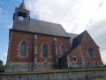
(21) Turn slightly right onto Rue de la Marbrerie until you reach the D115, Route de Trélon. Turn left, then left again onto Rue de Verdun, then right towards Saint-Ursmar Church and head into the centre of Eppe-Sauvage. Then head back up towards Saint-Ursmar Chapel.
(22) Follow the path uphill. Between the chapel and the D83, Rue Là-Haut. The ups and downs offer various views of the Helpe Majeure Valley and Château Maillard, a former18th-century forge. Turn left onto Chemin Trouillet but, shortly afterwards, follow the path on the right towards Chemin du Petit Moulin.
(23) Turn left onto Chemin du Petit Moulin, then turn right onto Rue du Grand Rieu. At the Y-junction, follow the road to the left, which soon becomes a footpath, to reach Rue du Grand Rieux. Continue straight ahead and take the footpath on the right to reach Rue de Touvent
(24) Walk along the right-hand side of the lake and, following the signposted path marked with bird-watching information boards, you’ll reach the ValJoly Park visitor centre (S/E).

 Visorando Member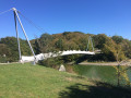

 AONB
AONB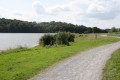
 Easy
Easy 
 Very difficult
 Moderate