Around the Soum de Casteigts

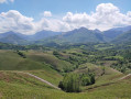
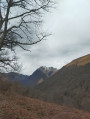
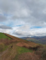
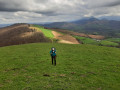
A very lovely walk offering breathtaking views of the valleys surrounding Mont de Casteigts. This walk alternates between tarmac roads, grassy paths and forest trails. There are several vantage points to discover along the route.

Details

8495006
Creation:
Last update:
Last review:
  • Walking
    Activity: Walking
  • ↔
    Distance: 2.76 mi
  • ◔
    Average duration: 1h 50 
  • ▲
    Difficulty: Moderate

  • ⚐
    Back to start: Yes
  • ↗
    Ascent: + 607 ft
  • ↘
    Descent: - 610 ft

  • ▲
    Highest point: 1,946 ft
  • ▼
    Lowest point: 1,339 ft
  • ⚐ Country: France
  • ⚐
    Area: Pyrenees
  • ⚐ City: Arette (64570)
  • ⚑
    Start/End: N 43.099317° / W 0.70332°
  • ❏
    IGN map(s): Ref. 1446ET, 1546OT
  • Hour-by-hour weather

Photos

Description of the walk

Park after Camou in the lay-by at the side of the road at the foot of the large oak tree. Take care not to obstruct traffic and to leave space for other vehicles.

(S/E) With your back to the oak tree, head right onto the road that climbs uphill. Walk for about 200 metres and take the path leading uphill on your left. Follow it until you reach a gravel track suitable for vehicles.
Head up this track to the left. Once at the top, in the final bend, you’ll pass a large birch tree and a picnic table on your left. Continue up towards the large steel barrier.

(1) Facing the barrier, turn right and head back down the hill, skirting a field on your left. Very soon, a little further down, take a path that starts on the left to go round the Soum de Casteigts.

(2) Once on the other side, at the bend, the path becomes less distinct, but you’ll see a track suitable for vehicles below (about 80 m). Join it and follow it for about 60 m, turning left.

(3) At the first bend, take a forest track that climbs up to your left. 50 m further on, you’ll come to a fern-filled grove (on your left) running alongside a field (on your right). Follow the track alongside the field and, at the end of it, head down to the right, aiming between the two large trees, to reach a track suitable for vehicles, a cattle grid and a barn.

(4) Once on this track, turn left, go through a cattle grid and leave the small barn on your right. Continue downhill, cross a large farmyard (watch out for dogs) and go through a second cattle grid. Continue downhill until you reach another junction of small roads.

(5) Turn left. Follow the track for just over a kilometre until you reach another junction. Turn left and follow the track to another junction, at the entrance to a farmyard (watch out for dogs). Turn left and head uphill until you reach your car at the foot of the large oak tree (S/E).

Waypoints

  1. S/E : mi 0 - alt. 1,457 ft - Car park at the foot of the large oak tree
  2. 1 : mi 0.58 - alt. 1,867 ft - Steel gate
  3. 2 : mi 0.94 - alt. 1,926 ft - Soum de Casteigts loop walk
  4. 3 : mi 1.13 - alt. 1,814 ft - Forest track
  5. 4 : mi 1.35 - alt. 1,647 ft - Vehicle-accessible track
  6. 5 : mi 1.77 - alt. 1,352 ft - Junction, turn left
  7. S/E : mi 2.76 - alt. 1,453 ft - Car park at the foot of the large oak tree

Notes

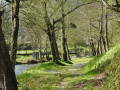
There are several springs along the second part of the walk, including a very pretty one that has been developed.
Watch out for dogs in the vicinity of the farmsteads.

Reviews and comments

4.3 / 5
Based on 2 reviews

Reliability of the description
5 / 5
Ease of following the route
3.5 / 5
Route interest
4.5 / 5
isabellebl
isabellebl

Overall rating : 5 / 5

Date of your route : Jul 22, 2024
Reliability of the description : Not used / Not applicable
Ease of following the route : ★★★★★ Very good
Route interest : ★★★★★ Very good
Very busy route : No

A lovely walk offering a 360° view of the surrounding mountains.
You might want to consider changing the route right from the start of the walk by taking the road to reach point 3 rather than the path, as there are a lot of brambles on the path between waypoints 1 and 2.

Machine-translated

Mino64360
Mino64360

Overall rating : 3.7 / 5

Date of your route : Apr 27, 2024
Reliability of the description : ★★★★★ Very good
Ease of following the route : ★★☆☆☆ Disappointing
Route interest : ★★★★☆ Good
Very busy route : No

A short family walk offering lovely views

Machine-translated

Other walks in the area

For more walks, use our search engine .

The GPS track and description are the property of this route's author. Please do not copy them without permission.