Around the Moulin de Ligoret

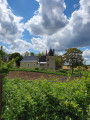
Enjoy the beautiful Touraine countryside on this 6 km circular route around the Échandon, starting from the Moulin de Ligoret.

Details

n°32090213
Creation:
Last update:
Last review:
  • Walking
    Activity: Walking
  • ↔
    Distance: 3.70 mi
  • ◔
    Average duration: 1h 50 
  • ▲
    Difficulty: Easy

  • ⚐
    Back to start: Yes
  • ↗
    Ascent: + 115 ft
  • ↘
    Descent: - 121 ft

  • ▲
    Highest point: 318 ft
  • ▼
    Lowest point: 220 ft
  • ⚐ Country: France
  • ⚐ City: Tauxigny (37310)
  • ⚑
    Start/End: N 47.2239° / E 0.830067°
  • ❏
    IGN map(s): Ref. 1923SB
  • Hour-by-hour weather

Photos

Description of the walk

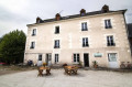
Park near the Moulin de Ligoret.

(S/E) Join the road and follow it uphill to the fork, almost at the top of the climb.

(1) Turn left, then right, and follow the path (Sentier de Saint-Martin) which runs alongside the beautiful Échandon river, a tributary of the Touraine, and reach the bridge over this river after turning left onto the small road.

(2) Cross the bridge to quickly reach the hamlet of Richêne. Continue straight ahead, slightly uphill, along a small country road to reach the junction with a crossroad (Route de la Cocardière).

(3) Cross at this junction, then carry on to the next road. Turn left here and at the next junction to reach the hamlet of La Bissonnière.

(4) Carry on to reach the village of La Gaudinière shortly.

(5) Turn right at the three-way junction, then follow the road as it bends to the left. Walk alongside a small copse on your right, then turn right immediately after house number 4. At the next junction, turn left onto Route de la Pièce Duret and arrive at the village of Le Coudray.

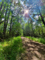
(6) At No. 13, take the grassy path opposite, heading towards the forest. Walk alongside the trees, then cross the woodland along a sunken path. Continue downhill and, as you emerge from the woodland, turn right and cross to the other side of the hedge you are walking alongside.
Walk past a pond, follow the ditch and, at the junction, turn left. Cross the Échandon again to return to the car park near the mill (S/E).

Waypoints

  1. S/E : mi 0 - alt. 236 ft - Car park near the mill - Échandon (rivière) à finaliser
  2. 1 : mi 0.14 - alt. 292 ft - Path on the left
  3. 2 : mi 1.27 - alt. 226 ft - Bridge
  4. 3 : mi 1.71 - alt. 292 ft - Road junction
  5. 4 : mi 2.42 - alt. 315 ft - The village of La Bissonnière
  6. 5 : mi 2.65 - alt. 305 ft - Three-way junction
  7. 6 : mi 3.09 - alt. 302 ft - Le Coudray
  8. S/E : mi 3.7 - alt. 236 ft - Car park near the mill

Reviews and comments

3.7 / 5
Based on 3 reviews

Reliability of the description
4.3 / 5
Ease of following the route
3.3 / 5
Route interest
3.3 / 5
User 22469516
• Edited:

Overall rating : 4 / 5

Date of your route : Aug 07, 2026
Reliability of the description : ★★★★☆ Good
Ease of following the route : ★★★★★ Very good
Route interest : ★★★☆☆ Average
Very busy route : No

A nice little walk, but nothing to write home about.
At the end of the evening, a beautiful sunset over the Touraine countryside.
The trail markings are missing in lots of places. I made good use of the Visio Rando app and used Google Maps or similar to find my way along the paths and work out where to turn off 👍
Old stone buildings, lovely country lanes, and fruit to pick depending on the season. A peaceful trail where you might even spot deer at 8 pm 😍

Machine-translated

VIOT37
VIOT37

Overall rating : 4 / 5

Date of your route : Feb 08, 2026
Reliability of the description : ★★★★☆ Good
Ease of following the route : ★★★★☆ Good
Route interest : ★★★★☆ Good
Very busy route : No

Please note that the route is no longer signposted.
The markings you encounter may lead to other routes.
If you follow the route on the app's GPS track, you'll be fine.

Otherwise, the route is nice, with plenty of wildlife.

Machine-translated

User 13074549

Overall rating : 3 / 5

Date of your route : May 14, 2025
Reliability of the description : ★★★★★ Very good
Ease of following the route : ★☆☆☆☆ Very disappointing
Route interest : ★★★☆☆ Average
Very busy route : No

It’s a good thing we had the app, because we could only see one landmark!!!🤔!!!!

Machine-translated

Other walks in the area

For more walks, use our search engine .

The GPS track and description are the property of this route's author. Please do not copy them without permission.