Around Boulevard Nature: Between Monod and l’Épine

This urban walk, taking you from park to park, allows you to discover or rediscover the city of Le Mans.
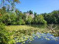
This route follows part of the Boulevard Nature, along the River Sarthe, and passes through Théodore Monod Park, Épine Park and Martin Luther King Park with its Lebanese cedar.

Details

34761501
Creation:
Last update:
Last review:
  • Walking
    Activity: Walking
  • ↔
    Distance: 5.13 mi
  • ◔
    Average duration: 2h 25 
  • ▲
    Difficulty: Easy

  • ⚐
    Back to start: Yes
  • ↗
    Ascent: + 82 ft
  • ↘
    Descent: - 69 ft

  • ▲
    Highest point: 233 ft
  • ▼
    Lowest point: 144 ft
  • ⚐ Country: France
  • ⚐ City: Le Mans (72100|72000)
  • ⚑
    Start/End: N 48.011904° / E 0.179901°
  • ❏
    IGN map(s): Ref. 1719SB
  • Hour-by-hour weather

Photos

Description of the walk

Park in one of the car parks behind Théodore Monod Park.

(S/E) Walk through Théodore Monod Park to emerge onto Boulevard Paul Chantrel, then follow the tram line along Rue Gambetta. At the second junction, turn left onto Rue Fleury. First turn right then left onto Rue des Muriers, then turn right onto Rue de la Perrine. Note the raised houses; these are former weavers’ dwellings. Return to the tram line.

(1) Turn left onto Rue Gambetta. Walk past an Art Nouveau building, built in 1909, which houses the Municipal Archives. Turn left onto Rue Montoise at the first junction, then right onto Rue d’Orléans at the next junction. Head towards the Église du Pré (12th century) via Rue Saint-Victeur.

(2) Walk round the church and the Square du Pré on the right-hand side. At Rue du Docteur Gallouedec, first turn right then left to follow Rue de la Douelle. Cross Rue Voltaire, then Rue du Pré. Note the Épicerie du Pré, a restored 16th-century inn. Continue along Rue de la Calandre, cross Rue du Port à l’Abbesse and, a little further on, turn right to end up on Quai Ledru-Rollin. Follow it to the left until you reach a footbridge.

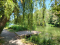
(3) Walk past it and turn right onto Rue des Pervenches; continue along Allée du Parc de Beaulieu, which leads to a footpath running alongside the River Sarthe. Please note: the end of the footpath is unpaved. Join Rue Jean Bouin by going round the boules court; then, at Avenue Chancel, turn right and you’ll arrive at the West Cemetery.

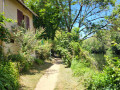
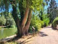
(4) Walk along the right-hand side of the cemetery. Ignore a path, then head down to the right towards the allotments to follow the paved path along the River Sarthe, which leads to Rue Jules Cheret.

(5) Follow it to the right. Take the first path on the same side to reach Allée Gustave Moreau. Enter a park. Keep to the right at every junction until you emerge onto Rue Chéret.

(6) Cross the road and take the steps leading to a park with a panoramic view overlooking Le Mans. At the end of this path, turn right onto Avenue Georges Duhamel, which becomes Rue du Léard. Walk past the Collège la Madeleine.

(7) Continue and take the second road on the right, Chemin de Montsaulnière. Cross Avenue Rhin et Danube and you’ll come to Rue de Saint Aubin.

(8) Turn right to enter the Parc de l’Épine (or Parc Roland et Annette Becdelièvre) at the first left. Cross the park, turning right. Exit onto Rue de Nice, walk down it and, opposite, take Rue de Dunkerque. Very soon, turn right into Rue du Havre and look for a footpath on the left, where the street bends.

(9) Follow this path, which runs alongside a block of flats and a playground. Continue straight on, then turn right. Take a right-left turn to reach Martin Luther King Park. Take a look at the remarkable tree, a Lebanese cedar, whose trunk measures over 8 metres in circumference.
Carry on straight ahead to leave the park via Impasse de Degré. At Rue de Degré, first turn left then right to join Rue de la Maison Neuve. Cross Avenue Rubillard to return to the car parks behind Parc Monod (A/D).


Waypoints

  1. S/E : mi 0 - alt. 164 ft - Car park behind Parc Monod
  2. 1 : mi 0.57 - alt. 154 ft - Municipal Archives Department
  3. 2 : mi 0.93 - alt. 154 ft - Église Notre-Dame-du-Pré (Le Mans)
  4. 3 : mi 1.4 - alt. 157 ft - Footbridge - Sarthe (rivière)
  5. 4 : mi 2.03 - alt. 161 ft - Western Cemetery
  6. 5 : mi 2.75 - alt. 161 ft - Rue Jules Cheret
  7. 6 : mi 3.05 - alt. 164 ft - Rue Cheret
  8. 7 : mi 3.61 - alt. 180 ft - La Madeleine Secondary School
  9. 8 : mi 3.98 - alt. 213 ft - Rue de Saint-Aubin
  10. 9 : mi 4.62 - alt. 171 ft - Junction
  11. S/E : mi 5.13 - alt. 164 ft - Car park behind Parc Monod

Notes

The route is marked in purple.
Public transport: T1 tram, bus no. 28 or 12: Théodore Monod stop.

There are two ways to get past the cemetery at (4): go round it or walk through it (don’t miss the many chapels and the graves of Commonwealth soldiers who died during the Second World War).

Worth a visit

Reviews and comments

3.9 / 5
Based on 3 reviews

Reliability of the description
4 / 5
Ease of following the route
3.7 / 5
Route interest
4 / 5
Arnaud_OTLMM
Arnaud_OTLMM

Hello,

Thank you for your positive feedback.
Have a lovely day.
Kind regards,
The whole team

Machine-translated

User 2767120

Overall rating : 4.3 / 5

Date of your route : Sep 08, 2026
Reliability of the description : ★★★★★ Very good
Ease of following the route : ★★★★☆ Good
Route interest : ★★★★☆ Good
Very busy route : No

A lovely walk along quiet paths and streets.

Machine-translated

Arnaud_OTLMM
Arnaud_OTLMM

Hello,

The Parc de l’Epine has deliberately not been signposted as the structures inside make it difficult to put up signs. There are, however, signs at the park’s exit.
Have a lovely day.

Machine-translated

MICHEMA
MICHEMA

Overall rating : 4 / 5

Date of your route : Apr 24, 2024
Reliability of the description : ★★★★☆ Good
Ease of following the route : ★★★★☆ Good
Route interest : ★★★★☆ Good
Very busy route : No

A lovely walk to explore Le Mans: its neighbourhoods and parks
Insufficient signposting towards the end of the route in the Epine neighbourhood

Machine-translated

kartavan
kartavan

Overall rating : 3.3 / 5

Date of your route : Jul 01, 2023
Reliability of the description : ★★★☆☆ Average
Ease of following the route : ★★★☆☆ Average
Route interest : ★★★★☆ Good
Very busy route : No

The signposting isn’t sufficient to follow the walk.
Even with the map, and particularly around the cemetery and Parc de l’Épine, it was difficult to find your way.

Machine-translated

Other walks in the area

For more walks, use our search engine .

The GPS track and description are the property of this route's author. Please do not copy them without permission.