Country:
 City:


As the woodland is on a slope, it is best to park on Rue Marcel Thomas, which is also the D160. When driving along this road heading eastwards from Rue Nationale (D935) towards the hamlet of Contoire, you will see a small car park on the right, just before the glass recycling bins. This small car park is the starting point.
(S/E) Cross the road and walk along the pavement. Once you’ve crossed, on the north side of the road where there’s a property (a white house and garages), turn right onto a grassy path that climbs northwards; this becomes tarmac and then a stony track until you reach the first junction, where you join theGR®123.
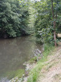
(1) Turn right onto this path, heading east. Once you reach the plateau, admire the Avre River valley on your right. Follow thisGR® in the same direction until you reach a road that crosses it.
(2) Leave theGR® and take the path across the plain on the left, before the road. At the first junction, carry on straight ahead towards the edge of the woodland. There, continue along the same path which runs alongside the woodland. The path then descends towards the start of a dry valley, before climbing again. Continue along this path, which runs along the edge of the woodland. Do not take the private paths on the left that lead into the woodland. After a while, the path leaves the edge of the woodland and emerges onto the plain. After less than 100 metres, the path joins Chemin Baudet at a right angle.
(3) Turn left onto this road, heading west, and rejoin the edge of the woodland. Carry on without entering the woodland. At the first junction you come to, turn right onto the road heading north which leads into the open plain. Leave the edge of the woodland. After a while, the track becomes tarmac and joins the road running from Trois Rivières to Le Plessier-Rozainvilliers (D137). Turn right here, towards Le Plessier-Rozainvilliers.
(4) Then, less than 200 metres on, take the small road on the left towards La Neuville Sire Bernard. This quiet little road winds its way across the plain. Do not take the first track on the right, nor the first private track on the left, nor the second track on the right which leads to the chalk quarry.
A short distance further on, look out for a track on the left that runs alongside a woodland and starts at the edge of it.
(5) Take this path and, at the second corner of the woodland, continue along the path which turns to the right. At the third corner, carry on straight ahead along the path which leaves the edge of the woodland. After a while, the path branches off to the left. Continue towards the large aerial and the hedge visible ahead. The path crosses the hedge and joins theGR® 123.
(6) Turn left onto it, heading south-east, and you’ll reach the D137 from Le Plessier-Rozainvilliers to Trois Rivières.
(7) Follow this road to the right, towards Trois Rivières, and you’ll reach the D935 between Montdidier and Moreuil. Take this road straight ahead and head towards the built-up area of the town.
You will see the large cardboard factory on the other side of the road.
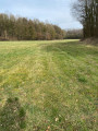
(8) On reaching the entrance to the town of Trois Rivières, take the path on the left which climbs north-eastwards. Continue to follow theGR® route. At the top, after 130 m, at the first junction, turn right onto the ‘chemin du tour de ville’, a grassy path mown by the local council. Follow this until you reach the junction from the outward journey.
(1) Head back down to Rue Marcel Thomas to return to the starting car park (S/E).


 Visorando Member

 Moderate