Along the banks of the River Avre at Moreuil and the ponds at Thennes

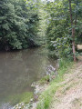
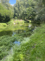
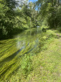
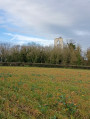
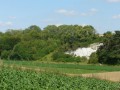
There are two rivers called the Avre. One is a tributary of the River Eure, the other is a tributary of the River Somme. This walk follows the second of these two rivers. The route offers the pleasure of walking alongside the River Avre at Moreuil. Indeed, the community of communes maintains the towpath. It also allows you to walk around the fishing ponds at Thennes and admire the rural landscape surrounding these bodies of water.

Details

n°37841889
Creation:
Last update:
Last review:
  • Walking
    Activity: Walking
  • ↔
    Distance: 4.61 mi
  • ◔
    Average duration: 2h 10 
  • ▲
    Difficulty: Easy

  • ⚐
    Back to start: Yes
  • ↗
    Ascent: + 16 ft
  • ↘
    Descent: - 13 ft

  • ▲
    Highest point: 118 ft
  • ▼
    Lowest point: 102 ft
  • ⚐ Country: France
  • ⚐ City: Moreuil (80110)
  • ⚑
    Start/End: N 49.772777° / E 2.477162°
  • ❏
    IGN map(s): Ref. 2309E
  • Hour-by-hour weather

Photos

Description of the walk

Park at the side of Rue de la République between Moreuil and Morisel. Turn right into Rue Jean-Baptiste Petit. When you reach the junction with Chemin de la Vergne, park at this crossroads.
You can also set off from Moreuil station.

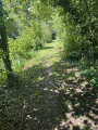
(S/E) Take the Chemin de la Vergne to reach the Arve quickly. Turn right onto the towpath and head towards the town’s sewage treatment plant.

(1) Continue in the same direction, with the Arve on your left and, on your right, the riparian woodland and private properties lining the river. You’ll arrive at the Lespinoy marsh.

(2) Carry on until you reach the junction with Rue du12e Cuirassier.

(3) Cross it and you’ll arrive opposite the gate where there are three signs prohibiting vehicles from passing. To the left of this gate, there is a pedestrian crossing. You can see this passage in the attached image. Take the path heading north. Atthe first junction, continue along the path on the left to see the pond. Carry on past the three ponds. You’ll reach another junction on the banks of the Avre and the large pond.

(4) Carry on for 300 metres to enjoy a lovely view of this pond.

(5) Return to the previous crossroads.

(4) Turn left, pass between the ponds, and you’ll soon come to a wide track running parallel to the railway line. Take this track to the right, following the three ponds before reaching the junction with Rue du12e Cuirassier.

(3) Head left for 40 m, then turn right onto Chemin de la Vergne and follow a virtually straight stretch of path to return to the car park on Rue de la République (S/E).

Waypoints

  1. S/E : mi 0 - alt. 115 ft - Car park on Rue de la République
  2. 1 : mi 0.19 - alt. 115 ft - Wastewater treatment plant - Avre (rivière)
  3. 2 : mi 1.08 - alt. 108 ft - Lespinoy Marshes
  4. 3 : mi 1.89 - alt. 108 ft - Junction with the circular Lakes Loop
  5. 4 : mi 2.16 - alt. 102 ft - The Avre. Turn-off for the return route at the viewpoint
  6. 5 : mi 2.35 - alt. 102 ft - Viewpoint overlooking the large pond
  7. S/E : mi 4.62 - alt. 118 ft - Car park on Rue de la République - Gare de Moreuil

Notes

This route is not difficult; however, you should dress appropriately to cope with winter weather conditions. Similarly, in summer, during hot weather, you should bring a hat and something to drink, as these are not available along the route.
During thaws and in wet weather, the towpath is slippery. Please wear suitable footwear and bring a walking stick.
It is best to avoid this walk during the hunting season, from mid-August to the end of February

Worth a visit

(1) Wastewater treatment plant: here you can see the treated water flowing in from the plant. The inflow of this treated water helps maintain the river’s flow during low-water periods.
Between (1) and (3) the riparian woodland

Reviews and comments

4.2 / 5
Based on 2 reviews

Reliability of the description
4 / 5
Ease of following the route
4.5 / 5
Route interest
4 / 5
dousop
dousop

Overall rating : 4.7 / 5

Date of your route : Jun 01, 2025
Reliability of the description : ★★★★★ Very good
Ease of following the route : ★★★★★ Very good
Route interest : ★★★★☆ Good
Very busy route : No

A lovely, relaxing walk along the water’s edge (so there are quite a few mosquitoes – do remember to use insect repellent 😉). It’s really peaceful and not very busy. The section with the three signs is there; it’s just that you’re not allowed to drive through it.

Machine-translated

FORE Claudette
FORE Claudette

Overall rating : 3.7 / 5

Date of your route : Apr 15, 2024
Reliability of the description : ★★★☆☆ Average
Ease of following the route : ★★★★☆ Good
Route interest : ★★★★☆ Good
Very busy route : Yes

There is an error here, as the Avre is not a tributary of the Eure – unless I am mistaken
On the route, at point 3, it mentions a passageway next to the gate where there are three signs; this passageway no longer exists – the whole area is closed off and under CCTV surveillance. We looked for it and even asked around, but nobody knows anything about it.

Machine-translated

Other walks in the area

For more walks, use our search engine .

The GPS track and description are the property of this route's author. Please do not copy them without permission.