Circular Davenescourt route via Warsy and Saulchoy

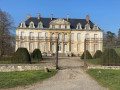
This walk follows theGR® 123 from Davenescourt to Warsy. You’ll then follow part of the Avre valley. You’ll pass by Warsy Castle. In this village, you’ll leave theGR® to climb back up onto the Santerre plateau to the pretty hamlet of Saulchoy-sur-Davenescourt. Crossing the Bois Morière takes you to the D160 at the monument erected in honour of Commander de Banville. The picturesque descent towards Davenescourt brings you to the impressive 18th-century château before completing the circular route.

Fiche technique

31156418
Creation:
Last update:
Last review:
  • trace_mode_pedestrian
    Activité: trace_mode_pedestrian
  • ↔
    label_distance: 6.23 mi
  • ◔
    Durée calculée: 3h 05 
  • ▲
    Difficulte: Facile

  • ⚐
    Retour point de depart: Oui
  • ↗
    label_elevation_gain: + 262 ft
  • ↘
    label_elevation_loss: - 236 ft

  • ▲
    label_highest_point: 348 ft
  • ▼
    label_lowest_point: 157 ft
  • ⚐ Pays: France
  • ⚐ Commune: Davenescourt (80500)
  • ⚑
    Départ/Arrivée: N 49.70979° / E 2.597348°
  • ❏
    Carte(s) IGN: Ref. 2409O
  • Météo détaillée heure par heure

Photos

Description of the walk

The starting point is in the car park in front of the town hall and school on Grande Rue.

(S/E) Head south and turn left onto Rue de l’Abreuvoir until you reach the bridge crossing the river. After the bridge, continue along Rue de la Chaussée for about 450 metres. This road then curves slightly to the right.

(1) At this point, leave the street and turn left onto Chemin de Péronne. Cross the river again. The path passes through a reforested area. After about 350 m, ignore a path that climbs to the left towards the north and stay in the valley. Further on, turn right, following theGR®123, to stay in the valley until the first junction.

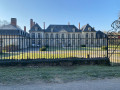
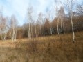
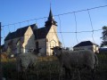
(2) Continue to the right on theGR®123, still in the valley, towards the Bois des Communes. Enter the wood and continue to Warsy, keeping the wet valley on your right and the hillside on your left. Walk past the cemetery, then pass between the first houses of the village. Carry on straight ahead until you reach the castle; walk past it on the right. Continue left along Rue du Château, passing to the north of the nearby church. After the church, you’ll reach a four-way junction.

(3) Head north and immediately turn left onto Rue du Moulin, heading west. Passing near a copse where there is an aerial, the road becomes a track. Continue in the same north-westerly direction. After 1.8 km, you’ll reach the junction with the RD160.

(4) Carry on straight ahead to reach Saulchoy-sur-Davenescourt. At the junction, turn left onto Rue Jack Berneuil, then take the first right onto Rue Sainte-Margareth and follow it to the end. You’ll arrive directly beneath a power line.

(5) Enter the Bois Morière via a very narrow path which is accessible only to pedestrians, although it is registered separately from the plots of land it crosses. Carry on straight ahead until you reach the field at the edge of the woods.

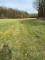
(6) At the edge of the field, turn left onto the track and follow it alongside the woodland until you reach the junction with the road.

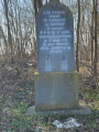
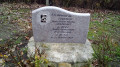
(7) Head down the D160, then immediately turn right, heading west. After a few metres, you’ll notice the Commander de Banville memorial on the left, overlooking the road. This quiet road leads, after 2 km, to the crossroads opposite the entrance to Davenescourt Castle.

(8) Turn left and head downhill to reach the car park (S/E).

Points de passages

  1. D/A : mi 0 - alt. 213 ft - Car park in front of the town hall and school
  2. 1 : mi 0.48 - alt. 174 ft - Chemin de Péronne junction
  3. 2 : mi 0.79 - alt. 220 ft - Crossroads
  4. 3 : mi 2.81 - alt. 220 ft - Junction by Warsy Town Hall
  5. 4 : mi 3.95 - alt. 338 ft - Junction with the D160
  6. 5 : mi 4.6 - alt. 328 ft - Bois Morière. Power line
  7. 6 : mi 4.7 - alt. 315 ft - Exit from the Morière woods
  8. 7 : mi 4.89 - alt. 335 ft - Crossroads by the memorial stone
  9. 8 : mi 6.12 - alt. 243 ft - Davenescourt Castle crossroads
  10. D/A : mi 6.23 - alt. 213 ft - Car park in front of the town hall and school

Informations pratiques

This route is not difficult, but you should dress appropriately to cope with the wind, which can blow strongly on the plateau in winter.
Similarly, in summer, when it is very hot, you should bring a hat and something to drink, as these are not available along the route.
During thaws, the paths are slippery. Make sure you wear suitable footwear and carry a walking stick.

Reviews and comments

4.5 / 5
Based on 2 reviews

Fiabilité de la description
4.5 / 5
Facilité à suivre l'itinéraire
4.5 / 5
Intérêt du circuit de randonnée
4.5 / 5
michele givron
michele givron

Note globale : 4.3 / 5

Date de la randonnée : Jul 21, 2025
Fiabilité de la description : ★★★★☆ Bien
Facilité à suivre l'itinéraire : ★★★★☆ Bien
Intérêt du circuit de randonnée : ★★★★★ Tres bien
Circuit très fréquenté : Non

The first part of the route is very pleasant as it’s well shaded; the route passes two beautiful castles; in Davenescourt there’s also a garden to visit: “A fleur d’Ô”, open from 1 June to 30 September by appointment. It’s a shame that this route ends with a 2 km stretch of road, but there isn’t too much traffic.

translation_auto

Marc 62
Marc 62

Note globale : 4.7 / 5

Date de la randonnée : Sep 24, 2023
Fiabilité de la description : ★★★★★ Tres bien
Facilité à suivre l'itinéraire : ★★★★★ Tres bien
Intérêt du circuit de randonnée : ★★★★☆ Bien
Circuit très fréquenté : Non

A short, very easy and enjoyable walk that takes less than 2 hours
Two beautiful castles to see
I came across very few people, even on the last 2 kilometres along the tarmac road

translation_auto

Other walks in the area

For more walks, use our search engine .

Les descriptions et la trace GPS de ce circuit restent la propriété de leur auteur. Ne pas les copier sans son autorisation.