A circular route from Guerbigny to Marquivillers

The Santerre plateau is a flat area of deep loam. Small rivers have carved their way through it, creating some very picturesque areas to explore. This walk takes you through one such area. The walk is unmarked. However, you do follow a marked section ofthe GR® 123 at the end of the circular walk.
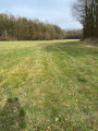
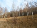
More than half the route follows paths through woodland.

Details

31660151
Creation:
Last update:
Last review:
  • Walking
    Activity: Walking
  • ↔
    Distance: 5.54 mi
  • ◔
    Average duration: 2h 45 
  • ▲
    Difficulty: Easy

  • ⚐
    Back to start: Yes
  • ↗
    Ascent: + 194 ft
  • ↘
    Descent: - 180 ft

  • ▲
    Highest point: 322 ft
  • ▼
    Lowest point: 187 ft
  • ⚐ Country: France
  • ⚐ City: Guerbigny (80500)
  • ⚑
    Start/End: N 49.699747° / E 2.660808°
  • ❏
    IGN map(s): Ref. 2409O, 2410O
  • Hour-by-hour weather

Photos

Description of the walk

Park in Guerbigny in the car park below the church, on the other side of Rue de la Chaussée.

(S/E) Walk up towards the church and turn right onto Rue de la Récréance. Then continue to the right along Rue du Larris. Shortly after the last house, this road becomes unpaved. You’ll come to a Y-junction.

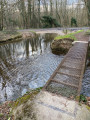
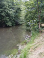
(1) Take the path on the right, heading east, then gradually turn southwards, with the wet valley below on your right. Carry on straight ahead. Approach the river, then carry on straight ahead, cross the bridge over it and reach a fork in the path.

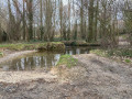
(2) Turn right. After about 100 m, cross a second branch of the river. Continue straight on towards the south. At the junction, carry on straight along the path that climbs towards the plain. After the first fields, skirt the Bois Pierrat on the left and continue straight across the plain. At an altitude of 95 m, you’ll reach a crossroads; carry on straight ahead, with the Tombelle plain on your right and the Chemin de Bracheuil plain on your left. About 800 m further on, turn left to join the tarmac road linking L’Échelle-Saint-Aurin in the north to Marquivillers in the south.

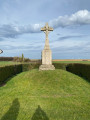
(3) Turn right onto this road, then follow the horse-riding track and carry on straight towards the village. At the wayside cross, turn right and continue for about fifty metres.

(4) Turn left, then immediately turn right onto the first dirt track. After 300 m, you’ll reach a Fork in the road. Take the track on the left for 100 m, running alongside the small triangular field.

(5) Turn right to continue skirting the field and head down towards the Bois de Laboissière valley along the public path. When you reach the far end of this field, continue along the path through the undergrowth until you reach the edge of a narrow field between two wooded areas.

(6) Continue along the path which first runs alongside this field, then crosses it, turning left. Once at the end, follow the path, back through the woodland, to the plain. You will then join theGR® 123.

(7) Follow it to the right, passing through the hamlet known as Les Prés à Saules. Join the D68 and follow it to the left until you reach the D329.

(8) Turn right onto it, enter the village of Guerbigny and head for the church car park (S/E).

Waypoints

  1. S/E : mi 0 - alt. 197 ft - Church car park
  2. 1 : mi 0.2 - alt. 259 ft - End of Rue du Larris, junction
  3. 2 : mi 1.01 - alt. 194 ft - Fork in the path. Bridge over the - Avre (rivière)
  4. 3 : mi 2.42 - alt. 318 ft - Road, bridleway
  5. 4 : mi 2.78 - alt. 299 ft - Turn left at the fork
  6. 5 : mi 3.08 - alt. 295 ft - Path to the Bois de Laboissière
  7. 6 : mi 3.71 - alt. 226 ft - Top of the field, fork in the path
  8. 7 : mi 4.53 - alt. 200 ft - GR 123, on the right
  9. 8 : mi 5.31 - alt. 190 ft - D329, turn right
  10. S/E : mi 5.54 - alt. 197 ft - Church car park

Notes

This route is not difficult, but you should dress appropriately to cope with the wind, which can blow strongly on the plateau in winter.
Similarly, in summer, when it is very hot, you should bring a hat and something to drink, as these are not available along the route.
During thaws, the paths are slippery. Wear suitable footwear and carry a walking stick.
A compass is useful.

Worth a visit

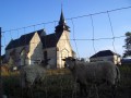
The Church of Saint-Pierre in Guerbigny was built in the 13th century and remodelled in the 15th and 16th centuries. It was damaged during the fighting in the First World War and restored between the two world wars. It has been listed as a historic monument since 1919.

Always be cautious and plan ahead when you're outdoors. Visorando and the author of this route cannot be held responsible for any accidents occurring on this route.

The GR® and PR® markings are the intellectual property of the Fédération Française de Randonnée Pédestre.

Reviews and comments

4 / 5
Based on 3 reviews

Reliability of the description
4 / 5
Ease of following the route
3.7 / 5
Route interest
4.3 / 5
vantroys
vantroys

Overall rating : 3.7 / 5

Date of your route : Mar 20, 2025
Reliability of the description : ★★★★☆ Good
Ease of following the route : ★★★☆☆ Average
Route interest : ★★★★☆ Good
Very busy route : No

A lovely walk, but the signposting is poor – one to do again

Machine-translated

phil80
phil80

Overall rating : 4.3 / 5

Date of your route : Jan 24, 2025
Reliability of the description : ★★★★☆ Good
Ease of following the route : ★★★★☆ Good
Route interest : ★★★★★ Very good
Very busy route : Yes

The directions for point No. 5 aren’t very clear, because between No. 4 and No. 6, you just need to follow the main path – that’s all!! There isn’t a detour as shown on the map.

Machine-translated

jean-pierre 59
jean-pierre 59

Overall rating : 4 / 5

Date of your route : Dec 12, 2024
Reliability of the description : ★★★★☆ Good
Ease of following the route : ★★★★☆ Good
Route interest : ★★★★☆ Good
Very busy route : No

A varied walk through wooded areas and open countryside…
However, after marker no. 4, we couldn’t find the small triangular field and carried on straight ahead; this leads to the same spot and takes us past an old chalk quarry with two small ‘caves’.
Very muddy at this time of year… Nothing out of the ordinary!!

Machine-translated

Other walks in the area

For more walks, use our search engine .

The GPS track and description are the property of this route's author. Please do not copy them without permission.