

Around Tilly-sur-Seulles

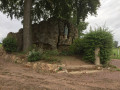
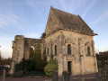
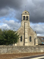
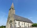
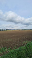
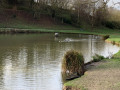
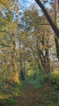
A very lovely walk that alternates between woodland, narrow paths, fields and a bit of town too. An easy walk suitable for everyone, not very busy and close to Caen.

Make sure you wear waterproof shoes as it can get muddy.

Details

n°111247301
Creation:
Last update:
Last review:
–
  • Walking
    Activity: Walking
  • ↔
    Distance: 4.60 mi
  • ◔
    Average duration: 2h 15 
  • ▲
    Difficulty: Easy

  • ⚐
    Back to start: Yes
  • ↗
    Ascent: + 164 ft
  • ↘
    Descent: - 167 ft

  • ▲
    Highest point: 502 ft
  • ▼
    Lowest point: 328 ft

Photos

Description of the walk

Park in the small car park at Juvigny Town Hall.

(S/E) Opposite the town hall, turn right and take the path that climbs to the left. Follow it for a while. Cross a river via a small wooden bridge at one point and you’ll reach a road.

(1) Turn left onto this road, pass a motocross track and follow it to the D13 (where there is a wayside cross).

(2) Turn left and follow Rue Jean de la Varende.

(3) At the roundabout, take Rue de Condom, which goes uphill opposite, and follow it. Cross Rue de Bayeux (D6) with care and continue straight on.

(4) A small path opens up on your right amongst the houses. Take it and follow it to a junction.

(5) At this junction, take the path on the left and follow it to the D13.

(6) Cross it carefully and carry on until you reach a small road.

(7) Turn left, cross another small road, then carry on straight ahead across the fields until you reach the D9.

(8) Cross it carefully and , immediately afterwards, at a Fork in the road, take the small path on the left. Carry on until you reach a road at a place called Pont Blanc.

(9) At the junction, there is another small path leading uphill to the left. Follow it until you reach the D9 at the entrance to Juvigny.

(10) Turn right and you’ll return to the town hall car park (S/E).

Waypoints

  1. S/E : mi 0 - alt. 354 ft - Small car park at Juvigny Town Hall
  2. 1 : mi 0.63 - alt. 354 ft - Junction with a small road
  3. 2 : mi 1.18 - alt. 354 ft - D13 road - Église Saint-Pierre (Tilly-sur-Seulles)
  4. 3 : mi 1.4 - alt. 338 ft - Roundabout
  5. 4 : mi 1.69 - alt. 404 ft - Start of the path
  6. 5 : mi 1.86 - alt. 436 ft - Junction
  7. 6 : mi 2 - alt. 446 ft - Crossing the D13
  8. 7 : mi 2.35 - alt. 463 ft - Road junction
  9. 8 : mi 3.18 - alt. 492 ft - Crossing the D9
  10. 9 : mi 3.8 - alt. 358 ft - Crossroads
  11. 10 : mi 4.49 - alt. 344 ft - D9 road – Entrance to Juvigny
  12. S/E : mi 4.6 - alt. 354 ft - Small car park at Juvigny Town Hall

Notes

In Tilly-sur-Seulles, there are public toilets marked on the map.

Make sure you wear waterproof shoes as it can get muddy.

Other walks in the area

For more walks, use our search engine .

The GPS track and description are the property of this route's author. Please do not copy them without permission.