Around Préhy

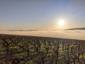
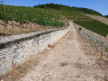
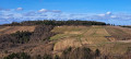
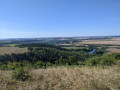
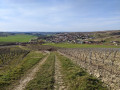
A walk showcasing both sides of the Chablis landscape: woodland and farmland on one side, vineyards on the other. 360° panoramic view at the start.

Details

n°31201466
Creation:
Last update:
Last review:
  • Walking
    Activity: Walking
  • ↔
    Distance: 5.85 mi
  • ◔
    Average duration: 3h 15 
  • ▲
    Difficulty: Easy

  • ⚐
    Back to start: Yes
  • ↗
    Ascent: + 630 ft
  • ↘
    Descent: - 620 ft

  • ▲
    Highest point: 1,125 ft
  • ▼
    Lowest point: 679 ft
  • ⚐ Country: France
  • ⚐ City: Préhy (89800)
  • ⚑
    Start/End: N 47.756876° / E 3.766832°
  • ❏
    IGN map(s): Ref. 2720SB
  • Hour-by-hour weather

Photos

Description of the walk

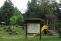
Parking at the Préhy picnic area

(S/E) Head towards the village and, just before the road, turn left onto the path between the fields. Continue to the crossroads.

(1) Turn right, then left, and begin the descent through the Vallée l’Èvèque to the pumping station.

(2) Carry on along the path which curves to the right and continue to the road at the entrance to Saint-Cyr-les-Colons.

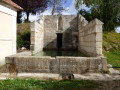
(3). Head up to the left and reach the Croix de Coulon. Take the path on the right and walk down to the bottom of the valley, where you’ll find an abandoned wash house and a picnic area. Continue along the main path and start the climb, heading due north, until you reach a crossroads

(4) Go straight on for a few metres, then take the path on the right which descends towards the vineyards. Follow it, cross a road after a water tower and carry on straight ahead, ignoring the side paths, until you reach the foot of the village of Courgis (you can climb up to the village via the road or one of the paths leading up to the left, and then rejoin the route).

(5) At the junction with two paths branching off to the right, take the first one and begin the climb towards Préhy.

(6) Cross the D2, continue along the road opposite and pass Sainte-Claire Church. Carry on along the road. When it bends to the right, go straight on along the track, then take the next track on the right to reach the picnic area (S/E).

Waypoints

  1. S/E : mi 0 - alt. 892 ft - Picnic area
  2. 1 : mi 0.3 - alt. 883 ft - Right/left fork
  3. 2 : mi 1.02 - alt. 705 ft - Pumping station
  4. 3 : mi 2.32 - alt. 892 ft - Road to the left
  5. 4 : mi 3.5 - alt. 1,106 ft - Crossroads
  6. 5 : mi 4.81 - alt. 679 ft - Path on the right
  7. 6 : mi 5.22 - alt. 850 ft - D2
  8. S/E : mi 5.85 - alt. 892 ft - Picnic area

Notes

Shelter in case of rain at the start/finish.
Light refreshments available in Saint-Cyr-les-Colons.

Worth a visit

Wine tastings at local wineries after the walk.

Reviews and comments

5 / 5
Based on 1 review

Reliability of the description
5 / 5
Ease of following the route
5 / 5
Route interest
5 / 5
cornette
cornette

Overall rating : 5 / 5

Date of your route : Feb 09, 2026
Reliability of the description : ★★★★★ Very good
Ease of following the route : ★★★★★ Very good
Route interest : ★★★★★ Very good
Very busy route : No

A walk to breathe deeply and enjoy the winter sun. No difficulty: just enjoy. Thank you.

Machine-translated

Other walks in the area

For more walks, use our search engine .

The GPS track and description are the property of this route's author. Please do not copy them without permission.