The Chitry circular walk

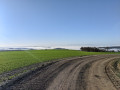
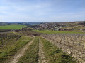
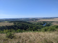
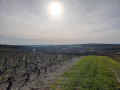
Chitry is one of the Yonne’s most beautiful villages; take a circular walk to see it from different angles. The weather may treat you to some superb views of the surrounding countryside.

Details

n°45131112
Creation:
Last update:
Last review:
  • Walking
    Activity: Walking
  • ↔
    Distance: 6.81 mi
  • ◔
    Average duration: 3h 45 
  • ▲
    Difficulty: Moderate

  • ⚐
    Back to start: Yes
  • ↗
    Ascent: + 699 ft
  • ↘
    Descent: - 715 ft

  • ▲
    Highest point: 1,135 ft
  • ▼
    Lowest point: 574 ft
  • ⚐ Country: France
  • ⚐ City: Chitry (89530)
  • ⚑
    Start/End: N 47.762388° / E 3.701802°
  • ❏
    IGN map(s): Ref. 2720SB
  • Hour-by-hour weather

Photos

Description of the walk

Start from the car park at the fortified church; there are spaces behind the church.

(S/E) Walk between the church and the town hall and head towards the cemetery, located on the outskirts of the village.

(1) A few dozen metres past the cemetery, at the sign marking the end of the built-up area, take the first path on the right.

(2) At the top of the long climb, turn right before the motorway bridge to follow the motorway, then veer off to the right. Pass a property in the woods and a series of pylons, before coming out at the crossroads with a cross (Croix à Durville).

(3) Cross the road, carry on straight ahead and you’ll reach a small crossroads at the bottom of the descent, after a 90° right-hand bend.

(4) Carry on straight ahead until you reach a four-way junction (Les Trameurs).

(5) Cross the road and go straight on. Follow the path slightly downhill, take the right-hand bend at a right angle, then turn left at the next junction, heading away from Chitry. You’ll come to a three-way junction with a central reservation.

(6) Take the path on the right to continue downhill, towards the road below, and carry on straight ahead until you reach it at a small picnic area on the right.

(7) Turn left, keep to the right at the next three-way junction, then immediately take the path that branches off to the right (north) and runs alongside a small stream fed by a natural spring. At the junction on the edge of the Bois de l’Étang, go straight on.

(8) At the T-junction at the edge of the woods, turn right and climb up to a track suitable for vehicles. Head left and you’ll come to a three-way junction.

(9) Take the path leading uphill to the right. Turn right at a 90° angle at the next junction and continue on level ground whilst enjoying the view. You’ll reach a junction with several roads and paths.

(10) Turn right onto the road and head downhill. At the cross, continue to the left, towards Chitry, and you’ll come to a fork at the corner of house no. 19 (Route de Montallery).

(11) Follow the road to the right, which becomes Rue du Ruisseau after the junction. Carry straight on to return to the church (S/E).

Waypoints

  1. S/E : mi 0 - alt. 679 ft - Fortified church
  2. 1 : mi 0.24 - alt. 699 ft - Path on the right
  3. 2 : mi 1.41 - alt. 1,070 ft - Turn right before the bridge
  4. 3 : mi 2.13 - alt. 1,122 ft - Cross at Durville, straight on
  5. 4 : mi 2.8 - alt. 1,079 ft - Junction: go straight on
  6. 5 : mi 3.37 - alt. 906 ft - Les Trameurs, crossroads
  7. 6 : mi 3.88 - alt. 787 ft - Path on the right
  8. 7 : mi 4.31 - alt. 597 ft - Road, picnic area
  9. 8 : mi 5.14 - alt. 643 ft - Crossroads by the spring
  10. 9 : mi 5.4 - alt. 751 ft - Path on the right
  11. 10 : mi 6.03 - alt. 797 ft - Multi-way junction, turn right
  12. 11 : mi 6.44 - alt. 653 ft - Chitry, Route de Montallery
  13. S/E : mi 6.81 - alt. 679 ft - Fortified church

Notes

In Chitry, be sure to visit the church, the cellars and the orientation board!

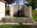
(8) When you reach the end of the path at the edge of the woods, you can take a detour to the little house on your left to visit the Source des Nincrées.

Worth a visit

(8) Do enjoy the spring if it’s hot!

Reviews and comments

4.2 / 5
Based on 2 reviews

Reliability of the description
4 / 5
Ease of following the route
4 / 5
Route interest
4.5 / 5
Wanderung89
Wanderung89

Overall rating : 4.3 / 5

Date of your route : Mar 02, 2025
Reliability of the description : ★★★★☆ Good
Ease of following the route : ★★★★☆ Good
Route interest : ★★★★★ Very good
Very busy route : Yes

A really lovely walk that offers views of the surrounding area from certain ‘high points’.
Clean, well-maintained paths.
The starting point in Chitry is not described clearly enough. There is some confusion regarding the paths.

Machine-translated

canto89
canto89

Overall rating : 4 / 5

Date of your route : Oct 22, 2024
Reliability of the description : ★★★★☆ Good
Ease of following the route : ★★★★☆ Good
Route interest : ★★★★☆ Good
Very busy route : No

Right.

Machine-translated

Other walks in the area

For more walks, use our search engine .

The GPS track and description are the property of this route's author. Please do not copy them without permission.