Around the Morières-Montrieux forest

Yet another walk on the Siou-Blanc plateau, which stands out for its route above Belgentier and its beautiful panoramic view.

Details

43494063
Creation:
Last update:
Last review:
  • Walking
    Activity: Walking
  • ↔
    Distance: 7.91 mi
  • ◔
    Average duration: 4h 20 
  • ▲
    Difficulty: Moderate

  • ⚐
    Back to start: Yes
  • ↗
    Ascent: + 823 ft
  • ↘
    Descent: - 837 ft

  • ▲
    Highest point: 2,113 ft
  • ▼
    Lowest point: 1,703 ft

Description of the walk

The walk starts from a hunters’ car park, situated at the second hairpin bend on the descent of the Siou-Blanc track, above Solliés-Toucas.

(S/E) Take the track heading north-west and, at the Fork in the road, ignore the path on the right, which will be the return route.

(1) Carry on straight ahead along the track opposite. Pass under some power lines and arrive at another Fork in the road. Ignore the track on the right. Continue to another junction at elevation 611.

(:2) Turn right and continue along the track, down a long descent which leads to theGR® 9.

(3) Take this track to the right, heading north-north-east, for 1.2 km until you reach a crossroads of tracks.

(4) Turn right to stay on theGR® 9 and reach a junction with a PR®.

(5) Continue along the track, leaving thePR® on your left, and pass the Pas de Belgentier.

(6) Leave theGR® 9. Head up the path to the right. At the crossroads, turn left and reach the plateau. Note the rocks on the left-hand side, overlooking the valley. This is an ideal spot for a picnic.

(7) Carry on straight ahead, heading south, leaving a track on your left and reaching a fork in the path.

(8) Carry on straight ahead, passing under some power lines. The track winds for 3 km and reaches two ‘ragages’ – a sort of chasm that can be seen as you head back into the high forest.

(9) Follow the track to the next fork.

(10) Turn right and start down a gully-like descent. You’ll come to a small cairn on the right; stones block the path.

(11) Take this path, otherwise you’ll come to a wire fence blocking the way. Carry on until you reach a road.

(12) Head back up towards the north-west. Car tyre tracks are strangely scattered across the track. Continue along the path until you reach a junction.

(13) Be careful here! Do not go straight on, but turn left, heading west. The path narrows slightly but is still passable. You’ll reach the track.

(1) Follow the route back in the opposite direction to the way out, heading south, to reach the hunters’ car park (S/E).

Waypoints

  1. S/E : mi 0 - alt. 1,919 ft - Hunters’ car park – descent via the Chemin de Siou-Blanc
  2. 1 : mi 0.11 - alt. 1,929 ft - Crossroads marking the end of the circular loop - Fôret domaniale de Morières-Montrieux
  3. 2 : mi 0.53 - alt. 2,005 ft - Track on the right
  4. 3 : mi 2.04 - alt. 2,057 ft - Junction GR°°®°° 9
  5. 4 : mi 2.88 - alt. 1,801 ft - GR°°®°° 9
  6. 5 : mi 3.59 - alt. 1,788 ft - Trail junction (PR)
  7. 6 : mi 4.19 - alt. 1,785 ft - Pas de Belgentier (537 m)
  8. 7 : mi 4.55 - alt. 1,985 ft - Panorama
  9. 8 : mi 4.98 - alt. 1,998 ft - Continuation of the track
  10. 9 : mi 6.5 - alt. 2,008 ft - Ragages
  11. 10 : mi 6.71 - alt. 1,867 ft - Descent through a ravine
  12. 11 : mi 6.91 - alt. 1,742 ft - Cairn on the right
  13. 12 : mi 7.17 - alt. 1,703 ft - Siou-Blanc Road
  14. 13 : mi 7.62 - alt. 1,834 ft - Path on the left
  15. S/E : mi 7.91 - alt. 1,919 ft - Hunters’ car park – descent via the Chemin de Siou-Blanc

Worth a visit

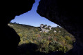
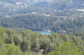
Point (6): lovely panoramic view over the Gapeau valley.

Always be cautious and plan ahead when you're outdoors. Visorando and the author of this route cannot be held responsible for any accidents occurring on this route.

The GR® and PR® markings are the intellectual property of the Fédération Française de Randonnée Pédestre.

Reviews and comments

4.1 / 5
Based on 4 reviews

Reliability of the description
4.5 / 5
Ease of following the route
3.5 / 5
Route interest
4.3 / 5
DENISFRAN
DENISFRAN

Overall rating : 4 / 5

Date of your route : Sep 10, 2025
Reliability of the description : ★★★★☆ Good
Ease of following the route : ★★★☆☆ Average
Route interest : ★★★★★ Very good
Very busy route : No

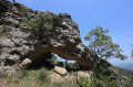
A beautiful route to do at the end of April to see the fields of asphodels between 1 and 3, a beautiful forest to cross between 3 and 5, a short detour between 6 and 7 to see the Garoute arch (take a small path to the right of the track - green markings, the arch is 200 m away), superb panorama at 7. The problem is the end of the route, between 10 and 13, which is difficult to find with GPS because the small cairn has disappeared and the vegetation has taken over. With the leaves covering the trail, without GPS it's not even worth trying... I'll go back and return to the starting point by taking another path between 8 and 9 after the "Galères"...
Thanks for this route, even though we had a really hard time getting back! ... There probably wasn't as much vegetation when it was posted, and the wild boars must have knocked over the cairn while playing leapfrog!

Machine-translated

RandoMichou
RandoMichou
• Edited:

Overall rating : 3.3 / 5

Date of your route : May 24, 2025
Reliability of the description : ★★★★☆ Good
Ease of following the route : ★★★☆☆ Average
Route interest : ★★★☆☆ Average
Very busy route : No

A walk mainly along wide tracks, ending with a more pleasant stretch through the forest towards the end, though we often lost the GPS signal.
A few lovely views.

Machine-translated

LesDeuxLoulous
LesDeuxLoulous

Overall rating : 4.3 / 5

Date of your route : May 03, 2025
Reliability of the description : ★★★★★ Very good
Ease of following the route : ★★★★☆ Good
Route interest : ★★★★☆ Good
Very busy route : No

A lovely walk. Not much of a climb. Beautiful views. However, the last 2 km are difficult to follow as the path is rarely used and therefore not very visible. Make sure you follow the GPS track closely, but otherwise there are no problems – the track is easy to follow.
We did it with two dogs weighing 10 and 20 kg without any problems.

Machine-translated

fouado
fouado

Overall rating : 4.7 / 5

Date of your route : Apr 23, 2024
Reliability of the description : ★★★★★ Very good
Ease of following the route : ★★★★☆ Good
Route interest : ★★★★★ Very good
Very busy route : No

A lovely walk to do in spring or autumn (fields of asphodels, plenty of deciduous trees), with very varied scenery; an easy route to follow. Another part of the Siou Blanc plateau to explore!
Thank you for introducing us to this!

Machine-translated

Other walks in the area

For more walks, use our search engine .

The GPS track and description are the property of this route's author. Please do not copy them without permission.