Country:

 City:
City:


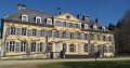
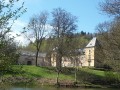
Car park on Rue Nicolas Roeltgen in Nothomb, between the very modern church (don’t look for a bell tower) and the school.
(S/E) With the church on your right, head down the road. At the junction, turn left. After No. 65, take the path on the right marked by a series of red barriers at its entrance. Cross the road, continue straight ahead and you’ll come to another road.
(1) Turn right. At the bend in the road, turn left, ignoring the dirt track opposite. The road becomes a dirt track after the house. Use the footbridge to cross the River La Nothomb and head up the path. At the top, turn right onto the path running behind the houses. Walk to the road. Turn right and continue for 100 metres
Before leaving the built-up area, turn right onto the farm track.
Red Rectangle signposting
Walk through open country with a view of the village. The path turns left and, at the junction by the edge of the copse, turn right. Walk to the T-junction.
(3) Carry on to the left along the path, which then turns right. Walk to the road and turn right onto it. A path rejoins on your left at the cluster of oak trees marked by a cross. Continue to the open area where the path meets a dirt track.
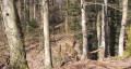
(4) Head straight on along the path, which begins with a tunnel of trees. The path becomes more enclosed. You will then emerge from the tree cover and walk alongside the river until you reach the road.
(5) Turn left onto the N 863, ignoring the road immediately to the left. Pass the last houses and walk to the ‘Frontières’ sign.
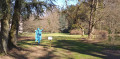
(6) Turn right into the meadow and head towards the border marker, its small terrace and the sculpture serving as an insect hotel. Walk down towards the Marais de Grendel, follow the boardwalks and take a round trip through the nature reserve.
(7) Then head back up to the road.
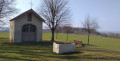
(6) Continue to the right for 500 m and enter Colpach. Turn left into Kierchestrooss. Walk up to the church. Turn right into the church car park, look out for the chapel on your right and then head right towards the adjoining cemetery. Cross the cemetery to reach the gate. Go through it and follow the path down to the road. Carry on straight ahead until you reach the car park for the rehabilitation centre on your right. Cross carefully and enter the car park. The signposting is interrupted for a short while.
No signposting
(8) Keep to the right and turn immediately right onto the footpath. Begin your exploration of Colp’Art, a permanent sculpture trail featuring works scattered throughout the park.
(9) Take the footbridge and, before the rehabilitation centre building, turn left. Turn left a second time and, before the bridge, turn right. At the end of the path, take a sharp right-hand bend. You’ll rejoin the signposting.
Red Rectangle
Walk to the crossroads.
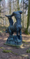
(9) Turn right towards the castle. Continue to the left of the castle. The path turns left; walk alongside the new building. Before the other car park, turn left towards the pond. Walk round it on the right-hand side. Follow the path up at the far end of the pond and continue to the left. At the crossroads, carry on straight ahead, with the statue ‘The Death of the Last Centaur’ on your left. Pass the tomb of the castle’s last owners and walk to the junction just before the crossroads.
(9) Turn right and, once back on the other path, continue to the left. At the gate to the vegetable garden, turn immediately right. Walk up the winding path; the path then continues through an avenue of chestnut trees. Walk downhill, cross the footbridge and then turn right. Walk up to the crossroads with the boxwood hedges and turn right. Walk to the bend with the barrier. Leave the park near the gate and you’ll immediately come out onto the road.
(10) Follow the road to the left for 700 m until you reach the crossroads with a beech tree and a cross. Carry on straight ahead. Signposting ends here.
No signposting
Head downhill and, when you reach the first conifers, look out for the path on your left.
(11) Turn left. At the road, turn left and, at thefirst forest track on your right, turn off. Follow the main forest track to the T-junction. The signposting resumes.
Red Rectangle
(12) Head left. You’ll see the River Koulbich crossing the road. Use the footbridge on the right, at a place called Petit Nobressart, to cross without getting your feet wet. Head uphill and enter the village. At the crossroads, carry straight on. Walk past the church and then leave the village. Walk to the Frontières crossroads.
(13) Carry on straight ahead for about 700 m until you reach a road again. Head down to the right and enter the village of Nothomb. You’ll come to the crossroads where the circular route began on the way out.
(2) Carry on straight ahead and follow the route in the opposite direction to the outward journey, returning to the car park (S/E).

 Visorando Member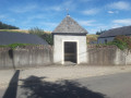

 Association / Club / Walk leader
 Easy
Easy