South of Névez, between land and sea

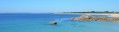
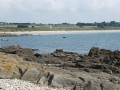
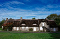
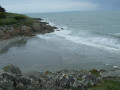
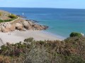
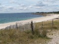
In southern Finistère, near Pont-Aven and Concarneau, this lovely walk will take you along sunken paths through the pretty, green countryside, dotted with flowers and charming hamlets. You’ll also walk along the magnificent section of the GR®34 coastal path.

Details

105101654
Creation:
Last update:
Last review:
  • Walking
    Activity: Walking
  • ↔
    Distance: 8.98 mi
  • ◔
    Average duration: 4h 15 
  • ▲
    Difficulty: Moderate

  • ⚐
    Back to start: Yes
  • ↗
    Ascent: + 167 ft
  • ↘
    Descent: - 171 ft

  • ▲
    Highest point: 121 ft
  • ▼
    Lowest point: 7 ft
  • ⚐ Country: France
  • ⚐ City: Trégunc (29910)
  • ⚑
    Start/End: N 47.805738° / W 3.832566°
  • ❏
    IGN map(s): Ref. 0519ET, 0620ET
  • Hour-by-hour weather

Description of the walk

Park in the car park near Saint-Philibert Chapel.

Yellow signposts
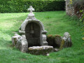
(S/E) After admiring the beautiful Saint-Philibert Chapel, from the car park take the path southwards for about 100 m, then take the path on the left. Continue until you reach a road.

(1) Follow the road to the left for about 100 m, then turn right towards Tréhubert. Continue along the path on the right, then take the road on the left, which is circular and passes through the hamlet of Tréhubert.

(2) Carry on along the path for about 700 m until you reach the hamlet of Riel.

(3) Turn sharply right and, at the end of the road, follow the path (turning left), then immediately take the path on the left heading south for about 200 m.

(4) Turn left, following the sign for the granite boulders. The path is circular and loops round the boulders.

(5) Retrace your steps.

(4) Continue straight ahead along the winding path, which merges with the road

(6) Turn left onto a track and follow it westwards then southwards. Join another road.

(7) Follow it to the left between the houses until you come out onto the D1.

(8) Cross it carefully and head down opposite towards the sea at Kersidan Beach.

Red and white markings
(9) Turn right onto the GR®34 coastal path towards Pointe de Kerjean.

(10) At the headland, continue along the coastal path. Walk past Don Beach and Trez Cao Beach.

(11) At Trez Cao Beach, keep following the GR® towards Pointe de Trévignon and its lighthouse,

(12) Go round the headland, walk along the beach and follow the road to the car park near the Ecomuseum.

End of red and white markings; yellow markings begin
(13) Leave the coastal path by heading up to the right along the yellow-marked path. You will arrive at the hamlet of KerLin.

(14) Cross the road carefully and continue straight ahead along the path to the Route de Kerléo.

(15) Turn right and follow the road for about 400 metres until you reach the D1 county road.

(16) Cross itcarefully, go round a campsite and follow the path uphill to the chapel car park (S/E).

Waypoints

  1. S/E : mi 0 - alt. 56 ft - Car park - Chapelle Saint-Philibert (Saint-Philibert)
  2. 1 : mi 0.67 - alt. 62 ft - Road junction
  3. 2 : mi 1.22 - alt. 82 ft - Back on the path
  4. 3 : mi 1.68 - alt. 115 ft - The hamlet of Riel
  5. 4 : mi 1.98 - alt. 92 ft - Junction (signpost)
  6. 5 : mi 2.24 - alt. 49 ft - Granite rock formations
  7. 6 : mi 2.75 - alt. 82 ft - Junction on the path
  8. 7 : mi 3.47 - alt. 56 ft - Road junction
  9. 8 : mi 3.8 - alt. 52 ft - Cross the D1
  10. 9 : mi 3.99 - alt. 39 ft - Kersidan Beach
  11. 10 : mi 4.69 - alt. 30 ft - Pointe de Kerjean
  12. 11 : mi 5.45 - alt. 13 ft - Trez-Cao Beach car park
  13. 12 : mi 6.42 - alt. 16 ft - Pointe de Trévignon
  14. 13 : mi 7.34 - alt. 20 ft - Car park and Trévignon Beach Ecomuseum
  15. 14 : mi 7.84 - alt. 59 ft - Road junction in the hamlet of Kerlin
  16. 15 : mi 8.45 - alt. 56 ft - Route de Kerléo
  17. 16 : mi 8.67 - alt. 66 ft - D1 road
  18. S/E : mi 8.98 - alt. 49 ft - Car park - Chapelle Saint-Philibert (Saint-Philibert)

Notes

Start from the car park by the chapel in the hamlet of Saint-Phillibert. The chapel is in the commune of Tregunc but very close to the town centre of Névez.

Worth a visit

Always be cautious and plan ahead when you're outdoors. Visorando and the author of this route cannot be held responsible for any accidents occurring on this route.

The GR® and PR® markings are the intellectual property of the Fédération Française de Randonnée Pédestre.

Other walks in the area

For more walks, use our search engine .

The GPS track and description are the property of this route's author. Please do not copy them without permission.