Country:
 City:
City:


The route starts from La Ferté-sous-Jouarre station (Transilien line P). Those arriving by car can find parking spaces in the neighbouring streets.
(S/E) From the station, we head east towards the bridge spanning the railway line. We cross this bridge and then immediately turn left into Rue Duburcq Clément. After about 300 metres, we turn right up Ruelle aux Loups, following theGR®14A(red and white markings). We turn left and pass through the forest gate at Bois de la Barre.
(1) We head down the first path on the left. We pass over the old millstone spillways above the railway line, which lies below us. We carry on straight ahead, passing two turnings on the right and then one on the left.
(2) At the T-junction, we turn left and, at the next Fork in the road, we take the path on the right. We follow this until we reach a junction where we take the path on the right, which climbs up towards the quarry sites.
(3) At the next junction (information boards), turn left and rejoin the red/white markings. After about 200 m, climb a flight of steps on the right. Ignore a path branching off to the left and alternate between the footpath and the steps. After a left-hand bend, you’ll reach a junction.
(4) We then leave the red/white markings and turn right. We cross a footbridge and reach another one further on.
(5) Be careful: do not cross the footbridge, but take a narrow path to the left instead. Staying on the hillside, follow the track, turning left at every junction. A short climb takes you up to the Ruelle aux Loups path.
(6) We take this path on the right. At the end, we cross a street and continue diagonally to the left into Rue du Limon. After about a hundred metres (elevation 137), we take the first path on the right (Chemin de Mantel). At a Fork in the road, we continue straight on until we reach Rue Simon Roussel.
(7) We follow Rue Simon Roussel to the right. We cross Rue de Favières on the right-hand side and, about 150 metres further on, before the bus stop, we take a path on the right between two houses. We head downhill and come out onto the D603, which we follow for about thirty metres to the left. We then use the pedestrian crossing to cross the road (beware of fast-moving traffic). Opposite, we head down Sente de la Bergette.
(8) At the first junction of paths, head down the path which then turns left. Then, at a three-way junction, head diagonally left and continue downhill. We cross the D80 road and pass under the railway bridge.
Red/white markings.
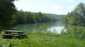
(9) Once at the banks of the Marne, turn left and follow the towpath. After 400 m, at the edge of the woods, head up to the left towards Tanqueux and cross over the railway line.
End of red/white markings
(10) At the T-junction, we turn left and follow the D80 for 200 m, behind Tanqueux Castle.
(11) We leave the D80 before the last house and turn right onto a path that climbs and narrows into a track between the houses. We cross two roads in the Tanqueux housing estate in succession and continue along the path. At the T-junction, at the entrance to the Bois de la Bergette, we head down the footpath on the left and rejoin the route we took earlier.
(8) We head back down, retracing our steps to the banks of the Marne.
(9) We then turn right (red/white markings) and walk with the Marne on our left. At the first car park, we take the path along the bank of the Marne, past the river stop and the Promenade de l’Île Cartier. We come out onto Boulevard du 8 mai 1945 and follow it to the left for about a hundred metres.
(12) At the junction, we turn right onto Rue des Pelletiers, past the Town Hall square, then continue along Rue Michel Fauvet.
(S/E). Turn left onto the street below, Rue de la Gare, and cross at the pedestrian crossing to reach the station forecourt.


 Visorando Member
 Very difficult
 Difficult
  Association / Club / Walk leader