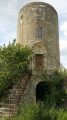
North of Saint-Étienne-de-Lisse

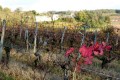
A hilly route through the vineyards with beautiful views and renowned châteaux, some of which are classified as Saint-Émilion Grand Cru.

Details

394784
Creation:
Last update:
Last review:
  • Walking
    Activity: Walking
  • ↔
    Distance: 5.05 mi
  • ◔
    Average duration: 2h 40 
  • ▲
    Difficulty: Easy

  • ⚐
    Back to start: Yes
  • ↗
    Ascent: + 351 ft
  • ↘
    Descent: - 331 ft

  • ▲
    Highest point: 322 ft
  • ▼
    Lowest point: 72 ft

Photos

Description of the walk

Park in the school car park.

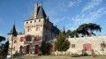
(S/E) Head for the D245. At the foot of the wayside cross, take the path on the left through the vineyards, which leads you to Pressac Castle,

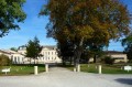
(1) Further up, go round the château by following the path to the left, and take a stroll along the esplanade to enjoy the view. Then head back out via the main avenue.

(2) At the exit, follow the road opposite, ignoring the Tour Pressac junction. Carry on straight ahead along the same road, passing the hamlet of Thibaud.

(3) At the first copse, take the left-hand fork in the path and carry on straight ahead. When you reach the road, take the path opposite, in line with the one you’ve just left, and follow it alongside the copse until you reach the road.

(4) Turn right towards the hamlet of Veyrac and, before reaching the hamlet, turn left. Walk along the edge of the pond, go round Château Cantin on the right, then turn left to rejoin the road.

(5) Carry on straight ahead.

(6) After the left-hand bend, take the second track on the right through the vineyards to reach the hamlet of Les Échères, which you go round on the right. Continue to the right on the D243. At the crossroads, turn left onto the D243E2 and continue for 250 metres.

(7) At the T-junction, take the path on the left straight ahead towards Tourans, cross the château grounds and follow the white path.

(8) Turn right to reach the woodland; follow the edge of the woodland until you reach the last plot.

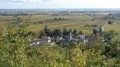
(9) Head slightly uphill to the left and find the path on the right which will take you to the viewpoint, where you can enjoy the magnificent view over the Dordogne valley, Château Ferrand and Saint-Étienne-de-Lisse.

Leave the woods and turn right onto the direct descent towards the car park which you can see below (S/E).


Waypoints

  1. S/E : mi 0 - alt. 82 ft - School car parks
  2. 1 : mi 0.3 - alt. 151 ft - Turn left, towards the castle
  3. 2 : mi 0.86 - alt. 279 ft - Y-junction: turn left towards Tour Pressac
  4. 3 : mi 1.55 - alt. 174 ft - Path on the left
  5. 4 : mi 2.23 - alt. 190 ft - Keep to the right at the road
  6. 5 : mi 2.8 - alt. 223 ft - Y-junction – go straight on
  7. 6 : mi 3.02 - alt. 285 ft - Path on the right
  8. 7 : mi 3.61 - alt. 276 ft - Path on the left towards Tourans
  9. 8 : mi 4.23 - alt. 282 ft - Turn right to walk along the edge of the woods
  10. 9 : mi 4.59 - alt. 272 ft - On the right, access to the viewpoint
  11. S/E : mi 5.05 - alt. 82 ft - School car parks

Notes

Important: this route takes you off the beaten track. All the landmarks mentioned in the description (local place names, castle names, as well as high-voltage power lines, bridges, etc.) are shown on the corresponding IGN 1:25,000 map but are not always included on the scaled-down map.
It is strongly recommended that you either obtain the map in question or use a smartphone app, which will also allow you to be geolocated at all times, enabling you to track your progress accurately.
The route may cross or follow other signposted routes. It is tempting to follow the signposts! Unless otherwise specified, do not stray from the route.
Using walking poles can be very useful and reassuring; as well as providing stability, they help distribute the strain more evenly.

Worth a visit

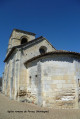
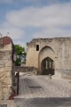
Pressac Castle was founded in the Middle Ages, as evidenced by its medieval gate. The castle was subsequently fortified on several occasions.
It was at Pressac Castle, following the French victory at Castillon-la-Bataille, that the surrender took place, bringing the Hundred Years’ War to an end.
Pressac Castle was a major structure comprising no fewer than 27 towers, some of which still exist as ruins.
Early 18th century
Between 1737 and 1747, Vassal de Montviel planted a noble grape variety native to Quercy in his vineyards: the Auxerrois. Owners of neighbouring vineyards followed suit. Consequently, the variety came to be known as ‘Noir de Pressac’. Later, Sieur Malbek cultivated it in the Bordeaux region, and the grape variety came to be known as ‘Malbec’.
In 1775, when Sieur d’Anglade sold the château to Jean-Marc Constantin, the notary described the château as follows: “An old château, parts of which have fallen into ruin, with a moat in front, peasants’ dwellings, wine cellars, vats, barrels and a forecourt, all surrounded by walls.” (Source: the château’s website)

Reviews and comments

4.3 / 5
Based on 3 reviews

Reliability of the description
4.3 / 5
Ease of following the route
4 / 5
Route interest
4.7 / 5
delangeb
delangeb

Overall rating : 4.3 / 5

Date of your route : Nov 26, 2023
Reliability of the description : ★★★★☆ Good
Ease of following the route : ★★★★☆ Good
Route interest : ★★★★★ Very good
Very busy route : No

A lovely walk. Please note that the route passes through private property, but it’s easy to go round it. Take a detour to admire the view from the Tourans cross.

Machine-translated

Regine24.
Regine24.

Overall rating : 5 / 5

Date of your route : Oct 22, 2021
Reliability of the description : ★★★★★ Very good
Ease of following the route : ★★★★★ Very good
Route interest : ★★★★★ Very good
Very busy route : No

A brilliant autumn walk after the grape harvest. Some very beautiful vineyards.

Machine-translated

marcher en Lib
marcher en Lib

Overall rating : 3.7 / 5

Date of your route : Dec 09, 2019
Reliability of the description : ★★★★☆ Good
Ease of following the route : ★★★☆☆ Average
Route interest : ★★★★☆ Good

Hello,
The route is marked out right from the start by an entrance that goes round a chain blocking the path. It istherefore private property.
Between waymarks 4 and 5, the path taken leads directly into Château Cantin (private property).

Machine-translated

Other walks in the area

For more walks, use our search engine .

The GPS track and description are the property of this route's author. Please do not copy them without permission.