Country:

 City:
City:


Starting point and access: Chars railway station
- Transilien line J, Paris-Saint-Lazare–Gisors route.
- Car park right next to the station.
(S/E) With your back to the station, turn left and follow Rue du Général Leclerc. Then turn left onto the small square leading to the old Chars bridge, situated to the right of the Viveco grocery shop.
(1) When you reach the bridge, cross the railway line carefully to reach the town hall forecourt. From the town hall, follow the street towards the church. Then turn left into the first street, Rue de l’Hôtel-Dieu, and continue to the end of the tarmac road.
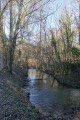
(2) When you reach the footpath running alongside the Viosne, do not take it but turn right onto the path leading uphill between two stone walls. Continue uphill to the top of the steps made from railway sleepers, then head back down to the right along the tarmac road D188 to the Church of Saint-Supplice.
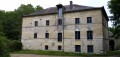
(3) Opposite the church, turn left into Rue de la Gloriette. Cross the D915 county road with care, then continue straight ahead along the pedestrian section of Rue de la Gloriette and carry on downhill. Turn right into Rue André-Baleydier. When you reach Place des Fêtes, go under the railway line, then continue along Rue Dory as far as the Chars mill and the wash house.
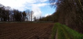
(4) Shortly afterwards, turn right onto Rue de la Groue, then take the dirt track that winds around the meadows at the bottom of the valley. Then head uphill to the right to join Rue de Gisors (the D915) and follow it to the right. Turn left onto Rue du Général Leclerc and you will arrive at Chars station (S/E).
 Visorando Member
 Very difficult
 Moderate
 Association / Club / Walk leader