


 Country:

 City:
City:


The starting point is at Place de l’Église, at the foot of the town hall and the church. Parking spaces are limited. If the car park is full, look for a space in the adjacent streets.
Yellow markings
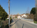
(S/E) With your back to the church, turn right and leave the town hall on your right. At the T-junction, turn left onto Rue Basse (a cul-de-sac). Cross Rue du Château Gaillard on the left-hand side. At the end of the tarmac, continue along a grassy path. Cross a stream and walk between a hedge on your left and a field on your right.
(1) At a three-way junction, turn right onto a dirt track. Ignore a path branching off to the right and walk alongside a woodland on your left. Ignore a path branching off to the left and head down between the fields. Enter a woodland and walk back up. Ignore a path branching off to the right; continue for a while along the edge of the woodland, then between the fields.
(2) At the junction (metal cross), turn left onto a sandy track. At thefirst Fork in the road, take the track on the right (do not take the track on the left which climbs towards a farm). Immediately afterwards, at thesecond Fork in the road, follow thePR®5to the left (twoPR® routes split here). Climb up through shaded terrain. At the top, continue along a road and you’ll soon reach the junction with Rue de la Harpe on the right-hand side.
Yellow + Red and White markings
(3) Continue straight on along a road, keeping to the right-hand verge for better visibility on the upcoming left-hand bend. Ignore a track branching off to the right and continue along the small road for some time until you reach its junction with the D28.
(4) Cross the D28 carefully, follow it to the left for about twenty metres and take a wide path on the right.
(5) When this turns left, take a discreet path on the right (there’s a signpost shortly afterwards). Head uphill along this narrow path, sandwiched between a field on the left and a hedge on the right. At the top, continue along a track between the fields. Then walk along the edge of the woodland until you reach a junction with a road.
Yellow markings
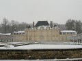
(6) Follow the road to the left, keeping the wall of the Château de Saint-Cyr-sur-Chars park on your right. At the junction with other paths (elevation 127), continue straight on along the road until you reach a crossroads.
(7) Follow the D28 to the right and walk gently uphill along the main street of Neuilly-en-Vexin.
(8) At the foot of the château, turn left onto the D188 towards Le Heaulme. At the junction shortly afterwards, turn right onto the D188 towards the community hall.
(9) Ignore a narrow lane on the left and head slightly uphill. At the corner by the cemetery, take a path on the right. Pass the community hall and follow a sunken lane uphill.
(10) At the T-junction (forest gate on the left), turn right and walk alongside a wall on your right. At the crossroads, take thefirst left, a quiet little road. Walk for a long while, alternating between short ascents and descents, passing through woods, along the edges of fields or old orchards. Enter Marines.
Unmarked
(11) Cross the Chemin des Anglais on the right-hand side and continue straight on along the gently sloping road. Cross the Rue des Hautiers on the right-hand side and walk gently uphill along the Rue du Maréchal Foch.
Yellow markings
(12) At the corner of No. 26, just before a cross, turn left into an uphill lane. Turn left after No. 1 and head uphill between two fences. Continue uphill through woodland, ignoring faint tracks off to the sides. Still in the woodland, follow a fence on your left.
(13) At the end of the fence, ignore a path branching off to the left and carry on straight ahead. Wind your way through the woodland, keeping an eye out for the markings. Near a road, recent forestry work has significantly altered the terrain and made the route difficult to follow (as of March 2023): the easiest option is to carry on straight ahead until you reach the road.
(14) Follow the road to the left and, after a few metres, turn left onto a wide forest track. Immediately ignore a path branching off to the right and walk alongside a recently thinned area on your right. Keep going straight on (some sections may be damp), pass a reservoir and head downhill. Go through a forest gate and you’ll immediately come to a junction you passed earlier.
(10) Head down the sunken track to the right. At the corner by the cemetery, follow the road to the left.
No signposting
(9) When the road bends to the left, turn right onto a smaller road which immediately bends to the right.
Yellow signposting
At the next junction, head up Rue de l’Église to the left and you’ll very quickly reach Place de l’Église (S/E).



 Visorando Member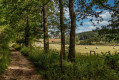
 Easy
Easy 
 Association / Club / Walk leader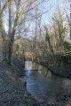
 Very difficult
