The old Magny railway line

This route takes you along part of the old railway line that ran from Pontoise to Magny-en-Vexin, passing by the ponds of the Viosne valley and the Bouconvillers plateau.

Details

44110179
Creation:
Last update:
Last review:
  • Walking
    Activity: Walking
  • ↔
    Distance: 6.05 mi
  • ◔
    Average duration: 3h 00 
  • ▲
    Difficulty: Easy

  • ⚐
    Back to start: Yes
  • ↗
    Ascent: + 259 ft
  • ↘
    Descent: - 259 ft

  • ▲
    Highest point: 374 ft
  • ▼
    Lowest point: 226 ft

Photos

Description of the walk

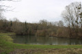
Car park in front of the large Villetertre pond on the D536, halfway between Bouconvillers and La Villetertre.

(S/E) Start this route by walking round the large Villetertre pond (set off to the left when facing the pond).

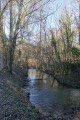
(1) On returning to the road, turn left and walk for 200 metres until you reach a hairpin bend, then continue straight ahead along a wide path. Pass under a railway bridge and you’ll soon reach the small Villetertre pond. Walk past the pond and continue along the path for 250 metres until you reach a Fork in the road.

(2) Take the path branching off to the left uphill and follow this path as it forms a circular loop in the Bois de Beaumont. You’ll join a well-markedGR® trail.

(3) Turn right and follow thisGR® for 1.5 km until you reach a railway line, which you cross (Caution! The Pontoise–Gisors line is in operation).

(4) Immediately afterwards, let theGR® head off to the left and head uphill opposite, cross another disused railway line and continue along the path for 500 m.

(5) As you emerge from the woods, turn right onto a wide grassy path; this is the old railway line. Walk uphill to the entrance to Bouconvillers,

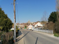
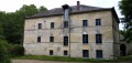
(6) Cross the D915 road at the pedestrian crossing and continue straight ahead, then cut across two streets, keeping in the same direction: there are a few railway remains in this area, including the old station, the former gatekeeper’s house and the old points.

(7) At the end of the path, turn right onto a small road (Allée des Tilleuls) and, at the end of this, turn right again to reach Bouconvillers Church.

(8) In front of the church, turn left into Rue de la Mare de la Ville and, after 400 metres, you’ll reach the D915.

(9) Cross the road carefully and take the path opposite leading out onto the plain. Follow it to where it ends in front of the Petit Bachaumont farm and turn left. Walk for about 200 m.

(10) Turn sharply right onto a faint path that descends into the woods and continue until you reach the road. The car park is then 100 metres on your left (S/E).


Waypoints

  1. S/E : mi 0 - alt. 240 ft - Car park at the large Villetertre pond
  2. 1 : mi 0.7 - alt. 253 ft - Road junction
  3. 2 : mi 1.03 - alt. 246 ft - Fork in the road
  4. 3 : mi 1.74 - alt. 374 ft - Bourbizé crossroads (GR)
  5. 4 : mi 2.75 - alt. 226 ft - Railway line
  6. 5 : mi 3.13 - alt. 272 ft - Exit from the woods
  7. 6 : mi 3.93 - alt. 325 ft - D915
  8. 7 : mi 4.28 - alt. 328 ft - Linden Tree Avenue
  9. 8 : mi 4.49 - alt. 344 ft - Bouconvillers Church
  10. 9 : mi 4.72 - alt. 371 ft - RD 915
  11. 10 : mi 5.74 - alt. 325 ft - GR junction
  12. S/E : mi 6.05 - alt. 240 ft - Car park at the large Villetertre pond

Notes

Café and tobacconist’s in Bouconvillers, on the D915, 100 m off the route.

Worth a visit

Villetertre Ponds, the village of Bouconvillers, railway ruins, the Petit Bachaumont farm.

Always be cautious and plan ahead when you're outdoors. Visorando and the author of this route cannot be held responsible for any accidents occurring on this route.

The GR® and PR® markings are the intellectual property of the Fédération Française de Randonnée Pédestre.

Reviews and comments

3.7 / 5
Based on 4 reviews

Reliability of the description
3.3 / 5
Ease of following the route
4 / 5
Route interest
3.8 / 5
gerard leduc
gerard leduc

Overall rating : 3.3 / 5

Date of your route : Aug 28, 2025
Reliability of the description : ★★☆☆☆ Disappointing
Ease of following the route : ★★★★☆ Good
Route interest : ★★★★☆ Good
Very busy route : No

the map is perfect, but the description is wrong in many places. Apart from that, it's a very beautiful parish-specific to Brittany hike. G. Leduc

Machine-translated

NRBJ
NRBJ

Overall rating : 5 / 5

Date of your route : Jun 29, 2025
Reliability of the description : Not used / Not applicable
Ease of following the route : ★★★★★ Very good
Route interest : ★★★★★ Very good
Very busy route : No

Route taken this Sunday, setting off at dawn and returning in the opposite direction so that I would be in the shade of the woods once the sun was up. It's very nice, I liked the area around the pond (source of the Viosne) and the undergrowth. No problems with the directions, I used GPS.
Be careful between points 5 and 6 (before Bouconvillers in the direction of the route), as the path is currently very overgrown with tall grass, brambles and nettles. It's still passable, though.
I extended my walk with a detour through the Mare woods next to Lavilletertre, but I wouldn't recommend it as the paths are overgrown with trees and branches, and I even had to end up returning to the pond via the road.
I then went back up the Viosne valley upstream from the pond to the white cross, then passed through Lierville (pretty church) and returned via the GR 11. It was very nice except for a short stretch along the D53.

Machine-translated

Fred Chauveau
Fred Chauveau

I’m sorry that, contrary to the previous review, you found this walk disappointing. Having re-read my description, I’ve realised that at point 2 I wrote ‘right’ instead of ‘left’, and I’m sorry about that. I’ll correct it as soon as possible. The route thus avoids following the Viosne along a stretch that is often too wet. As for point 10, the path does indeed exist, as it is part of the GR11.
I’d like to point out that before suggesting walks on this site, I do them with a group of about fifteen people and take their feedback on board.
As for the title, I’m not sure if it’s the best choice, but we do follow this old, forgotten railway line between points 4 and 7, thanks to the efforts of Bouconvilliers Town Council.
Once again, my sincere apologies for this error in the description, and I wish you all some wonderful walks in the Vexin.

Machine-translated

blt7878
blt7878
• Edited:

Overall rating : 2.3 / 5

Date of your route : Sep 14, 2024
Reliability of the description : ★★★☆☆ Average
Ease of following the route : ★★☆☆☆ Disappointing
Route interest : ★★☆☆☆ Disappointing
Very busy route : No

The route is poorly marked on two occasions: at the start along the Viosne (point no. 2) and at the end near point no. 10 (no ‘barely marked’ path). The section around the lake is pleasant but doesn’t justify the rest of this rather dull walk, which ends with a very long straight stretch through the fields. The title, which mentions the old railway line, has nothing to do with the route itself.

Machine-translated

Walker2
Walker2

Overall rating : 4.7 / 5

Date of your route : Apr 25, 2024
Reliability of the description : ★★★★★ Very good
Ease of following the route : ★★★★★ Very good
Route interest : ★★★★☆ Good
Very busy route : No

An easy, lovely walk for a family; the start at the pond is really pleasant, alternating between wooded sections and fields, with few roads.

Machine-translated

Other walks in the area

For more walks, use our search engine .

The GPS track and description are the property of this route's author. Please do not copy them without permission.