Ascent of Pizzo Cassinello

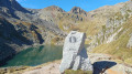
The ascent of Cassinello Peak is a wonderful excursion through wild mountain terrain. Although fully signposted, this route is distinctly high-mountain in character and requires vigilance whilst climbing , as well as a good sense of direction and an understanding of the terrain to find the path to the summit.

Details

106625300
Creation:
Last update:
Last review:
  • Walking
    Activity: Walking
  • ↔
    Distance: 7.42 mi
  • ◔
    Duration according to the author: 8 hrs 
  • ▲
    Difficulty: Very difficult

  • ⚐
    Back to start: Yes
  • ↗
    Ascent: + 5,092 ft
  • ↘
    Descent: - 5,089 ft

  • ▲
    Highest point: 10,125 ft
  • ▼
    Lowest point: 5,397 ft

Description of the walk

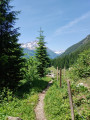
(S/E) From the car park, follow the red and white markings and the signposts towards the refuge and the pass. The well-marked path climbs steeply until it joins the access path to the Scaradra Refuge.

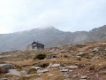
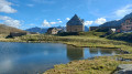
(1) Turn left to stop for a break at the refuge.

(2) Head back to the junction.

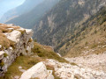
(1) Continue the ascent to the left, towards the Soreda Pass. The final section of the climb to the Soreda Pass is steep, over fairly unstable terrain. Considerable effort has been made to secure the path and make progress easier (steps, cables, etc.), but it remains precarious and you must remain vigilant due to the risk of falling rocks.

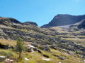
(3) Reach Col Soreda, which offers views across to the other side and along the rest of the ascent towards Pizzo Cassinello. From the pass, there is no proper path; progress is largely made over large rock slabs (which are not slippery if dry).
Climb towards the summit by following the markings (which change to blue and white), the cairns, and by relying on your sense of the terrain to choose the best route. Good visibility is essential...

(4) The descent follows the route back in reverse before returning to the car park (S/E).

Waypoints

  1. S/E : mi 0 - alt. 5,397 ft - Car park
  2. 1 : mi 1.69 - alt. 7,133 ft - Turn-off for the Scaradra Refuge
  3. 2 : mi 1.93 - alt. 7,152 ft - Scaradra Refuge
  4. 3 : mi 3.15 - alt. 9,009 ft - Soreda Pass
  5. 4 : mi 3.96 - alt. 10,125 ft - Pizzo Cassinello
  6. S/E : mi 7.42 - alt. 5,400 ft - Car park

Notes

CAS rating: T3+

The starting point at the end of the Luzzone dam is accessible by car.
The road runs along the dam wall, then passes through a long road tunnel.
The final 3 kilometres along the dam are unpaved, but the track is in relatively good condition.

It is possible to reach the start by bus; the bus terminus is at the end of the tarmac road, after the tunnel and about 3 km from the indicated start point.

Although the Scaradra Refuge is unstaffed, booking this comfortable refuge is compulsory.

This ascent should only be undertaken in good weather and with good visibility.
There is a real risk of rockfalls on the ascent to the Soreda Pass.

Other walks in the area

For more walks, use our search engine .

The GPS track and description are the property of this route's author. Please do not copy them without permission.