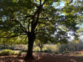
Aritzmendi from Zahar

This walk serves as a starter before lunch at Venta Zahar, where you can then use the car park.
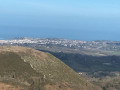
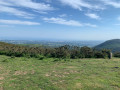
It forms a lovely circular route, passing over the summit of Aritzmendi for a view of the Basque Coast.

Details

n°14009578
Creation:
Last update:
Last review:
  • Walking
    Activity: Walking
  • ↔
    Distance: 4.28 mi
  • ◔
    Average duration: 2h 50 
  • ▲
    Difficulty: Easy

  • ⚐
    Back to start: Yes
  • ↗
    Ascent: + 994 ft
  • ↘
    Descent: - 994 ft

  • ▲
    Highest point: 1,516 ft
  • ▼
    Lowest point: 518 ft

Photos

Description of the walk

Take the road to the Col d’Ibardin. When you reach the pass, head straight on towards Bera; after the first bend on the right, take the small road branching off to the left. It winds through the forest, then passes the Okalarre restaurant and continues on to the Zahar restaurant.

(S/E) At the far end of the car park, to the right of the bridge leading to the inn, take the path straight ahead along the Intzolako erreka stream. The path runs alongside the stream, changing banks several times until it reaches a Y-junction with a wider track that heads north-east.

(1) Turn left onto this track, which leads out of the forest for about 300 m, then take the hairpin bend to the right towards the south-east onto a track that climbs along the edge of the forest and heads north for about 400 m.

(2) Take a hairpin bend to the right. Ignore a hairpin bend to the left and carry on straight ahead, heading south then east to join the Haute Route Pyrénéenne.

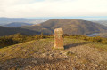
(3) Take a hairpin bend to the left to climb to the summit of Aritzmendi.

(4) Descend back onto the HRP (Haute Route des Pyrénées) and continue along a wide, circular descent leading to Venta Yasola. Continue downhill to the Descarga Haundi pass.

(5) Turn left onto the track heading south-west for a hundred metres until you reach a junction. Take the path on the left; this is a variant of the HRP which leads back to Venta Zahar and the car park (S/E).

Waypoints

  1. S/E : mi 0 - alt. 522 ft - Venta Zahar car park
  2. 1 : mi 0.74 - alt. 728 ft - Fork
  3. 2 : mi 1.17 - alt. 981 ft - Turn right
  4. 3 : mi 1.81 - alt. 1,322 ft - Sharp left – HRP
  5. 4 : mi 2.13 - alt. 1,450 ft - Summit - Aritzmendi
  6. 5 : mi 3.43 - alt. 892 ft - Col de Descarga Haundi
  7. S/E : mi 4.28 - alt. 522 ft - Venta Zahar car park

Notes

The car park is reserved for customers; if you’re not a customer, you can sometimes find one or two spaces by the side of the road before the final bend, but you must ensure you leave the way clear.

The Venta is closed until the end of March, so its car park is available during this period.

The map shows that the path crosses the Intzola stream, but in reality, you’ll have to wade across not once but six times, and if it’s rained the day before, you’ll sometimes find yourself wading with wet feet.

Reviews and comments

4.5 / 5
Based on 2 reviews

Reliability of the description
4.5 / 5
Ease of following the route
4.5 / 5
Route interest
4.5 / 5
User 30800129

Overall rating : 5 / 5

Date of your route : Sep 21, 2026
Reliability of the description : ★★★★★ Very good
Ease of following the route : ★★★★★ Very good
Route interest : ★★★★★ Very good
Very busy route : No

A brilliant walk – we weren’t swamped by other walkers; a peaceful route with an extraordinary view

Machine-translated

isas
isas

Overall rating : 4 / 5

Date of your route : Oct 29, 2023
Reliability of the description : ★★★★☆ Good
Ease of following the route : ★★★★☆ Good
Route interest : ★★★★☆ Good
Very busy route : No

Perfect for having lunch at one of the three ventas along the route, whilst avoiding the crowds on some of the nearby paths.

Machine-translated

Other walks in the area

For more walks, use our search engine .

The GPS track and description are the property of this route's author. Please do not copy them without permission.