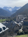
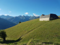
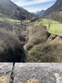
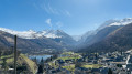
The “Ambivalence” structure and Pla de Cros as seen from the church in Bordères-Louron

Starting from the car park in front of the church in Bordères-Louron, this accessible circular walk offers lovely sights all along the route.
After the first climb, you’ll reach the architectural structure “Ambivalence”, created by students from the Toulouse School of Architecture: an unusual seating area with a view over the valley, marking the entrance to the Montious Massif Regional Nature Reserve. You can then enjoy the panoramic view of the highest peaks in the Pyrenees and make use of the picnic tables.

Details

n°58537490
Creation:
Last update:
Last review:
  • Walking
    Activity: Walking
  • ↔
    Distance: 3.32 mi
  • ◔
    Average duration: 2h 55 
  • ▲
    Difficulty: Moderate

  • ⚐
    Back to start: Yes
  • ↗
    Ascent: + 1,591 ft
  • ↘
    Descent: - 1,591 ft

  • ▲
    Highest point: 4,370 ft
  • ▼
    Lowest point: 2,779 ft

Photos

Description of the walk

Car park at the church in Bordères-Louron.

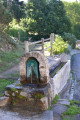
(S/E) Turn your back on the river and follow Rue Cami de Caussade. Turn right at the T-junction, passing an old washhouse (where you can fill up with water). Keep left at the Fork in the road, then turn left onto Rue Bié de Sabathé. At the T-junction, turn right and continue to the end of the street.

(1) Leave the village by passing between the houses, then follow the low stone wall. Follow the path uphill through the woodland.

(2) At the junction, turn left and continue uphill beneath the power line. Further on, the path turns due east to reach Pla de Cros and its picnic table.

(3) Walk towards the viewpoint and discover the ‘Ambivalence’ structure before turning back.

(3) Carry on along the path to the right. Join a track on the right.

(4) At the hairpin bend in the track, carry straight on along another track.

(5) At the junction, leave the main track and take the right-hand hairpin bend to head back down. You’ll come back to the junction you passed on the way out.

(2) Follow the outward route in the opposite direction to return to the village. On your way back, you can stroll through the streets and along the banks of the Neste before returning to the car park (S/E).

Waypoints

  1. S/E : mi 0 - alt. 2,779 ft - Church car park - Neste du Lourou (rivière) - Affluent de la Neste
  2. 1 : mi 0.18 - alt. 2,897 ft - Leaving the village
  3. 2 : mi 0.56 - alt. 3,225 ft - Junction
  4. 3 : mi 1.1 - alt. 3,852 ft - Pla de Cros - Ambivalence (structure bois)
  5. 4 : mi 1.54 - alt. 4,236 ft - Trail junction
  6. 5 : mi 1.9 - alt. 4,370 ft - Junction of track and path
  7. S/E : mi 3.32 - alt. 2,779 ft - Church car park

Notes

- Water point near the wash house at the start of the walk.

Worth a visit

- During the walk, discover the wooden structure ‘Ambivalence’, which marks the entrance to the Montious Massif Nature Reserve. It was created as part of the ‘L’Ascension de Sisyphe’ competition, the first edition of which took place in 2022.

- Enjoy the view and the picnic area at “Pla de Cros”.

Reviews and comments

5 / 5
Based on 1 review

Reliability of the description
5 / 5
Ease of following the route
5 / 5
Route interest
5 / 5
Panipwoblem77
Panipwoblem77

Overall rating : 5 / 5

Date of your route : May 01, 2026
Reliability of the description : ★★★★★ Very good
Ease of following the route : ★★★★★ Very good
Route interest : ★★★★★ Very good
Very busy route : No

A very pleasant hike. The gradient at the start is incredibly steady. This initial section lasts 2 km at 20.5%... very manageable at your own pace, and the path isn’t technical at all: you can manage it in trainers, though the descent includes sections where hiking boots are strongly recommended, even though the descent itself is very pleasant

Machine-translated

Other walks in the area

For more walks, use our search engine .

The GPS track and description are the property of this route's author. Please do not copy them without permission.