Country:

 City:
City:



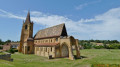
Park in the abbey’s car park: picnic tables and toilets available.
(S/E) Return to the access road to the car park, then head up this road to the left towards the roundabout. Just before the roundabout, turn left past the picnic table and cross the D4 to take the path opposite leading to the recycling bins.
(1) Head up this path and follow it through the woods to a crossroads.
(2) Take the path opposite, ignoring the first path on the right and the other two on the left. Head back down to a three-way junction.
(3) Be careful not to take the wrong path; make sure you take the path on the right, which passes near a pond and leads up through fields – make sure you close the metal gates properly – until you reach a tarmac road.
(4) Follow it to the left. Turn onto the second path on the left towards some houses. At the end, turn right to join the D43. Cross the D43 with care and continue straight ahead on the tarmac road until you reach the Roanne-Digoin canal.
(5) There are two options: either continue to follow the yellow markings of the Community of Communes No. 31, which take you to Briennon harbour across the fields, or turn left and follow the peaceful canal past a lock (route of your choice). Watch out for cyclists as this is the ‘Véloire’ cycle route.
(6) When you reach the D4, cross the bridge, then turn left immediately to walk alongside the canal on the opposite bank. Don’t miss the barge that has been converted into the Museum of River Transport – it’s well worth a visit.
(7) The harbour is a pleasant spot with several picnic tables. This site was once home to a tile factory. Walk past the town hall on Rue Saint-André, then turn right towards the cemetery. Cross the D43 carefully, then continue along the road opposite, which zigzags. Carry on uphill until you reach another path, which you take on the left, following the edge of a woodland.
(8) Please note: follow the yellow signposting which turns left to continue alongside the forest. Cross a road and carry on straight ahead for a few metres.
(9) Turn right onto the path leading down to La Bénisson-Dieu. Once in the village, turn left and then immediately right to rejoin the D4.
(10) Turn right and follow the D4 uphill to the third pedestrian crossing. Cross the road, turn right, then left about twenty metres further on to reach the primary school and its car park, which offers panoramic views of the abbey. Walk down towards the abbey, view its north façade, then return to the south façade. Visit the interior of this magnificent building.
(11) Leave the church on the village side, cross Rue des Convers and take the path opposite which leads back to the car park (S/E).

 Visorando Member
 Easy
Easy 
 Tourist office