


Refine your search for walks in Abbaye de Clervaux
Randonnées Abbaye de Clervaux


 Clervaux and the Irbich Valley
 Visorandonneur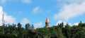
 6.25 mi
 +1,060 ft
 -1,050 ft
 3h 50
3h 50
 Moyenne
 Départ à Clervaux (Luxembourg (Country))
A climb from Clervaux to a superb view of the abbey bell tower and the valley, then a route mainly through forest, finally returning along the Irbich river on country roads or dirt tracks.
You can shorten the walk by continuing from (6) to Drauffelt station (6 km in total) and returning by train (free on the GDL).
The Luxembourg Ardennes between Troisvierges and Drauffelt
 11.92 mi
+1,460 ft
-1,804 ft
6h 45
Moyenne
Départ à Troisvierges (Luxembourg (Country))
11.92 mi
+1,460 ft
-1,804 ft
6h 45
Moyenne
Départ à Troisvierges (Luxembourg (Country))
Set off to explore the north of the Grand Duchy of Luxembourg and, in particular, Clervaux Abbey.
Please note: this hike is not circular and is based on the concept of walks from station to station. We chose to leave our vehicle at the free P+R car park at Drauffelt station, from where the train takes hikers to Troisvierges free of charge (1 train per hour on track 1).
Walks near Abbaye de Clervaux
From Goebelsmühle station to Michelau station via Bourscheid Castle
9.05 mi
+2,096 ft
-2,175 ft
6h 00
Moyenne
Départ à Bourscheid (Luxembourg) (Luxembourg (Country))
This walk takes us up above the meanders of the Sûre into the heart of the Éislek, following part of the Escapardenne Lee Trail, a hiking trail linking Ettelbruck to Kautenbach. Once we’ve reached Luxembourg’s largest fortified castle, we can walk around the next bend and head uphill to reach a remarkable viewpoint before descending towards Michelau station. If you’re short on time or energy, you can reach the station more directly by taking the Haute Sûre path down from the castle.
It was designed to be accessible by train (free in Luxembourg since March 2020).
From Gouvy station to Vielsalm station
12.32 mi
+1,112 ft
-1,457 ft
6h 40
Moyenne
Départ à Gouvy (Province de Luxembourg)
From Gouvy to Vielsalm, skirting Courtil and Provèdroux, the route is quintessentially Ardennes and serene. It alternates between peaceful forest stretches and open countryside, with gently rolling hills. The terrain becomes more undulating as you approach Vielsalm. The walk through the hamlet of La Comté, followed by the climb over the next ridge with its magnificent views, is a real treat. This is followed by the typical descent towards Vielsalm, where you’ll find it all: schist, the Bonalfa forest, blueberry bushes… and the ‘macralles’ (witches)!
Benonchamps – Sterpigny
 15.60 mi
+1,020 ft
-1,040 ft
8h 05
15.60 mi
+1,020 ft
-1,040 ft
8h 05
 Difficile
Départ à Bastogne (Province de Luxembourg)
Difficile
Départ à Bastogne (Province de Luxembourg)
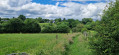
This route takes us through wide open landscapes alternating with paths and tracks through the woodland. The surfaces are either tarmac or dirt, and the paths are often still overgrown with grass given the time of year and the fact that they are probably not used very often. That’s the charm of these moments spent in direct contact with nature.
Sterpigny – Rodt Sankt-Vith
 14.25 mi
+840 ft
-587 ft
7h 15
Difficile
Départ à Gouvy (Province de Luxembourg)
14.25 mi
+840 ft
-587 ft
7h 15
Difficile
Départ à Gouvy (Province de Luxembourg)
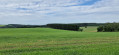
Here we are in the Eastern Cantons. This region isn’t part of Wallonia, but I’ve included it in my ‘Parkin’son tour of Wallonia’ all the same. Through a succession of climbs, some of which are quite steep, as are the descents, we gradually make our way towards the highest altitudes in Belgium. Mainly via paths, tracks and back roads, we link up the various villages and small towns situated between Sterpigny and Rodt, namely Gouvy, Aldringen, Maldingen and Crombach.