In search of the lost Garennes trail

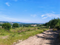
A lovely walk to enjoy with the family. Partly along small roads and partly along a ‘forgotten’ path deep in the woods. Birdsong and animal tracks guaranteed...
See the reviews – the paths really do seem to have ‘disappeared’!

Details

n°3123173
Creation:
Last update:
Last review:
  • Walking
    Activity: Walking
  • ↔
    Distance: 3.35 mi
  • ◔
    Average duration: 1h 50 
  • ▲
    Difficulty: Easy

  • ⚐
    Back to start: Yes
  • ↗
    Ascent: + 348 ft
  • ↘
    Descent: - 331 ft

  • ▲
    Highest point: 2,044 ft
  • ▼
    Lowest point: 1,742 ft
  • ⚐ Country: France
  • ⚐ City: Thauron (23250)
  • ⚑
    Start/End: N 46.022224° / E 1.797356°
  • ❏
    IGN map(s): Ref. 2130E
  • Hour-by-hour weather

Photos

Description of the walk

Starting point: the village of Bonneville.

(S/E) Take the path leading uphill at the northern entrance to the village. At the end of the path, carry on straight ahead to the left. Cross the road and take the path opposite.

(1) At the fork in the road, turn left. After the house known as Fontmeau du Haut, continue along the small road that branches off to the left. At the T-junction, take the road on the right. In Bonnefond, take thefirst right, then immediately left, and then right again. After a steep climb, the woodland on the right seems almost to meet the road, forming a point.

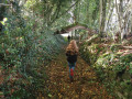
(2) The entrance to the hidden path is there… Leave the road on the right, take a few steps across the open meadow, and enter at the edge of the woodland. The path isn’t visible just yet, but it definitely starts here! Follow the edge of the woodland, as if heading back towards Bonnefond. The path soon becomes visible… Do not follow the various paths leading down to the left, where the mountain bike signposts are, even if the path sometimes seems to disappear. Stay at the edge of the woodland and carry on straight ahead.

(3) Cross a small ditch – this is the hollow of the old track – and follow it, keeping it on your left; it is sometimes bordered by an old low wall. Pass a dead tree – a food source for insects frequented by woodpeckers – and carry on for a further 150 metres or so until you reach the Croix Lagarde (it is so weathered that you might mistake it for a simple stone placed at a crossroads).

(4) Turn right and admire the view of the Chaîne des Puys and Mont Sancy. Continue south.

(1) Return along the original path to Bonneville (S/E).

Waypoints

  1. S/E : mi 0 - alt. 1,742 ft - Bonneville
  2. 1 : mi 0.36 - alt. 1,857 ft - Fork
  3. 2 : mi 1.77 - alt. 1,991 ft - Entrance to the meadow
  4. 3 : mi 2.16 - alt. 2,021 ft - Small ditch
  5. 4 : mi 2.59 - alt. 1,969 ft - Croix Lagarde
  6. S/E : mi 3.35 - alt. 1,745 ft - Bonneville

Notes

This walk can also be done by mountain bike or on horseback...

Reviews and comments

3.5 / 5
Based on 2 reviews

Reliability of the description
3.5 / 5
Ease of following the route
4 / 5
Route interest
3 / 5
Chris97133
Chris97133

Overall rating : 2.3 / 5

Date of your route : Jul 24, 2023
Reliability of the description : ★★☆☆☆ Disappointing
Ease of following the route : ★★★☆☆ Average
Route interest : ★★☆☆☆ Disappointing
Very busy route : No

No reports… No S/E zone
The section between 2.5 km and 4 km is unsuitable due to the change in landscape – there is no path, the undergrowth is impassable for 800 metres and trees have been felled. This route is of no interest. Chris97133

Machine-translated

picaud eliane
picaud eliane

Overall rating : 4.7 / 5

Date of your route : Aug 30, 2020
Reliability of the description : ★★★★★ Very good
Ease of following the route : ★★★★★ Very good
Route interest : ★★★★☆ Good
Very busy route : No

A lovely, well-maintained short walking route, alternating between woodland paths and superb views. The icing on the cake: on our return from the walk, we met the route’s creator and were lucky enough to hear some interesting details about the local heritage.
We really enjoyed it!

Machine-translated

Other walks in the area

For more walks, use our search engine .

The GPS track and description are the property of this route's author. Please do not copy them without permission.