Country:

 City:
City:


Car park in front of the Abri de Machey, on the D34a, also known as the “Route des Américains” (if you’re coming from La Bresse, turn left 800 metres before the Col de Bramont towards the Route des Crêtes).
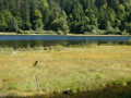
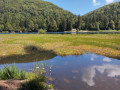
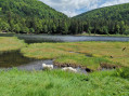
(S/E) Take the path on the left-hand side of the road leading towards the Machais bog. Cross the road and take the path running alongside the bog, marked with a Red Triangle (entry to the bog is prohibited and dangerous). There are some lovely views of the bog through the trees.
(1) At the end of the bog, take the Vaxelaire path, marked with a Yellow Cross, which climbs towards the Col de Bramont (do not continue along the path that goes round the bog, unless you wish to extend the route).
(2) Once you reach the Col de Bramont, cross the road with care (there can be heavy motorbike traffic at times). You now have two options:
Option shown on the map: marked with Blue Rectangles and White Rectangles (a variant ofthe GR®531), head left for about a hundred metres to take the small path on the right-hand side of the road, heading towards the Altenberg (the Old Mountain), Pourri Faing (which you will not descend) and the Col de la Vierge via the Sentier des Douaniers. See Practical Information.
After about 1 km, cross the wide forest track and continue straight ahead for a few dozen metres.
Easier option: You can avoid most of this exposed section by taking the wide forest track, theGR®531marked with a Blue Rectangle, which climbs at the same point, opposite the Col de Bramont car park.
After about 1 km, leave the wide forest track to the right to stay on theGR® and continue for a few dozen metres.
(3) Continue on theGR®531until the junction leading down to Pourri Faing.
(4) Leave theGR® to follow the Blue Disc markings and carry on straight ahead towards La Vieille Montagne and the Col de la Vierge.
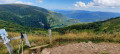
Once you reach the Chaume de la Vieille Montagne, cross this beautiful expanse of blueberry bushes. Pass the first path on your right and carry on to the next junction 200 metres further on.
(5) Ignore the return path on your right and carry on straight ahead towards the Col de la Vierge, following the Blue Disc markings.
(6) At the Col de la Vierge (shelter, Refuge de l’Union), you are at the western end of the circular route.
Return to the Chaume de la Vieille Montagne via the same route you took on the way out.
The shortcut shown on the IGN map no longer appears to be passable, but we did try it; this is why the GPS track does not quite follow the outward route back to the Chaume. It’s up to you whether you want to give it a go or take the same route back as on the way out.
(5) Leave the path you took on the way out and head off to the left until you reach the edge of the forest at a crossroads.
(7) Turn left into the stubble field at the edge of the woodland for a few tens of metres, then turn right into the woodland to join the Chemin Béry (Blue Disc). It descends to the right, heading north-north-east to the Col de Bramont, allowing you to avoid the road linking the two passes.
(2) Back at the Col de Bramont, take the shortcut on the left to join theGR®531(Blue Rectangle), which climbs quite steeply towards the Col de l’Étang.
(8) At the Col de l’Étang you’ll find a shelter if needed, then continue towards the Rainkopf (Blue Rectangle). The climb is quite steep. At the junction with the Route des Américains (D34a), cross the road (take care) and carry on straight up the hill until you reach a junction with a cross-country path.
(9) Turn right for a round trip along this Green Cross-marked path; it leads quickly to the source of the Thur.
(10) Whilst the source of the Thur isn’t particularly impressive, the view over Lake Kruth and the valley is very pleasant. You are now at the eastern end of the circular route. Return to the previous junction.
(9) Carry on straight ahead along this path marked with a Green Cross; this is the Chemin du Génie. It descends and joins the Chemin du Grand Bougre (marked with a Yellow Cross) for 200 metres.
(11) Turn left off the Chemin du Grand Bougre to begin a long detour round the western side of the Tête du Régit. Continue to follow the Green Cross markings of the Chemin du Génie, which will take you back to the Abri de Machais (or Machey) (S/E).

 Visorando Member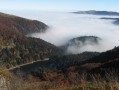

 Difficult
 Easy
Easy