Country:
 City:


At the roundabout where the D23 and 113b meet, enter Meursault via Rue de Citeaux and park in the first car park signposted ‘Parking gratuit’ on the left.
(S/E) Leave the car park via the same exit (ignoring the ‘Centre ville’ sign for pedestrians – you’ll be coming back this way), and follow the road to the left, towards the centre of the village. At the junction, go straight on into Rue Labbé, and at the next junction go straight on again into the one-way street which immediately turns right.
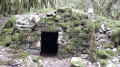
(1) Turn left onto Rue de la Planche Meunière. Cross the Ruisseau des Cloux; at the junction, continue along the path opposite. Pass a wayside shrine on your left and you’ll reach a junction with another path.
(2) Follow this path in the same direction, then at the four-way junction, carry on straight ahead. At the end of the vineyard plot, veer left and continue in the same direction until you reach a small road. Follow it to the right; note the red and yellow GRP® signposting, which you should now follow until otherwise indicated. You’ll come to a junction of small roads.
(3) Turn right. At the Fork in the road, keep left. Then carry on straight ahead along this road, ignoring any side paths or roads branching off. You’ll reach Auxey-Duresses at a crossroads.
(4) Temporarily leave the GRP® signposting and continue straight on, crossing the Ruisseau des Cloux. Walk through the village, staying on Rue du Dessous, and rejoin the GRP® signposting, which you should follow until otherwise indicated. Turn left onto Rue du Pont Boillot just before the church. You’ll reach a junction marked with the ‘Auxey-Duresses’ sign (the GRP® sign advises against using this route in wet weather or on hunting days, which considerably limits the suitable times! We won’t be taking this section).
(5) Follow the GRP® to the right and, shortly afterwards, turn onto the small road branching off to the left.
(6) About 250 m further on, the GRP® takes a path to the right; leave it to follow the small, unmarked road, which soon becomes a track. After a fairly long walk, you’ll reach a crossroads.
(7) Turn left to follow a lovely forest track.
(8) Follow the path as it curves to the left, ignoring the track branching off to the right. At the next junction, turn right, then ignore a path on the right and you’ll come to a wide path marked GRP®.
(9) Turn left, and you will immediately notice the Narvaux lime tree on your left, marked by a sign. Continue along the GRP® until you reach the “Les Chaumes” signpost.
(10) Leave the GRP® and take the path on the right towards “Blagny PR®15”, marked in yellow.
(11) At the junction with a small road, signposted GRP®, follow it to the left until you reach the crossroads at the “Chaume des Narvaux” signpost.
(12) Turn right towards “Meursault PR®14”, marked in yellow. At the junction where the path meets the road, take the path opposite, marked in yellow. Further on, cross a road.
(13) At the next junction, turn left. Continue straight on to return to Meursault.
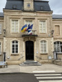
(14) When you reach the town hall and its fountain, head slightly to the right towards the church, walk past it on its left-hand side towards the Maison le Chevreuil, then turn slightly to the right. Leave the post office on your left and immediately take the path on the left which leads to the car park (S/E).
 Visorando Member
 Moderate

 Difficult