


Nearby:
The Charleroi–Brussels Canal and the Ronquières Incline
The old Charleroi–Brussels Canal and the River Samme
The medieval castle of Écaussinnes
Nivelles and its collegiate church
Ronquières and the ‘Bonhomme de Fer’


Part countryside, part woodland, this circular walk takes you on a journey of discovery through the area to the west of the Ronquières Inclined Plane on the Brussels–Charleroi Canal and the Hainaut town of Braine-le-Comte.
Although the walk does not strictly speaking pass through the incline site itself, it offers a fine view of its tower, visible from a great distance even though it lies at the bottom of the Senette valley.
Starting with a stretch through the countryside, the route quickly climbs towards the Houssière woodland, with its countless paths and tracks and its old sand pits.
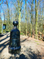
You’ll come across the ‘Bonhomme de Fer’ at the southern end of this woodland. It is quite simply a geodetic marker dating fromthe mid-19th century, erected by the Belgian military engineers of the time to map Belgium more accurately. It formed part of a primary network of 86 cast-iron markers in the shape of a human figure, with a removable head to which measuring instruments could be attached.
Details
Creation:
Last update:
Last review:
–
–
-
 Activity: Walking
 -
 Distance: 10.50 mi
 -
 Average duration: 5h 25
 -
 Difficulty: Moderate
 -
-
 Back to start: Yes
 -
 Ascent: + 640 ft
 -
 Descent: - 643 ft
 -
-
 Highest point: 577 ft
 -
 Lowest point: 194 ft
-
 Country:
Belgium
Country:
Belgium
-
 City:
Braine-le-Comte
City:
Braine-le-Comte -
 Start/End: N 50.610345° / E 4.219913°
 -


 Hour-by-hour weather
Photos
Waypoints
- S/E : mi 0 - alt. 236 ft - Ronquières Cemetery
- 1 : mi 0.72 - alt. 341 ft - Charly-des-Bois
- 2 : mi 1.04 - alt. 436 ft - The Houssière Woods
- 3 : mi 1.59 - alt. 354 ft - The stream in the Bois de Fauquez
- 4 : mi 3.66 - alt. 512 ft - The former Marouset sandpit
- 5 : mi 4.89 - alt. 574 ft - The former sandpit at Point du Jour
- 6 : mi 6.41 - alt. 469 ft - Bonhomme de Fer
- 7 : mi 7.84 - alt. 328 ft - Henripont
- 8 : mi 8.46 - alt. 236 ft - RAVeL
- S/E : mi 10.5 - alt. 236 ft - Ronquières Cemetery
Worth a visit
Other walks in the area
Ronquières inclined plane, Canal and Old Brussels-Charleroi Canal
 Visorando Member
 8.04 mi
+348 ft
-377 ft
4h 00
Moderate
8.04 mi
+348 ft
-377 ft
4h 00
Moderate
 Departure from Braine-le-Comte (Hainaut)
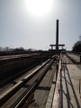
This easy walk follows the Canal du Centre and the old canal for the most part, before crossing the countryside to reach the top of the Ronquières inclined plane, which is used to transfer boats. This ‘lift’ overcomes a 68-metre difference in height over a distance of 1,432 metres.
Grand tour of the Bois de la Houssière
 7.35 mi
+410 ft
-430 ft
3h 45
Moderate
Departure from Braine-le-Comte (Hainaut)
7.35 mi
+410 ft
-430 ft
3h 45
Moderate
Departure from Braine-le-Comte (Hainaut)
After a short warm-up walk in the arboretum, where small educational signs provide information on the names of the trees found here, the hike takes you on a long, easy walk around the Bois de la Houssière, a popular destination for walkers in this region of Belgium.
Countryside and castles around Écaussinnes
 8.69 mi
+561 ft
-574 ft
4h 30
Moderate
Departure from Braine-le-Comte (Hainaut)
8.69 mi
+561 ft
-574 ft
4h 30
Moderate
Departure from Braine-le-Comte (Hainaut)
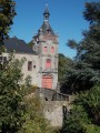
This is an easy walk, about an hour's drive from Brussels. You will discover the two castles of Écaussinnes as you walk through the forest, along country roads and paths with the Ronquières Tower as a landmark.
Panoramic views in Ittre
 5.93 mi
+358 ft
-367 ft
3h 00
5.93 mi
+358 ft
-367 ft
3h 00
 Easy
Departure from Ittre (Brabant Wallon)
Easy
Departure from Ittre (Brabant Wallon)
Starting from the heights of Ittre, a short footpath followed by a stretch of road leads to the first panoramic view, stretching all the way to the tower of the Ronquières inclined plane on the Brussels–Charleroi Canal. Your journey will take you as far as this canal, taking in a succession of other panoramic views, each as beautiful as the last, before descending to join the Ravel cycle route along the water’s edge.
The climb back up takes you through the fields, always with the Ronquières Tower in view. After bidding it farewell, there’s a short break on the plateau and another panoramic view of the route you took on the way there, before you descend into the Ri de Fauquez valley, from where you climb back up to rejoin the original route. The icing on the cake is that you might just be greeted by a llama in a meadow...
Along the Brussels-Charleroi Canal and the Ittre lock
 6.58 mi
+108 ft
-112 ft
3h 05
Moderate
Departure from Ittre (Brabant Wallon)
6.58 mi
+108 ft
-112 ft
3h 05
Moderate
Departure from Ittre (Brabant Wallon)
On this easy walk, which is mainly on hard-surfaced paths, you will discover a fine feat of engineering, one of many in the region, symbolising both the economic vitality of this area and human ingenuity in overcoming natural obstacles.
Discover the locks of the old canal in the province of Hainaut
 7.39 mi
+302 ft
-308 ft
3h 40
Easy
Departure from Seneffe (Hainaut)
7.39 mi
+302 ft
-308 ft
3h 40
Easy
Departure from Seneffe (Hainaut)
This region is criss-crossed by canals, some very modern ones having replaced the old canals, a section of which we follow on this easy walk that takes us past some of the locks dotting the route.The locks that can be seen during this walk have been out of use since 1958. Since then, the lock gates have been removed and artificial waterfalls have been created on the downstream side. And this is the result that can be seen today.
Monstrous, Ronquière: land and water
10.38 mi
+446 ft
-427 ft
5h 10
Moderate
Departure from Nivelles (Brabant Wallon)
A route where every step reveals a fragment of history. At Les Onze Bonniers, the mist floats like a memory. The streams of Pont à Mousson and Les Corbeaux whisper their legends — it is said that crows guided travellers. In the Bois de l'Hôpital, du Planti and d'en Bas, you will find elusive chamois, ancient herbs and secret springs. The Brussels–Charleroi canal unfurls its memories of barges and towpaths. La Gratière, La Thines and Hiernoulet offer golden light and dragonflies. There are also the Fermes de la Barette, de l'Abbaye and du Seigneur, guardians of the fields. At the Caverne du Philosophe, silence becomes history. Villages such as Ronquières, Chenu and Bornival are as gentle as an old book.A hike that whispers its secrets.
Ittre and the Château de la Tournette golf course
 6.46 mi
+338 ft
-351 ft
3h 15
Moderate
Departure from Ittre (Brabant Wallon)
6.46 mi
+338 ft
-351 ft
3h 15
Moderate
Departure from Ittre (Brabant Wallon)
A circular route almost entirely through the countryside, starting from the centre of Ittre and ending at the Château de la Tournette golf course. Along the way, the Ravel cycle path runs alongside the Ri Ternel river, taking in the sweeping agricultural landscapes on the heights of Haut-Ittre – with, among other things, its beautiful hedgerows allowing nature to flourish – and crossing the golf course, all in an atmosphere of calm and serenity.
For more walks, use our search engine .
The GPS track and description are the property of this route's author. Please do not copy them without permission.

