Country:
 City:
City:


Park in the car park near Lababan Chapel.
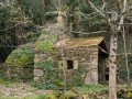
(S/E) Head towards the far end of the car park, walk along the grassy area with the picnic table and pass between the cemetery and the chapel. Enter the cemetery and walk to the uniquely designed war memorial. It includes the gravestone of Abbé Riou, a refractory parish priest of this parish who was guillotined on 17 March 1794. Exit through a gate at the corner of the cemetery. Open and then close this old wooden gate, and continue along a track—first tarmac, then grassy—which runs alongside a wetland area on your right.
(1) After the last house, turn left and head uphill to a small road, which you follow to the right. Pass a property entrance on your left and, a little further on, look out for a farm track on the left between the fields. Turn left and continue straight on to Kerleffry, an equestrian farm.
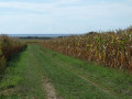
(2) At the junction of the paths, turn left, go round the back of two new houses and follow the wide track between the fields, which runs alongside a poplar grove on the right. At Ruguelven – a beautiful estate – turn left onto the path climbing between the fields (with a view of the sea to the south) and you’ll come to a cross (note the old granite shaft and the figures at the top carved from kersantinite).
Turn right and continue along this track through the meadows until you reach a small road; turn left onto it, passing the Kerné cider house.
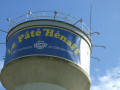
(3) At the junction (with a medieval cross on the left), turn right, then right again towards Pendreff (signposted ‘Maison du pâté Hénaff’). Follow this road, from where you can see the water tower, the top of which is modelled on the famous tin can. Walk past the Hénaff family’s birthplace, now an eco-museum (car park on the left).
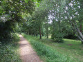
(4) Turn right onto a short stretch of one-way road and continue along a stony path which bends left, running alongside a stream (a lovely, shaded stretch). Join a road and follow it to the left. Walk past the water treatment plant, then round the Hénaff factory and arrive at the Stop sign on the D40.
(5) Follow it to the left for about a hundred metres, cross at the pedestrian crossing and follow the road that runs between the Pierre Jakez Hélias State School and the Parc An Id care home. At the end, turn left towards the church. Enter the churchyard to walk round it, then take the steps on the right onto Rue de Pont-l’Abbé.
PR® yellow markings
Turn left into the first street, passing the town hall on your right and the Espace Simone Veil multi-purpose hall on your left, then turn right into Impasse de Poul Bolic and left into Rue des Goélands, which you follow until you reach the ‘Stop’ sign on the D 143.
(6) First turn right then left to cross the road at the pedestrian crossing, then continue along the path between the fields, which leads to a road junction.
No signposting
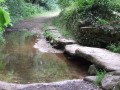
Let thePR®® turn right and carry on straight ahead to reach a ford, which you cross over some beautiful stone slabs.
PR® yellow markings
Turn left, rejoining thePR®® in a wooded section, and emerge onto a small road near the hamlet of Kergoglé.
(7) Follow this road to the left, leaving the yellow markings which branch off to the right near a stream. You’ll rejoin them a little further on, after the hamlet of Morvé. Head up this small road (there’s an inconspicuous fountain on the left) and continue straight on towards the village. Pass close to a business specialising in garden decorations made from tree stumps and arrive at the ‘Stop’ sign on the D 143.
Cross with care (there is no pedestrian crossing here) and carry on straight ahead along Rue de la Mairie.
No signposting
(8) Turn right into the first street, Rue des Hirondelles, which leads to Rue de Quimper. Turn left onto this street and, at No. 20, pass the birthplace of Per Jakez Hélias, now a museum.
Carry on to the end of the street and cross at the traffic lights (Rue de la Mer).
Turn right onto Rue Hent Kreisker, which runs past the secondary school and the sports hall before joining Route de l’Usine.
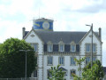
(9) Follow this road to the right, situated between the factory car park and the Collège Privé Notre-Dame de Penhors. Turn left, following the path between the factory car park and a small green space. Note the large house which houses the family business’s offices.
Walk past the foot of the water tower and reach a road. Follow it to the left (signposted ‘museum 650 m away’), continuing to skirt the factory and passing a cross on the right.
(10) At a house (No. 46), turn right onto a grassy path which leads to the Route de Lababan; follow this to the left towards the Kerné Cider House.
(3) Turn left to go round the buildings and, at the three-way junction, take the path on the right – the one you took on the way out. Carry on straight ahead towards the cross, which stands out against a backdrop of the sea.
Veer to the right near the cross and rejoin the Route de Lababan. Turn left, then right at the small roundabout, to head down towards the chapel and return to the car park (S/E).

 Visorando Member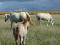

 Easy
Easy