Discovering Fontaine-lès-Luxeuil

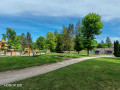
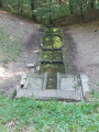
Founded by the first Christian missionaries from Ireland, Fontaine-lès-Luxeuil has preserved the memory of times gone by in the stones of its built heritage.
You’ll also be charmed by the gentle tranquillity that reigns in the neighbouring forests.

Details

764818
Creation:
Last update:
Last review:
  • Walking
    Activity: Walking
  • ↔
    Distance: 9.06 mi
  • ◔
    Average duration: 4h 30 
  • ▲
    Difficulty: Moderate

  • ⚐
    Back to start: Yes
  • ↗
    Ascent: + 427 ft
  • ↘
    Descent: - 427 ft

  • ▲
    Highest point: 1,070 ft
  • ▼
    Lowest point: 797 ft

Photos

Description of the walk

Car park at the community hall in Fontaine-les-Luxeuil, Rue des Tulipes.

(DA) Cross the playground at the back of the community hall, cross the stream and head towards Rue du Tyrol. Turn right, pass the cemetery and turn left. Head towards the main street.

(1) Turn right and, after 150 metres, turn left and continue towards La Tuilerie.

(2) At the small roundabout, turn right onto a small road, then onto a dirt track. Continue to the edge of the woods.

(3) Carry on straight ahead along a wide track which gradually curves. Head up into the woods and follow the grassy path closely as it winds its way through the copses (follow the yellow markings – difficult section: steep climb). Reach a wide track and continue along it to the left. Come out onto a large open space.

(4) Carry on straight ahead. Follow the path downhill for 350 metres.

(5) At the junction, take a small path to the left. Continue for 1.5 km through the woods.

(6) Join a dirt track heading towards the Hermitage.

(7) At the Ermitage junction, keep to the right and walk for about 800–900 metres.

(8) At the next crossroads, turn left towards the hamlet of Le Beuchot

(9) Take the road on the left to walk alongside the Étang du Beuchot. Continue straight on (do not take the road leading to La Logeotte).

(10) Turn left onto the wide forest track.

(11) At the end, turn right and continue for 800 metres.

(12) Turn right to head back down into the village via Rue du Mont. Continue for 500 metres and turn right to rejoin the D304. Follow it for 300 metres.

(13) Turn right towards the Tacot railway line.

(14) Turn left, head towards the village pond and continue to the D964
Please take care when crossing the road to reach Rue des Tulipes on the opposite side (S/E).


Waypoints

  1. S/E : mi 0 - alt. 840 ft - Car park at the community hall. Cross the - Rôge (rivière)
  2. 1 : mi 0.42 - alt. 876 ft - Grande Rue on the right
  3. 2 : mi 0.85 - alt. 873 ft - Roundabout
  4. 3 : mi 1.44 - alt. 906 ft - Edge of the woods
  5. 4 : mi 2.24 - alt. 1,070 ft - Small square
  6. 5 : mi 2.53 - alt. 951 ft - Narrow path
  7. 6 : mi 3.45 - alt. 896 ft - Stone path
  8. 7 : mi 3.86 - alt. 896 ft - L’Ermitage
  9. 8 : mi 4.45 - alt. 801 ft - Rue du Beuchot
  10. 9 : mi 4.87 - alt. 810 ft - Etang du Beuchot
  11. 10 : mi 5.99 - alt. 840 ft - Allée Forestière
  12. 11 : mi 6.68 - alt. 912 ft - Forest Track
  13. 12 : mi 7.48 - alt. 892 ft - Rue du Mont
  14. 13 : mi 7.88 - alt. 846 ft - Chemin de Breuches
  15. 14 : mi 8.25 - alt. 876 ft - Forest track
  16. S/E : mi 9.06 - alt. 840 ft - Car park at the community hall

Notes

If in doubt, follow the Yellow Ring signposts carefully

Worth a visit

Beuchot Pond.

Reviews and comments

4.3 / 5
Based on 3 reviews

Reliability of the description
4.3 / 5
Ease of following the route
4.3 / 5
Route interest
4.3 / 5
User 13930563

Overall rating : 4 / 5

Date of your route : Jun 09, 2026
Reliability of the description : ★★★★☆ Good
Ease of following the route : ★★★★☆ Good
Route interest : ★★★★☆ Good
Very busy route : No

The route follows almost exactly the one marked with Yellow Circles starting from the car park.
Apart from a slight error in the signposting, everything is pleasant.

Machine-translated

laurent.tournier
laurent.tournier

Overall rating : 5 / 5

Date of your route : Aug 07, 2025
Reliability of the description : ★★★★★ Very good
Ease of following the route : ★★★★★ Very good
Route interest : ★★★★★ Very good
Very busy route : No

Pleasant hike with no difficulty

Machine-translated

plidenantes
plidenantes

Overall rating : 4 / 5

Date of your route : Aug 03, 2019
Reliability of the description : ★★★★☆ Good
Ease of following the route : ★★★★☆ Good
Route interest : ★★★★☆ Good

A lovely walk to warm up. We tried out a different route, heading along the other bank of the pond. We rejoined the original route at the end of the walk. This section is probably not passable all the time.

Machine-translated

Other walks in the area

For more walks, use our search engine .

The GPS track and description are the property of this route's author. Please do not copy them without permission.