Country:
 City:
City:


Park in the car park in Fougerolles town centre, 20 Rue Bas de Laval.
(S/E) Cross at the pedestrian crossing and turn right into Rue Bas de Laval. After about a hundred metres, take the steps on the left leading up to the church forecourt. Walk round the church, and to the left of the town hall, take Rue du Parc, then Rue des Jardins, which continues from it. At the junction, take Rue des Moines Hauts. After 100 m on the left: Jardin Secret de la Fée Verte.
Club Vosgien markings: Blue Ring
(1) Continue along the street until the tarmac ends: it veers to the left and becomes a farm track. You’ll reach a tarmac road. Turn right onto it, heading uphill towards Les Monts Durand. After 200 metres, take a farm track on the left. After about 700 metres, at the T-junction, turn left, then you’ll reach a tarmac road.
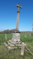
(2) Continue straight ahead along this road. Pass a small chapel and a cross on the right, then head downhill to the village of Fougerolles-le-Château. Turn right onto the D83, then reach a bridge. (Typical covered drinking fountain.)
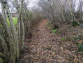
(3) Cross the bridge, turn left at the foot of the castle, then immediately right onto a farm track, and right again onto a path that may be difficult to spot (follow the hedge) and go round the back of the castle (views of the castle). Further on, at the tarmac road, turn left. 300 metres further on, you’ll reach a crossroads with four roads.
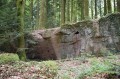
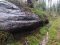
- Option (off the route): first take the first left, which leads to an old sandstone quarry, and further on offers a bird’s-eye view of the castle.
End of signposting
(4) Turn left uphill (leaving the Blue Ring signposting).
At the wayside shrine (Red signposting) at the start of the hamlet of Le Bourguignon, turn right: the road becomes a farm track. At the Croix du Milieu de la Commune, turn right. When you reach the hamlet of Jean Dicotet, take the road on the left. Then turn sharply left, then right.
(5) At the start of a slight right-hand bend in the road, leave the red signposting and the tarmac to take the track on the left. Pass under the power line.
(6) Do not follow the Blue Ring markings to the left.
Continue along the main path until you reach a bridge over the Ruisseau des Pochattes. Cross it, then turn left to follow the stream along its opposite bank. After 100 m, you’ll come across the Blue Ring markings again.
Club Vosgien signposting: Blue Ring
(7) Follow these markings by taking the path that climbs to the right. You’ll arrive beneath a power line, then spot a house.
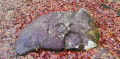
(8) Before the house, veer left and pass under the power line again. 200 m further on, the path forks. Take the left-hand path and walk past the foot of the Pierres Rouges. A little further on, at the T-junction, take the path uphill to the right.
(9) Further up, facing some rocks that might resemble a natural bunker, turn left. You’ll come to a good track; take it to the right, then left after the aerial mast. You’ll reach the N57.
(10) Very dangerous crossing: fast-moving traffic. Cross the road, then take the path opposite, to the right of the wayside shrine. At La Besse d’Any, walk down the tarmac road a short way to the right of a beautiful chalot. Then turn left onto a path lined on its right by a row of thuja trees. When you reach Le Petit Fays, walk down to the main road.
(11) Turn left towards the Ecomuseum.
(12) Retrace your steps.
(11) Carry on straight ahead. At the crossroads, turn left towards Le Prédurupt, then take the first right onto Route des Chalots. At a crossroads with a road on the right, marked by recycling bins, turn left onto the path lined with a hedge. When you reach the D 149, turn left onto it. (50m further on, there’s a chapel on the right). Just before passing under the power line, take the path on the left, then head slightly uphill to the right until you reach the foot of the N 57.
(13) Go under the power line and continue straight ahead. You’ll reach a tarmac road. Take this to the left, heading downhill towards Fougerolles. Continue along the main street (Rue du Clos), which leads to the D 57d.
(14) Cross at the pedestrian crossing and turn right. Take the second street on the left (Rue Queney). At the junction, turn left onto the bridge over the Combeauté, cross the canal as well, and after 60 metres, follow the old railway line to the right, then quickly turn left towards the car park (S/E).


 Tourist office

 Easy
Easy  Visorando Member