9 – In the Maisental

A relaxing walk through the remarkable landscape of the Maisental valley, past the Gütesteiner and the Urach Waterfall.

Details

n°46898560
Creation:
Last update:
Last review:
  • Walking
    Activity: Walking
  • ↔
    Distance: 6.32 mi
  • ◔
    Average duration: 4h 05 
  • ▲
    Difficulty: Difficult

  • ⚐
    Back to start: Yes
  • ↗
    Ascent: + 1,355 ft
  • ↘
    Descent: - 1,355 ft

  • ▲
    Highest point: 2,139 ft
  • ▼
    Lowest point: 1,417 ft

Photos

Description of the walk

Start: P23 Maisental, Vorderes Maisental 6, 72574 Bad Urach
From the west, heading towards Reutlingen on the B28 to Bad Urach. From the north/east, take the A8 to Kirchheim unter Teck, then follow the B465 and the B28 to Bad Urach. Continue on the B28 to Bad Urach Wasserfall railway station, then turn off into the Vorderes Maisental and park at the Maisental hiking car park (P23).

(S/E) The walk starts heading towards Bad Urach. Follow the road and, after a short distance, turn left. After a few hundred metres, keep to the right. The path runs alongside the fields and crosses the railway line twice.

Shortly afterwards, it’s worth taking a brief detour downhill to the Fruit Growers’ Association’s demonstration and educational garden. The site is open all year round to any interested gardeners for a self-guided tour free of charge. Information boards help with orientation and provide interesting facts about the individual plants.

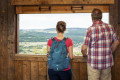
We continue our walk, following the path further along the meadows and fruit trees. Along the way, we are treated to wonderful views of the Maisental valley time and again.

(1) At the end of the path, we turn downhill and follow the path until we come to the Viehplatz barbecue area.

(2) This is a lovely spot for a barbecue and a rest. We take the path on the right and walk past the Güterstein stud farm.

(3) Shortly afterwards, we turn left and follow a steep, zigzagging path up to the Güterstein Waterfall.
At the Güterstein Waterfall, the water cascades down in many small steps into a man-made basin. This gives the waterfall a character all of its own. It is more secluded and romantic, yet no less impressive than the Urach Waterfall. The waterfall is situated within a nature reserve. You are therefore not permitted to leave the paths.

We follow the signposts to the left and then left again until we reach the Runden Berg.

(4) We walk round it until we reach the Schießtal valley. We follow the path that winds its way along the valley and thus reach the foot of the Urach Waterfall.

(5) If you wish, you can walk up the steps to the Hochwiese. The path along the Brühlbach stream finally leads us back to the starting point (S/E).

Waypoints

  1. S/E : mi 0 - alt. 1,503 ft - P23 Maisental
  2. 1 : mi 1.64 - alt. 1,762 ft - Downhill junction
  3. 2 : mi 1.89 - alt. 1,627 ft - Viehplatz barbecue area
  4. 3 : mi 2.5 - alt. 1,913 ft - Zigzag path to the Güterstein Waterfall
  5. 4 : mi 3.15 - alt. 1,804 ft - Runder Berg
  6. 5 : mi 5.25 - alt. 1,755 ft - Urach Waterfall
  7. S/E : mi 6.32 - alt. 1,476 ft - P23 Maisental

Notes

How to get there
P23 Maisental, Vorderes Maisental 6, 72574 Bad Urach
From the west, heading towards Reutlingen on the B28 to Bad Urach. From the north/east, take the A8 to Kirchheim unter Teck, then follow the B465 and B28 to Bad Urach. Continue on the B28 to Bad Urach Wasserfall railway station, then turn off into the Vorderes Maisental and park at the Maisental hiking car park (P23).

Equipment
Sturdy footwear, walking poles and sure-footedness are recommended for this walk.

Safety information
Our circular walks are not leisurely strolls but hiking trails. Sturdy footwear, walking poles and sure-footedness are recommended for all walks. Particularly after and during rainfall, as well as during the winter months, the limestone and the ground can be very slippery, especially on slopes. We would also like to draw your attention to the presence of natural hazards in the forest. Please exercise appropriate caution.

In an emergency, please always dial 112. If necessary, please mention that the injured persons are in inaccessible terrain, so that the Bad Urach Mountain Rescue Service is also informed and no unnecessary time is lost during the rescue.

On the posts of the arrow signposts, you will find a plaque with the exact location number. This is known to the control centre. In an emergency, this ensures that help arrives quickly.

Worth a visit

The former royal seat of Bad Urach lies in the heart of the UNESCO Swabian Alb Biosphere Reserve. Magnificent natural surroundings, fresh air and the picturesque half-timbered town ensure a relaxing atmosphere, a chance to take a deep breath and a restful holiday.

Author’s tip
Why not also discover our five ‘Grafensteige’ premium hiking trails: Wasserfallsteig, Hohenurachsteig, Hochbergsteig, Hohenwittlingensteig or Seeburgsteig. All these premium hiking trails are suitable for fit and sure-footed walkers and lead you to the most beautiful spots in Bad Urach.

Viehstelle barbecue area (2)
Gütersteiner Waterfall (3)
Runder Berg (4)
Urach Waterfall (5)
Hochwiese Waterfall barbecue area
Brühlbach Valley Meadows
Kneipp facility in the Maisental valley

Reviews and comments

4.7 / 5
Based on 1 review

Reliability of the description
5 / 5
Ease of following the route
4 / 5
Route interest
5 / 5
Julien VR
Julien VR ★

Hello,
Thank you for taking the time to write this positive review, especially as it is the first comment on this tour!
We're glad you enjoyed the tour.
Best regards,
Julien

Machine-translated

Content Manager & User support

User 26129051

Overall rating : 4.7 / 5

Date of your route : Jun 16, 2025
Reliability of the description : ★★★★★ Very good
Ease of following the route : ★★★★☆ Good
Route interest : ★★★★★ Very good
Very busy route : Yes

Great hike, also beautiful through the forest.
Wildly romantic.
We went on Whit Monday, and there were lots of people out and about in the afternoon when we were on our way back.
It was much quieter in the morning.

Machine-translated

Other walks in the area

For more walks, use our search engine .

The GPS track and description are the property of this route's author. Please do not copy them without permission.