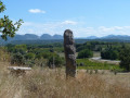
Pays de Grignan – The Priory of Aleyrac

This route takes you north of Grignan, passing through the hamlet of Bayonne. After a path that can be a bit tricky in places, you’ll catch sight of the wind turbines at Aleyrac and its former priory. Inside, a miraculous spring awaits you! Following a very wild path, from which you’ll enjoy a magnificent view, you’ll descend to the picturesque village of Salles-sous-Bois and reach Grignan via La Grande Tuilière and the Montine vineyard.

Details

n°1214173
Creation:
Last update:
Last review:
  • Mountain biking
    Activity: Mountain biking
  • ↔
    Distance: 19.90 mi
  • ◔
    Duration according to the author: 4 hrs 
  • ▲
    Difficulty: Difficult

  • ⚐
    Back to start: Yes
  • ↗
    Ascent: + 1,490 ft
  • ↘
    Descent: - 1,506 ft

  • ▲
    Highest point: 1,673 ft
  • ▼
    Lowest point: 538 ft
  • ⚐ Country: France
  • ⚐
    Area: Dauphiné
  • ⚐ City: Grignan (26230)
  • ⚑
    Start/End: N 44.418817° / E 4.904593°
  • ❏
    IGN map(s): Ref. 3038SB, 3039ET

  • ◶
    Type of surface: Not specified
  • ⇧
    Bike carrying: Not specified
  • ▲
    Difficulty: Not specified
  • Hour-by-hour weather

Description of the route

Starting point: Espace Sévigné, Rue du 11 Novembre, Grignan.

Mountain bike route no. 5

(S/E) From the Espace Sévigné, head uphill towards the gendarmerie, then continue through vineyards and holm oaks until you reach the Berre ford. Follow a path that is narrow at the start, climbing up to the hamlet of Bayonne.

(1) Cross the hamlet, passing between the stone houses, and, further on, take a path on the right for a long climb, which is at times made technical and uneven by stones and cobblestones. Reach Le Terron (alt. 348m) and follow a path through the woodland to Le Fraysse (alt. 360m), passing in front of the wash house.

(2) Le Fraysse. Cross the road and continue along theGR®429on a gentle climb to reach the edge of the ridge. Pass through Fangeas (elevation 417m).

(3) Carry on to reach the pass at Serre Colon (433m). Watch out for cars!

(4) Cross the road and continue along theGR®429on the opposite side via a path. Further on, follow a fairly steep and technical climb to reach a descent leading to the Route d’Aleyrac. Watch out for cars!

(5) Turn left, then right at Champ Tortel (alt. 480m) to reach the Prieuré d’Aleyrac.

(6) Follow the path behind the cemetery, before heading back down a path that is often stony.

(7) At the road (elevation 276m), turn right; further on, take the path opposite to cross a ford and head uphill to reach Salles-Sous-Bois. Walk through the village and continue due south.

(8) Cross the road and turn left onto the D24, then turn right straight away and carry on. Cut across the D9 and then the D14 – watch out for cars.

(9) Carry on straight ahead and take a cross-country path on the right, then another further on to the left which leads to La Grande Tuilière, the Montine vineyard.

(10) Reach and pass through the hamlet of La Grande Tuilière.

(11) At the three-way junction, take the path on the right to ‘Le Figuier’. At the crossroads where four paths meet, carry on straight ahead, go round a 90° bend, then turn right onto a path that climbs up to the vineyards, offering a beautiful view of Grignan Castle. Continue to the next junction.

(12) Turn right onto the track to reach a road in the hamlet of Le Mas. Turn left to take a pleasant path through the woodland straight ahead, then follow a narrow, steep descent to reach the D541.

(13) Carry on straight ahead. At the large crossroads, leave the D541 and continue straight ahead. Walk past the Centre des Finances Publiques and the ‘Les Bouts de Choux’ nursery, then head back up to the ramparts. Turn left onto the Cours d’Adhémar and follow it downhill. At the end, turn right just before the road, join the Allée du 11 Novembre, walk past the church and the cemetery, and reach the finish line (S/E).

Waypoints

  1. S/E : mi 0 - alt. 620 ft - Espace Sévigné
  2. 1 : mi 2 - alt. 659 ft - The hamlet of Bayonne
  3. 2 : mi 5.23 - alt. 1,217 ft - Poteau Fraysse (alt. 360m)
  4. 3 : mi 6.5 - alt. 1,371 ft - Fangeas
  5. 4 : mi 7.03 - alt. 1,417 ft - Serre Colon Pass, at the foot of the wind turbines
  6. 5 : mi 9.51 - alt. 1,591 ft - D9 junction
  7. 6 : mi 10.25 - alt. 1,490 ft - Aleyrac Priory
  8. 7 : mi 13.26 - alt. 912 ft - Junction of minor roads
  9. 8 : mi 14.03 - alt. 837 ft - D24 to Salles-Sous-Bois
  10. 9 : mi 15.08 - alt. 774 ft - Junction with the D14
  11. 10 : mi 17.32 - alt. 692 ft - La Grande Tuilière hamlet
  12. 11 : mi 17.52 - alt. 666 ft - Three-way junction, turn right
  13. 12 : mi 18.23 - alt. 679 ft - At the junction, turn right
  14. 13 : mi 18.97 - alt. 614 ft - D541
  15. S/E : mi 19.9 - alt. 620 ft - Espace Sévigné

Notes

We strongly recommend that you take the IGN map referred to on these pages with you. Mountain bikers must be self-sufficient; professional guides are available if required. Emergency numbers: 18 or 112
Enquiries at the Pays de Grignan – Enclave des Papes Tourist Office: 04 75 46 56 75 (Grignan) and 04 90 35 04 71 (Valréas) / info@tourisme-paysdegrignan.com /
Pays de Grignan Tourist Office
Valréas Tourist Office

Always be cautious and plan ahead when you're outdoors. Visorando and the author of this route cannot be held responsible for any accidents occurring on this route.

The GR® and PR® markings are the intellectual property of the Fédération Française de Randonnée Pédestre.

Reviews and comments

4.7 / 5
Based on 1 review

Reliability of the description
5 / 5
Ease of following the route
4 / 5
Route interest
5 / 5
Vivi07
Vivi07

Overall rating : 4.7 / 5

Date of your route : Mar 30, 2026
Reliability of the description : ★★★★★ Very good
Ease of following the route : ★★★★☆ Good
Route interest : ★★★★★ Very good
Very busy route : No

A lovely mountain bike route with a variety of vegetation and terrain... A few short muddy sections...
Long but not very difficult
A great day

Machine-translated

Other walks in the area

For more walks, use our search engine .

The GPS track and description are the property of this route's author. Please do not copy them without permission.